Arcen elevation
Arcen (Limburg, Gemeente Venlo), Netherlands elevation is 18 meters and Arcen elevation in feet is 59 ft above sea level [src 1]. Arcen is a populated place (feature code) with elevation that is 3 meters (10 ft) bigger than average city elevation in Netherlands.
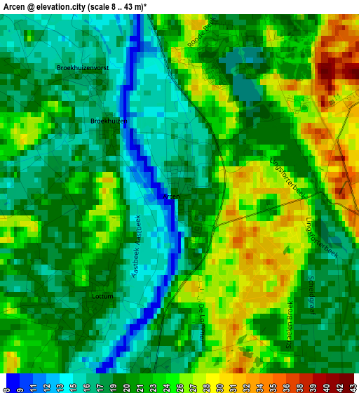
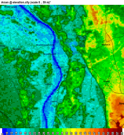
Below is the Elevation map of Arcen, which displays elevation range with different colors. Scale of the first map is from 8 to 43 m (26 to 141 ft) with average elevation of 21.3 meters (=70 ft) [note 1]
These maps also provides idea of topography and contour of this city, they are displayed at different zoom levels. More info about maps, scale and edge coordinates you can find below images.
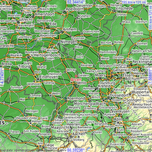
| \ | Map #1 | Map #2 | Topo.Map |
| Scale [m] | 8..43 m | 8..59 m | × |
| Scale [ft] | 26..141 ft | 26..194 ft | × |
| Average | 21.3 m = 70 ft | 24.6 m = 81 ft | × |
| Width | 6.09 km = 3.8 mi | 12.17 km = 7.6 mi | 194.8 km = 121 mi |
| Height | 6.09 km = 3.8 mi | 12.17 km = 7.6 mi | 194.8 km = 121 mi |
| ↑Max Latitude | 51.504032° | 51.531378° | 52.34414° |
| Latitude at center | 51.47667° | 51.47667° | 51.47667° |
| ↓Min Latitude | 51.449291° | 51.421896° | 50.59238° |
| ← Min Longitude | 6.136615° | 6.092669° | 4.77431° |
| Longitude center | 6.18056° | 6.18056° | 6.18056° |
| →Max Longitude | 6.224505° | 6.268451° | 7.58681° |
Nearby cities:
Cities around Arcen sort by population:
• Venlo elevation 24 m
11.9 km,  184°
184°
• Sevenum 31 m
12.2 km,  234°
234°
• Well 15 m
10.3 km,  322°
322°
• Wanssum 16 m
9.8 km,  312°
312°
• Meerlo 20 m
7.8 km,  301°
301°
• Oirlo 25 m
10.6 km,  291°
291°
• Wellerlooi 19 m
7.1 km,  334°
334°
• Hegelsom 28 m
10.7 km,  246°
246°
• Melderslo 26 m
6.8 km,  255°
255°
• Lottum 21 m
2.1 km,  218°
218°
• Blitterswijck 17 m
7.8 km, 320°
• Tienray 21 m
6.4 km, 288°
Multilingual:
 En español:
Arcen elevación 18 m.
 En France:
Arcen élévation 18 m.


Sources and notes:
- [note 1] Map square and city borders are not equal. Map elevation data is calculated only from area inside that square.
- [src 1] Elevation data from geonames database provided with same terms of usage.
- [src 2] The elevation map of Arcen is generated using elevation data from NASA's 3 arcsec (90m) resolution SRTM data.
- [src 3] Base (background) map © OpenStreetMap contributors tiles are generated by Geofabrik and OpenTopoMap.
Copyright & License:
This Arcen Elevation Map is licensed under CC BY-SA. You may reuse any part from this page, if you give a proper credit by linking to this URL:
 More info on terms of use page.