Venlo elevation
Venlo (Limburg, Gemeente Venlo), Netherlands elevation is 24 meters and Venlo elevation in feet is 79 ft above sea level [src 1]. Venlo is a seat of a second-order administrative division (feature code) with elevation that is 9 meters (30 ft) bigger than average city elevation in Netherlands.
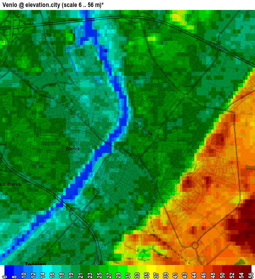
Below is the Elevation map of Venlo, which displays elevation range with different colors. Scale of the first map is from 6 to 56 m (20 to 184 ft) with average elevation of 25.9 meters (=85 ft) [note 1]
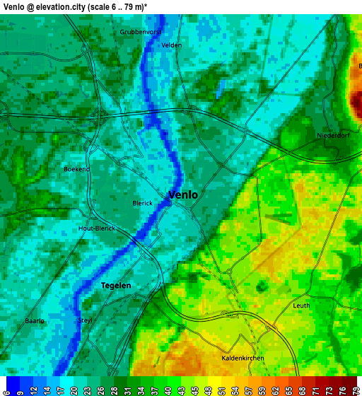
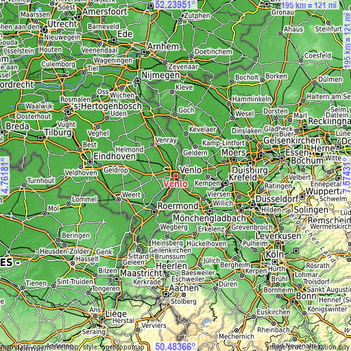
These maps also provides idea of topography and contour of this city, they are displayed at different zoom levels. More info about maps, scale and edge coordinates you can find below images.
| \ | Map #1 | Map #2 | Topo.Map |
| Scale [m] | 6..56 m | 6..79 m | × |
| Scale [ft] | 20..184 ft | 20..259 ft | × |
| Average | 25.9 m = 85 ft | 29.8 m = 98 ft | × |
| Width | 6.1 km = 3.8 mi | 12.2 km = 7.6 mi | 195.2 km = 121.3 mi |
| Height | 6.1 km = 3.8 mi | 12.2 km = 7.6 mi | 195.2 km = 121.3 mi |
| ↑Max Latitude | 51.397426° | 51.424836° | 52.23951° |
| Latitude at center | 51.37° | 51.37° | 51.37° |
| ↓Min Latitude | 51.342557° | 51.315098° | 50.48366° |
| ← Min Longitude | 6.124115° | 6.080169° | 4.76181° |
| Longitude center | 6.16806° | 6.16806° | 6.16806° |
| →Max Longitude | 6.212005° | 6.255951° | 7.57431° |
Nearby cities:
Cities around Venlo sort by population:
• Tegelen elevation 20 m
3.6 km,  217°
217°
• Arcen 18 m
11.9 km,  4°
4°
• Reuver 27 m
11.4 km,  213°
213°
• Baarlo 24 m
6.7 km,  229°
229°
• Maasbree 31 m
8.4 km,  260°
260°
• Sevenum 31 m
10.2 km,  297°
297°
• Offenbeek 25 m
11 km, 207°
• Kessel 24 m
11.8 km, 222°
• Koningslust 30 m
12.2 km, 263°
• Hegelsom 28 m
11.8 km,  310°
310°
• Melderslo 26 m
11.7 km,  330°
330°
• Lottum 21 m
10.2 km,  357°
357°
Multilingual:
 En español:
Venlo elevación 24 m.
 En France:
Venlo élévation 24 m.


Sources and notes:
- [note 1] Map square and city borders are not equal. Map elevation data is calculated only from area inside that square.
- [src 1] Elevation data from geonames database provided with same terms of usage.
- [src 2] The elevation map of Venlo is generated using elevation data from NASA's 3 arcsec (90m) resolution SRTM data.
- [src 3] Base (background) map © OpenStreetMap contributors tiles are generated by Geofabrik and OpenTopoMap.
Copyright & License:
This Venlo Elevation Map is licensed under CC BY-SA. You may reuse any part from this page, if you give a proper credit by linking to this URL:
 More info on terms of use page.