Cranendonck elevation
Cranendonck (North Brabant, Gemeente Cranendonck), Netherlands elevation is 31 meters and Cranendonck elevation in feet is 102 ft above sea level [src 1]. Cranendonck is a populated place (feature code) with elevation that is 16 meters (52 ft) bigger than average city elevation in Netherlands.
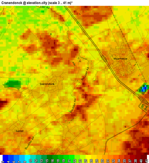
Below is the Elevation map of Cranendonck, which displays elevation range with different colors. Scale of the first map is from 3 to 41 m (10 to 135 ft) with average elevation of 28.2 meters (=93 ft) [note 1]
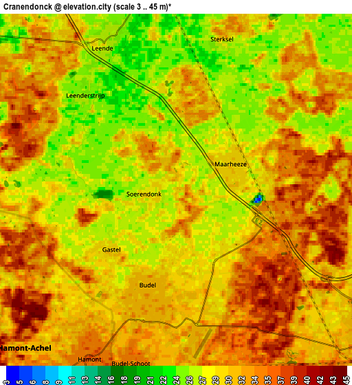
These maps also provides idea of topography and contour of this city, they are displayed at different zoom levels. More info about maps, scale and edge coordinates you can find below images.
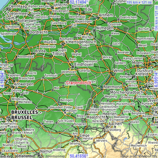
| \ | Map #1 | Map #2 | Topo.Map |
| Scale [m] | 3..41 m | 3..45 m | × |
| Scale [ft] | 10..135 ft | 10..148 ft | × |
| Average | 28.2 m = 93 ft | 30.4 m = 100 ft | × |
| Width | 6.11 km = 3.8 mi | 12.22 km = 7.6 mi | 195.5 km = 121.5 mi |
| Height | 6.11 km = 3.8 mi | 12.22 km = 7.6 mi | 195.5 km = 121.5 mi |
| ↑Max Latitude | 51.331636° | 51.359085° | 52.17494° |
| Latitude at center | 51.30417° | 51.30417° | 51.30417° |
| ↓Min Latitude | 51.276688° | 51.249189° | 50.41656° |
| ← Min Longitude | 5.544945° | 5.500999° | 4.18264° |
| Longitude center | 5.58889° | 5.58889° | 5.58889° |
| →Max Longitude | 5.632835° | 5.676781° | 6.99514° |
Nearby cities:
Cities around Cranendonck sort by population:
• Weert elevation 38 m
10.1 km,  125°
125°
• Valkenswaard 27 m
10.4 km,  300°
300°
• Heeze 24 m
8.8 km,  352°
352°
• Budel 32 m
3.7 km,  194°
194°
• Nederweert 36 m
11.3 km,  100°
100°
• Maarheeze 30 m
2.1 km,  66°
66°
• Keent 36 m
10.4 km, 131°
• Leende 26 m
5.7 km,  335°
335°
• Geenhoven 25 m
10.8 km, 304°
• Budel-Schoot 35 m
6.5 km, 194°
• Soerendonk 28 m
1 km,  248°
248°
• Budel-Dorplein 35 m
7.5 km,  180°
180°
Multilingual:
 En español:
Cranendonck elevación 31 m.
 En France:
Cranendonck élévation 31 m.
 Auf Deutsch:
Cranendonck höhe über dem Meeresspiegel ist 31 m.

Sources and notes:
- [note 1] Map square and city borders are not equal. Map elevation data is calculated only from area inside that square.
- [src 1] Elevation data from geonames database provided with same terms of usage.
- [src 2] The elevation map of Cranendonck is generated using elevation data from NASA's 3 arcsec (90m) resolution SRTM data.
- [src 3] Base (background) map © OpenStreetMap contributors tiles are generated by Geofabrik and OpenTopoMap.
Copyright & License:
This Cranendonck Elevation Map is licensed under CC BY-SA. You may reuse any part from this page, if you give a proper credit by linking to this URL:
 More info on terms of use page.