Margraten elevation
Margraten (Limburg, Eijsden-Margraten), Netherlands elevation is 171 meters and Margraten elevation in feet is 561 ft above sea level [src 1]. Margraten is a populated place (feature code) with elevation that is 156 meters (512 ft) bigger than average city elevation in Netherlands.
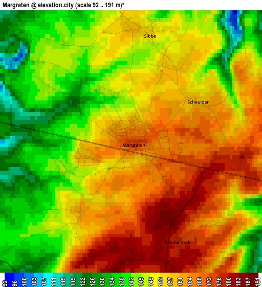
Below is the Elevation map of Margraten, which displays elevation range with different colors. Scale of the first map is from 92 to 191 m (302 to 627 ft) with average elevation of 152.6 meters (=501 ft) [note 1]
These maps also provides idea of topography and contour of this city, they are displayed at different zoom levels. More info about maps, scale and edge coordinates you can find below images.
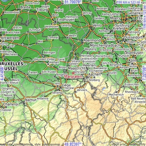
| \ | Map #1 | Topo.Map |
| Scale [m] | 92..191 m | × |
| Scale [ft] | 302..627 ft | × |
| Average | 152.6 m = 501 ft | × |
| Width | 6.17 km = 3.8 mi | 197.6 km = 122.8 mi |
| Height | 6.17 km = 3.8 mi | 197.5 km = 122.7 mi |
| ↑Max Latitude | 50.848584° | 51.70079° |
| Latitude at center | 50.82083° | 50.82083° |
| ↓Min Latitude | 50.793059° | 49.92397° |
| ← Min Longitude | 5.776885° | 4.41458° |
| Longitude center | 5.82083° | 5.82083° |
| →Max Longitude | 5.864775° | 7.22708° |
Nearby cities:
Cities around Margraten sort by population:
• Heer elevation 58 m
6.7 km,  286°
286°
• Scharn 58 m
6.9 km,  297°
297°
• De Heeg 61 m
6.9 km,  273°
273°
• Gulpen 106 m
4.8 km,  96°
96°
• Valkenburg 72 m
5 km,  9°
9°
• Berg 124 m
5.2 km,  329°
329°
• Gronsveld 62 m
6.4 km,  260°
260°
• Broekhem 73 m
5.6 km,  359°
359°
• Wijlre 103 m
5.4 km,  75°
75°
• Houthem 63 m
6.1 km,  341°
341°
• Sibbe 153 m
2.6 km, 8°
• Banholt 184 m
3.5 km,  194°
194°
Multilingual:
 En español:
Margraten elevación 171 m.
 En France:
Margraten élévation 171 m.
 Auf Deutsch:
Margraten höhe über dem Meeresspiegel ist 171 m.

Sources and notes:
- [note 1] Map square and city borders are not equal. Map elevation data is calculated only from area inside that square.
- [src 1] Elevation data from geonames database provided with same terms of usage.
- [src 2] The elevation map of Margraten is generated using elevation data from NASA's 3 arcsec (90m) resolution SRTM data.
- [src 3] Base (background) map © OpenStreetMap contributors tiles are generated by Geofabrik and OpenTopoMap.
Copyright & License:
This Margraten Elevation Map is licensed under CC BY-SA. You may reuse any part from this page, if you give a proper credit by linking to this URL:
 More info on terms of use page.