De Heeg elevation
De Heeg (Limburg, Gemeente Maastricht), Netherlands elevation is 61 meters and De Heeg elevation in feet is 200 ft above sea level [src 1]. De Heeg is a section of populated place (feature code) with elevation that is 46 meters (151 ft) bigger than average city elevation in Netherlands.
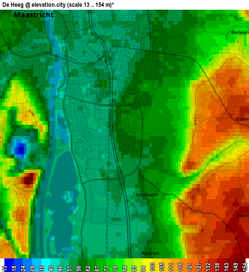
Below is the Elevation map of De Heeg, which displays elevation range with different colors. Scale of the first map is from 13 to 154 m (43 to 505 ft) with average elevation of 72.1 meters (=237 ft) [note 1]
These maps also provides idea of topography and contour of this city, they are displayed at different zoom levels. More info about maps, scale and edge coordinates you can find below images.
| \ | Map #1 | Map #2 | Topo.Map |
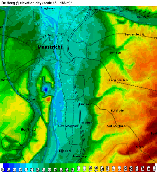
| Scale [m] | 13..154 m | 13..186 m | × |
| Scale [ft] | 43..505 ft | 43..610 ft | × |
| Average | 72.1 m = 237 ft | 87.4 m = 287 ft | × |
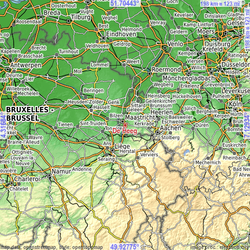
| Width | 6.17 km = 3.8 mi | 12.35 km = 7.7 mi | 197.5 km = 122.7 mi |
| Height | 6.17 km = 3.8 mi | 12.35 km = 7.7 mi | 197.5 km = 122.7 mi |
| ↑Max Latitude | 50.852292° | 50.880027° | 51.70443° |
| Latitude at center | 50.82454° | 50.82454° | 50.82454° |
| ↓Min Latitude | 50.796772° | 50.768987° | 49.92775° |
| ← Min Longitude | 5.679145° | 5.635199° | 4.31684° |
| Longitude center | 5.72309° | 5.72309° | 5.72309° |
| →Max Longitude | 5.767035° | 5.810981° | 7.12934° |
Nearby cities:
Cities around De Heeg sort by population:
• Maastricht elevation 56 m
3.6 km,  317°
317°
• Eijsden 58 m
5 km,  184°
184°
• Heer 58 m
1.6 km,  17°
17°
• Scharn 58 m
2.9 km,  14°
14°
• Amby 53 m
4.2 km, 8°
• Heugem 50 m
1.1 km,  289°
289°
• Belfort 84 m
5.1 km,  299°
299°
• Pottenberg 74 m
5.5 km, 302°
• Gronsveld 62 m
1.6 km,  161°
161°
• Limmel 47 m
4.9 km,  346°
346°
• Biesland 62 m
3.8 km, 298°
• Wolder 82 m
4.7 km, 287°
Multilingual:
 En español:
De Heeg elevación 61 m.
 En France:
De Heeg élévation 61 m.


Sources and notes:
- [note 1] Map square and city borders are not equal. Map elevation data is calculated only from area inside that square.
- [src 1] Elevation data from geonames database provided with same terms of usage.
- [src 2] The elevation map of De Heeg is generated using elevation data from NASA's 3 arcsec (90m) resolution SRTM data.
- [src 3] Base (background) map © OpenStreetMap contributors tiles are generated by Geofabrik and OpenTopoMap.
Copyright & License:
This De Heeg Elevation Map is licensed under CC BY-SA. You may reuse any part from this page, if you give a proper credit by linking to this URL:
 More info on terms of use page.