Posterholt elevation
Posterholt (Limburg, Gemeente Roerdalen), Netherlands elevation is 33 meters and Posterholt elevation in feet is 108 ft above sea level [src 1]. Posterholt is a populated place (feature code) with elevation that is 18 meters (59 ft) bigger than average city elevation in Netherlands.
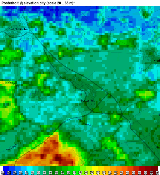
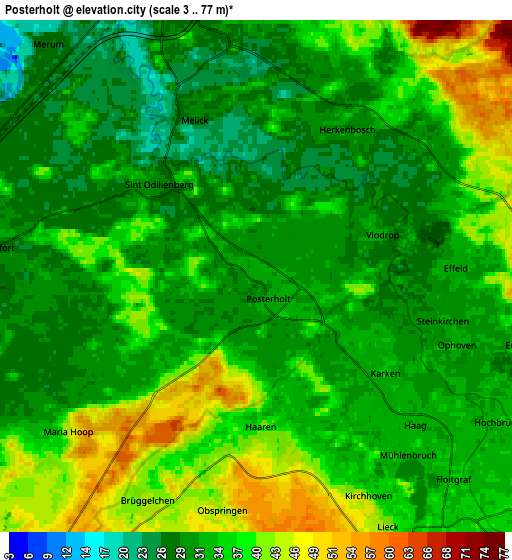
Below is the Elevation map of Posterholt, which displays elevation range with different colors. Scale of the first map is from 20 to 63 m (66 to 207 ft) with average elevation of 32 meters (=105 ft) [note 1]
These maps also provides idea of topography and contour of this city, they are displayed at different zoom levels. More info about maps, scale and edge coordinates you can find below images.
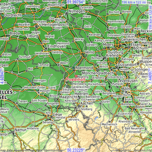
| \ | Map #1 | Map #2 | Topo.Map |
| Scale [m] | 20..63 m | 3..77 m | × |
| Scale [ft] | 66..207 ft | 10..253 ft | × |
| Average | 32 m = 105 ft | 34.3 m = 113 ft | × |
| Width | 6.13 km = 3.8 mi | 12.27 km = 7.6 mi | 196.3 km = 122 mi |
| Height | 6.13 km = 3.8 mi | 12.27 km = 7.6 mi | 196.3 km = 122 mi |
| ↑Max Latitude | 51.150904° | 51.178461° | 51.99754° |
| Latitude at center | 51.12333° | 51.12333° | 51.12333° |
| ↓Min Latitude | 51.09574° | 51.068133° | 50.23225° |
| ← Min Longitude | 5.990775° | 5.946829° | 4.62847° |
| Longitude center | 6.03472° | 6.03472° | 6.03472° |
| →Max Longitude | 6.078665° | 6.122611° | 7.44097° |
Nearby cities:
Cities around Posterholt sort by population:
• Roermond elevation 31 m
8.5 km,  337°
337°
• Herkenbosch 32 m
3.9 km,  31°
31°
• Melick 28 m
4.2 km, 342°
• Linne 29 m
7.6 km,  297°
297°
• Herten 23 m
8.1 km,  321°
321°
• Montfort 30 m
6 km,  272°
272°
• Sint Odiliënberg 31 m
3.3 km,  312°
312°
• Merum 27 m
7.6 km, 316°
• Vlodrop 30 m
3.1 km,  69°
69°
• Koningsbosch 63 m
9.6 km,  213°
213°
• Sint Joost 28 m
9.5 km, 266°
• Brachterbeek 28 m
9.5 km,  286°
286°
Multilingual:
 En español:
Posterholt elevación 33 m.
 En France:
Posterholt élévation 33 m.
 Auf Deutsch:
Posterholt höhe über dem Meeresspiegel ist 33 m.

Sources and notes:
- [note 1] Map square and city borders are not equal. Map elevation data is calculated only from area inside that square.
- [src 1] Elevation data from geonames database provided with same terms of usage.
- [src 2] The elevation map of Posterholt is generated using elevation data from NASA's 3 arcsec (90m) resolution SRTM data.
- [src 3] Base (background) map © OpenStreetMap contributors tiles are generated by Geofabrik and OpenTopoMap.
Copyright & License:
This Posterholt Elevation Map is licensed under CC BY-SA. You may reuse any part from this page, if you give a proper credit by linking to this URL:
 More info on terms of use page.