Vaals elevation
Vaals (Limburg, Gemeente Vaals), Netherlands elevation is 203 meters and Vaals elevation in feet is 666 ft above sea level [src 1]. Vaals is a populated place (feature code) with elevation that is 188 meters (617 ft) bigger than average city elevation in Netherlands.
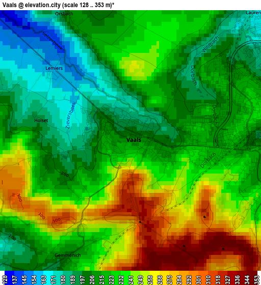
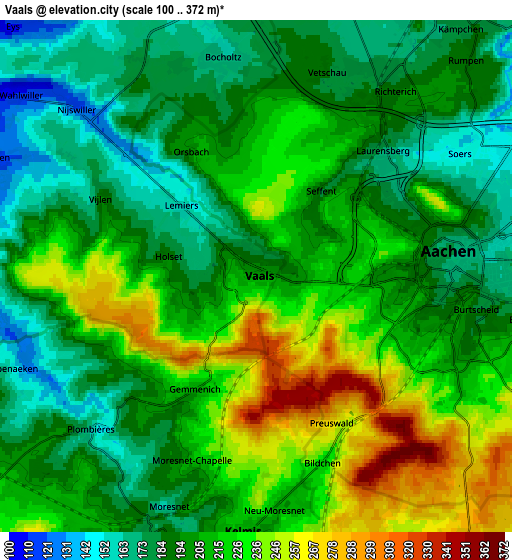
Below is the Elevation map of Vaals, which displays elevation range with different colors. Scale of the first map is from 128 to 353 m (420 to 1158 ft) with average elevation of 226.5 meters (=743 ft) [note 1]
These maps also provides idea of topography and contour of this city, they are displayed at different zoom levels. More info about maps, scale and edge coordinates you can find below images.
| \ | Map #1 | Map #2 | Topo.Map |
| Scale [m] | 128..353 m | 100..372 m | × |
| Scale [ft] | 420..1158 ft | 328..1220 ft | × |
| Average | 226.5 m = 743 ft | 206.8 m = 678 ft | × |
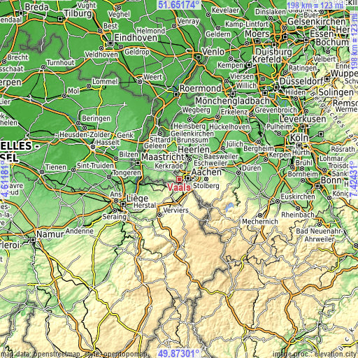
| Width | 6.18 km = 3.8 mi | 12.36 km = 7.7 mi | 197.8 km = 122.9 mi |
| Height | 6.18 km = 3.8 mi | 12.36 km = 7.7 mi | 197.8 km = 122.9 mi |
| ↑Max Latitude | 50.798614° | 50.826381° | 51.65174° |
| Latitude at center | 50.77083° | 50.77083° | 50.77083° |
| ↓Min Latitude | 50.74303° | 50.715213° | 49.87301° |
| ← Min Longitude | 5.974115° | 5.930169° | 4.61181° |
| Longitude center | 6.01806° | 6.01806° | 6.01806° |
| →Max Longitude | 6.062005° | 6.105951° | 7.42431° |
Nearby cities:
Cities around Vaals sort by population:
• Kerkrade elevation 157 m
11 km,  16°
16°
• Bocholtz 166 m
5.4 km,  350°
350°
• Bleijerheide 163 m
10 km, 20°
• Terwinselen 154 m
10.7 km,  2°
2°
• Gulpen 106 m
10.4 km,  298°
298°
• Spekholzerheide 159 m
9.4 km, 2°
• Kaalheide 155 m
10.6 km,  7°
7°
• Simpelveld 138 m
7.5 km,  340°
340°
• Gracht 160 m
9 km, 4°
• Ubachsberg 186 m
10.4 km,  331°
331°
• Mechelen 110 m
7 km,  293°
293°
• Vijlen 192 m
4.2 km, 297°
Multilingual:
 En español:
Vaals elevación 203 m.
 En France:
Vaals élévation 203 m.


Sources and notes:
- [note 1] Map square and city borders are not equal. Map elevation data is calculated only from area inside that square.
- [src 1] Elevation data from geonames database provided with same terms of usage.
- [src 2] The elevation map of Vaals is generated using elevation data from NASA's 3 arcsec (90m) resolution SRTM data.
- [src 3] Base (background) map © OpenStreetMap contributors tiles are generated by Geofabrik and OpenTopoMap.
Copyright & License:
This Vaals Elevation Map is licensed under CC BY-SA. You may reuse any part from this page, if you give a proper credit by linking to this URL:
 More info on terms of use page.