Ubachsberg elevation
Ubachsberg (Limburg, Gemeente Voerendaal), Netherlands elevation is 186 meters and Ubachsberg elevation in feet is 610 ft above sea level [src 1]. Ubachsberg is a populated place (feature code) with elevation that is 171 meters (561 ft) bigger than average city elevation in Netherlands.
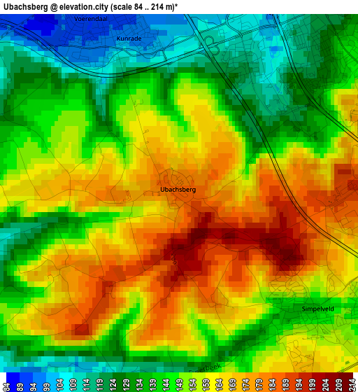
Below is the Elevation map of Ubachsberg, which displays elevation range with different colors. Scale of the first map is from 84 to 214 m (276 to 702 ft) with average elevation of 151 meters (=495 ft) [note 1]
These maps also provides idea of topography and contour of this city, they are displayed at different zoom levels. More info about maps, scale and edge coordinates you can find below images.
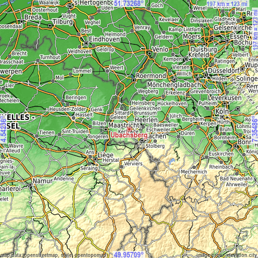
| \ | Map #1 | Topo.Map |
| Scale [m] | 84..214 m | × |
| Scale [ft] | 276..702 ft | × |
| Average | 151 m = 495 ft | × |
| Width | 6.17 km = 3.8 mi | 197.4 km = 122.7 mi |
| Height | 6.17 km = 3.8 mi | 197.4 km = 122.7 mi |
| ↑Max Latitude | 50.881065° | 51.73268° |
| Latitude at center | 50.85333° | 50.85333° |
| ↓Min Latitude | 50.825579° | 49.95709° |
| ← Min Longitude | 5.904665° | 4.54236° |
| Longitude center | 5.94861° | 5.94861° |
| →Max Longitude | 5.992555° | 7.35486° |
Nearby cities:
Cities around Ubachsberg sort by population:
• Heerlen elevation 114 m
4.1 km,  34°
34°
• Bocholtz 166 m
5.6 km,  134°
134°
• Terwinselen 154 m
5.5 km,  74°
74°
• Kunrade 93 m
3 km,  335°
335°
• Spekholzerheide 159 m
5.3 km,  87°
87°
• Voerendaal 90 m
3.6 km, 338°
• Meezenbroek 111 m
5.7 km, 31°
• Simpelveld 138 m
3.2 km, 132°
• Gracht 160 m
5.6 km, 91°
• Wijlre 103 m
4.3 km,  239°
239°
• Klimmen 136 m
5.4 km,  297°
297°
• Husken 100 m
4.7 km,  6°
6°
Multilingual:
 En español:
Ubachsberg elevación 186 m.
 En France:
Ubachsberg élévation 186 m.
 Auf Deutsch:
Ubachsberg höhe über dem Meeresspiegel ist 186 m.

Sources and notes:
- [note 1] Map square and city borders are not equal. Map elevation data is calculated only from area inside that square.
- [src 1] Elevation data from geonames database provided with same terms of usage.
- [src 2] The elevation map of Ubachsberg is generated using elevation data from NASA's 3 arcsec (90m) resolution SRTM data.
- [src 3] Base (background) map © OpenStreetMap contributors tiles are generated by Geofabrik and OpenTopoMap.
Copyright & License:
This Ubachsberg Elevation Map is licensed under CC BY-SA. You may reuse any part from this page, if you give a proper credit by linking to this URL:
 More info on terms of use page.