Camoapa elevation
Camoapa (Boaco), Nicaragua elevation is 571 meters and Camoapa elevation in feet is 1873 ft above sea level [src 1]. Camoapa is a seat of a second-order administrative division (feature code) with elevation that is 230 meters (755 ft) bigger than average city elevation in Nicaragua.
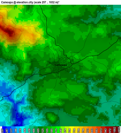
Below is the Elevation map of Camoapa, which displays elevation range with different colors. Scale of the first map is from 257 to 1032 m (843 to 3386 ft) with average elevation of 535.3 meters (=1756 ft) [note 1]
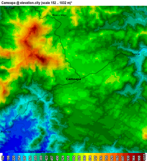
These maps also provides idea of topography and contour of this city, they are displayed at different zoom levels. More info about maps, scale and edge coordinates you can find below images.
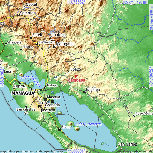
| \ | Map #1 | Map #2 | Topo.Map |
| Scale [m] | 257..1032 m | 152..1032 m | × |
| Scale [ft] | 843..3386 ft | 499..3386 ft | × |
| Average | 535.3 m = 1756 ft | 490.8 m = 1610 ft | × |
| Width | 9.55 km = 5.9 mi | 19.09 km = 11.9 mi | 305.4 km = 189.8 mi |
| Height | 9.55 km = 5.9 mi | 19.09 km = 11.9 mi | 305.4 km = 189.8 mi |
| ↑Max Latitude | 12.426749° | 12.469662° | 13.75362° |
| Latitude at center | 12.38383° | 12.38383° | 12.38383° |
| ↓Min Latitude | 12.340904° | 12.29797° | 11.00681° |
| ← Min Longitude | -85.556715° | -85.600661° | -86.91902° |
| Longitude center | -85.51277° | -85.51277° | -85.51277° |
| →Max Longitude | -85.468825° | -85.424879° | -84.10652° |
Nearby cities:
Cities around Camoapa sort by population:
• Juigalpa elevation 123 m
34.8 km,  152°
152°
• Boaco 380 m
18.6 km,  301°
301°
• San Lorenzo 381 m
16.7 km,  267°
267°
• El Ayote 504 m
32.6 km,  131°
131°
• Muy Muy 340 m
43.9 km,  343°
343°
• Teustepe 155 m
31.2 km,  277°
277°
• La Libertad 483 m
42 km,  116°
116°
• Cuapa 309 m
19.1 km, 132°
• San José de los Remates 678 m
36 km,  311°
311°
• Santa Lucía 553 m
27.1 km, 307°
• Comalapa 273 m
11.2 km,  178°
178°
• Esquipulas 522 m
43.1 km,  316°
316°
Multilingual:
 En español:
Camoapa elevación 571 m.
 En France:
Camoapa élévation 571 m.


Sources and notes:
- [note 1] Map square and city borders are not equal. Map elevation data is calculated only from area inside that square.
- [src 1] Elevation data from geonames database provided with same terms of usage.
- [src 2] The elevation map of Camoapa is generated using elevation data from NASA's 3 arcsec (90m) resolution SRTM data.
- [src 3] Base (background) map © OpenStreetMap contributors tiles are generated by Geofabrik and OpenTopoMap.
Copyright & License:
This Camoapa Elevation Map is licensed under CC BY-SA. You may reuse any part from this page, if you give a proper credit by linking to this URL:
 More info on terms of use page.