San Miguelito elevation
San Miguelito (Río San Juan), Nicaragua elevation is 49 meters and San Miguelito elevation in feet is 161 ft above sea level [src 1]. San Miguelito is a seat of a second-order administrative division (feature code) with elevation that is 292 meters (958 ft) smaller than average city elevation in Nicaragua.
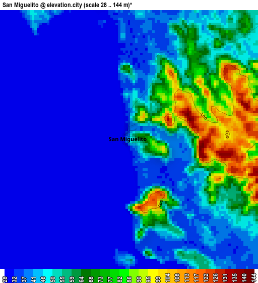
Below is the Elevation map of San Miguelito, which displays elevation range with different colors. Scale of the first map is from 28 to 144 m (92 to 472 ft) with average elevation of 47.4 meters (=156 ft) [note 1]
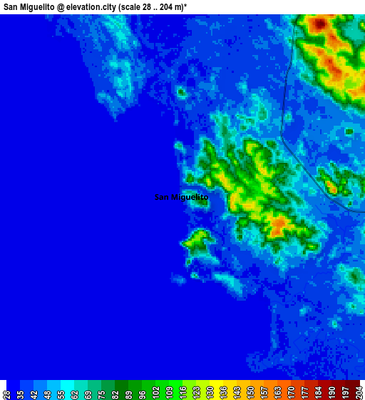
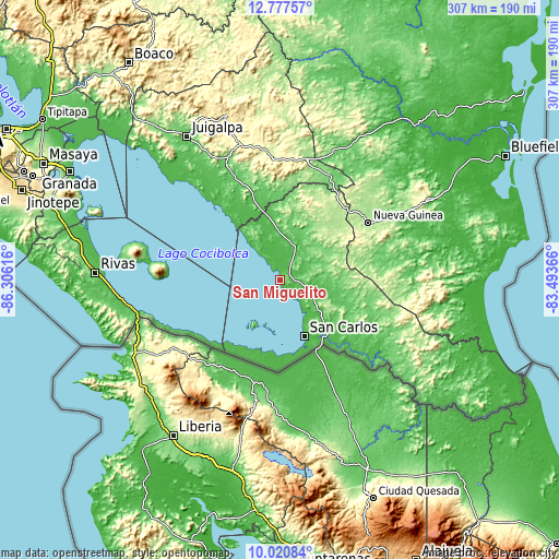
These maps also provides idea of topography and contour of this city, they are displayed at different zoom levels. More info about maps, scale and edge coordinates you can find below images.
| \ | Map #1 | Map #2 | Topo.Map |
| Scale [m] | 28..144 m | 28..204 m | × |
| Scale [ft] | 92..472 ft | 92..669 ft | × |
| Average | 47.4 m = 156 ft | 43.7 m = 143 ft | × |
| Width | 9.58 km = 6 mi | 19.16 km = 11.9 mi | 306.5 km = 190.4 mi |
| Height | 9.58 km = 6 mi | 19.16 km = 11.9 mi | 306.5 km = 190.4 mi |
| ↑Max Latitude | 11.445625° | 11.488693° | 12.77757° |
| Latitude at center | 11.40255° | 11.40255° | 11.40255° |
| ↓Min Latitude | 11.359469° | 11.316381° | 10.02084° |
| ← Min Longitude | -84.943855° | -84.987801° | -86.30616° |
| Longitude center | -84.89991° | -84.89991° | -84.89991° |
| →Max Longitude | -84.855965° | -84.812019° | -83.49366° |
Nearby cities:
Cities around San Miguelito sort by population:
• Nueva Guinea elevation 212 m
57.8 km,  56°
56°
• Santo Tomás 412 m
77 km,  344°
344°
• San Carlos 51 m
33.7 km,  156°
156°
• Acoyapa 101 m
69.7 km,  334°
334°
• Villa Sandino 306 m
72.5 km,  351°
351°
• Muelle de los Bueyes 74 m
84.2 km,  28°
28°
• Altagracia 66 m
76.1 km,  283°
283°
• El Almendro 175 m
37.5 km, 34°
• Morrito 37 m
31.3 km,  321°
321°
• Cárdenas 35 m
70.2 km,  250°
250°
• El Coral 127 m
63.5 km, 25°
• Boca de Sábalos 62 m
61.4 km,  129°
129°
Multilingual:
 En español:
San Miguelito elevación 49 m.
 En France:
San Miguelito élévation 49 m.
 Auf Deutsch:
San Miguelito höhe über dem Meeresspiegel ist 49 m.

Sources and notes:
- [note 1] Map square and city borders are not equal. Map elevation data is calculated only from area inside that square.
- [src 1] Elevation data from geonames database provided with same terms of usage.
- [src 2] The elevation map of San Miguelito is generated using elevation data from NASA's 3 arcsec (90m) resolution SRTM data.
- [src 3] Base (background) map © OpenStreetMap contributors tiles are generated by Geofabrik and OpenTopoMap.
Copyright & License:
This San Miguelito Elevation Map is licensed under CC BY-SA. You may reuse any part from this page, if you give a proper credit by linking to this URL:
 More info on terms of use page.