Dakingari elevation
Dakingari (Kebbi, Suru), Nigeria elevation is 191 meters and Dakingari elevation in feet is 627 ft above sea level [src 1]. Dakingari is a seat of a second-order administrative division (feature code) with elevation that is 106 meters (348 ft) smaller than average city elevation in Nigeria.
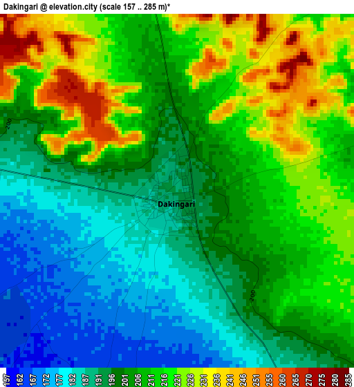
Below is the Elevation map of Dakingari, which displays elevation range with different colors. Scale of the first map is from 157 to 285 m (515 to 935 ft) with average elevation of 204.8 meters (=672 ft) [note 1]
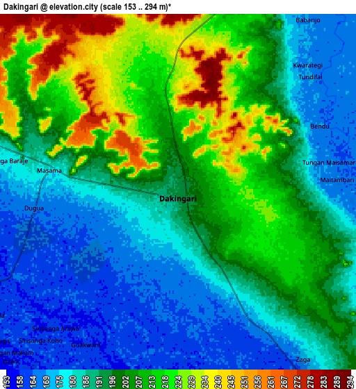
These maps also provides idea of topography and contour of this city, they are displayed at different zoom levels. More info about maps, scale and edge coordinates you can find below images.
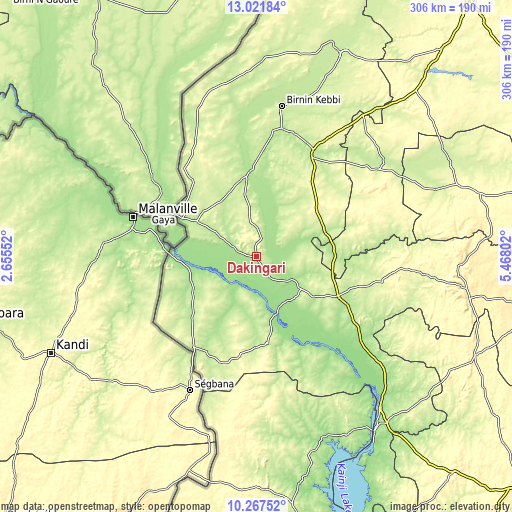
| \ | Map #1 | Map #2 | Topo.Map |
| Scale [m] | 157..285 m | 153..294 m | × |
| Scale [ft] | 515..935 ft | 502..965 ft | × |
| Average | 204.8 m = 672 ft | 196.3 m = 644 ft | × |
| Width | 9.57 km = 5.9 mi | 19.14 km = 11.9 mi | 306.3 km = 190.3 mi |
| Height | 9.57 km = 5.9 mi | 19.14 km = 11.9 mi | 306.3 km = 190.3 mi |
| ↑Max Latitude | 11.691127° | 11.734157° | 13.02184° |
| Latitude at center | 11.64809° | 11.64809° | 11.64809° |
| ↓Min Latitude | 11.605046° | 11.561996° | 10.26752° |
| ← Min Longitude | 4.017825° | 3.973879° | 2.65552° |
| Longitude center | 4.06177° | 4.06177° | 4.06177° |
| →Max Longitude | 4.105715° | 4.149661° | 5.46802° |
Nearby cities:
Cities around Dakingari sort by population:
• Jega elevation 242 m
72.7 km,  28°
28°
• Kamba 177 m
49.8 km,  297°
297°
• Maiyama 256 m
58.7 km, 34°
• Konkwesso 265 m
89.2 km,  177°
177°
• Shanga 167 m
74.3 km,  130°
130°
• Kende 159 m
25.9 km,  123°
123°
• Bagudo 159 m
32.5 km,  146°
146°
• Kebbe 221 m
90.6 km,  53°
53°
• Aliero 256 m
84 km, 32°
• Kalgo 204 m
76.9 km,  11°
11°
• Besse 161 m
58.5 km,  136°
136°
• Bunza 193 m
49.2 km,  354°
354°
Multilingual:
 En español:
Dakingari elevación 191 m.
 En France:
Dakingari élévation 191 m.
 Auf Deutsch:
Dakingari höhe über dem Meeresspiegel ist 191 m.

Sources and notes:
- [note 1] Map square and city borders are not equal. Map elevation data is calculated only from area inside that square.
- [src 1] Elevation data from geonames database provided with same terms of usage.
- [src 2] The elevation map of Dakingari is generated using elevation data from NASA's 3 arcsec (90m) resolution SRTM data.
- [src 3] Base (background) map © OpenStreetMap contributors tiles are generated by Geofabrik and OpenTopoMap.
Copyright & License:
This Dakingari Elevation Map is licensed under CC BY-SA. You may reuse any part from this page, if you give a proper credit by linking to this URL:
 More info on terms of use page.