Ejigbo elevation
Ejigbo (Osun), Nigeria elevation is 353 meters and Ejigbo elevation in feet is 1158 ft above sea level [src 1]. Ejigbo is a seat of a second-order administrative division (feature code) with elevation that is 56 meters (184 ft) bigger than average city elevation in Nigeria.
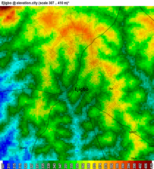
Below is the Elevation map of Ejigbo, which displays elevation range with different colors. Scale of the first map is from 307 to 410 m (1007 to 1345 ft) with average elevation of 350.3 meters (=1149 ft) [note 1]
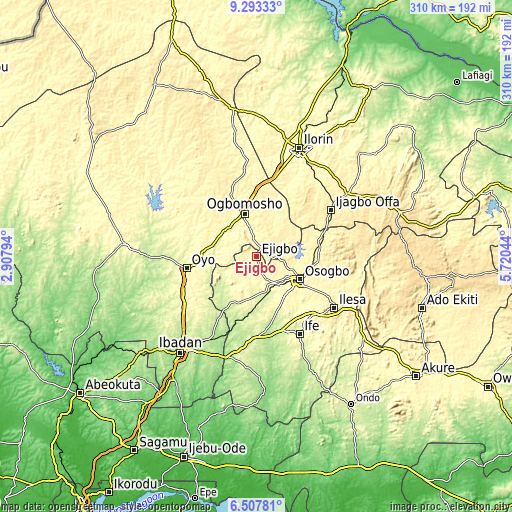
These maps also provides idea of topography and contour of this city, they are displayed at different zoom levels. More info about maps, scale and edge coordinates you can find below images.
| \ | Map #1 | Map #2 | Topo.Map |
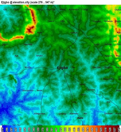
| Scale [m] | 307..410 m | 276..547 m | × |
| Scale [ft] | 1007..1345 ft | 906..1795 ft | × |
| Average | 350.3 m = 1149 ft | 353.7 m = 1160 ft | × |
| Width | 9.68 km = 6 mi | 19.36 km = 12 mi | 309.7 km = 192.4 mi |
| Height | 9.68 km = 6 mi | 19.36 km = 12 mi | 309.8 km = 192.5 mi |
| ↑Max Latitude | 7.946446° | 7.989967° | 9.29333° |
| Latitude at center | 7.90292° | 7.90292° | 7.90292° |
| ↓Min Latitude | 7.85939° | 7.815855° | 6.50781° |
| ← Min Longitude | 4.270245° | 4.226299° | 2.90794° |
| Longitude center | 4.31419° | 4.31419° | 4.31419° |
| →Max Longitude | 4.358135° | 4.402081° | 5.72044° |
Nearby cities:
Cities around Ejigbo sort by population:
• Iwo elevation 246 m
33.2 km,  206°
206°
• Inisa 368 m
6.3 km,  160°
160°
• Osogbo 336 m
30.5 km,  118°
118°
• Ilobu 334 m
20.1 km,  110°
110°
• Ile-Ogbo 274 m
32.2 km,  193°
193°
• Ogbomoso 361 m
26.9 km,  342°
342°
• Ede 293 m
22.8 km,  144°
144°
• Iresa-Adu 387 m
22.3 km,  22°
22°
• Ajaawa 292 m
20.9 km,  278°
278°
• Bode Osi 298 m
19.3 km, 208°
• Ifon 352 m
18.5 km,  104°
104°
• Awo 312 m
17.5 km,  149°
149°
Multilingual:
 En español:
Ejigbo elevación 353 m.
 En France:
Ejigbo élévation 353 m.


Sources and notes:
- [note 1] Map square and city borders are not equal. Map elevation data is calculated only from area inside that square.
- [src 1] Elevation data from geonames database provided with same terms of usage.
- [src 2] The elevation map of Ejigbo is generated using elevation data from NASA's 3 arcsec (90m) resolution SRTM data.
- [src 3] Base (background) map © OpenStreetMap contributors tiles are generated by Geofabrik and OpenTopoMap.
Copyright & License:
This Ejigbo Elevation Map is licensed under CC BY-SA. You may reuse any part from this page, if you give a proper credit by linking to this URL:
 More info on terms of use page.