Etinan elevation
Etinan (Akwa Ibom), Nigeria elevation is 39 meters and Etinan elevation in feet is 128 ft above sea level [src 1]. Etinan is a seat of a second-order administrative division (feature code) with elevation that is 258 meters (846 ft) smaller than average city elevation in Nigeria.
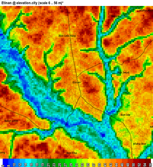
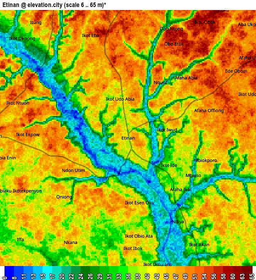
Below is the Elevation map of Etinan, which displays elevation range with different colors. Scale of the first map is from 6 to 56 m (20 to 184 ft) with average elevation of 34.2 meters (=112 ft) [note 1]
These maps also provides idea of topography and contour of this city, they are displayed at different zoom levels. More info about maps, scale and edge coordinates you can find below images.
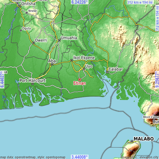
| \ | Map #1 | Map #2 | Topo.Map |
| Scale [m] | 6..56 m | 6..65 m | × |
| Scale [ft] | 20..184 ft | 20..213 ft | × |
| Average | 34.2 m = 112 ft | 39.7 m = 130 ft | × |
| Width | 9.74 km = 6.1 mi | 19.48 km = 12.1 mi | 311.6 km = 193.6 mi |
| Height | 9.74 km = 6.1 mi | 19.48 km = 12.1 mi | 311.6 km = 193.6 mi |
| ↑Max Latitude | 4.886407° | 4.930191° | 6.24226° |
| Latitude at center | 4.84262° | 4.84262° | 4.84262° |
| ↓Min Latitude | 4.79883° | 4.755037° | 3.44008° |
| ← Min Longitude | 7.808575° | 7.764629° | 6.44627° |
| Longitude center | 7.85252° | 7.85252° | 7.85252° |
| →Max Longitude | 7.896465° | 7.940411° | 9.25877° |
Nearby cities:
Cities around Etinan sort by population:
• Uyo elevation 45 m
24.9 km,  21°
21°
• Eket 30 m
23.7 km,  160°
160°
• Abak 56 m
17 km,  335°
335°
• Okopedi 49 m
30.3 km,  88°
88°
• Idu 72 m
27.7 km,  41°
41°
• Ikot Ibritam 27 m
26.6 km,  262°
262°
• Abat 23 m
25.1 km,  176°
176°
• Odot 48 m
20.6 km, 93°
• Mkpat Enin 38 m
16.6 km,  223°
223°
• Nung Udoe 53 m
14.8 km,  56°
56°
• Ikot Edibon 39 m
11.8 km,  132°
132°
• Afaha Offiong 48 m
6.3 km,  69°
69°
Multilingual:
 En español:
Etinan elevación 39 m.
 En France:
Etinan élévation 39 m.


Sources and notes:
- [note 1] Map square and city borders are not equal. Map elevation data is calculated only from area inside that square.
- [src 1] Elevation data from geonames database provided with same terms of usage.
- [src 2] The elevation map of Etinan is generated using elevation data from NASA's 3 arcsec (90m) resolution SRTM data.
- [src 3] Base (background) map © OpenStreetMap contributors tiles are generated by Geofabrik and OpenTopoMap.
Copyright & License:
This Etinan Elevation Map is licensed under CC BY-SA. You may reuse any part from this page, if you give a proper credit by linking to this URL:
 More info on terms of use page.