Ijebu-Igbo elevation
Ijebu-Igbo (Ogun, Ijebu North), Nigeria elevation is 94 meters and Ijebu-Igbo elevation in feet is 308 ft above sea level [src 1]. Ijebu-Igbo is a seat of a second-order administrative division (feature code) with elevation that is 203 meters (666 ft) smaller than average city elevation in Nigeria.
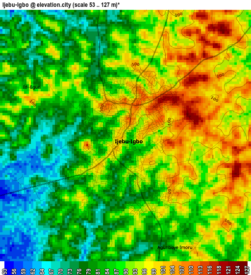
Below is the Elevation map of Ijebu-Igbo, which displays elevation range with different colors. Scale of the first map is from 53 to 127 m (174 to 417 ft) with average elevation of 88.1 meters (=289 ft) [note 1]
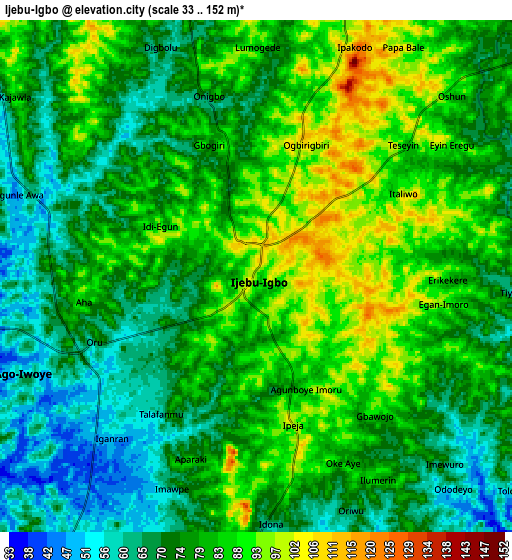
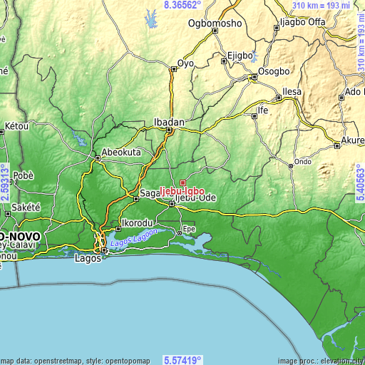
These maps also provides idea of topography and contour of this city, they are displayed at different zoom levels. More info about maps, scale and edge coordinates you can find below images.
| \ | Map #1 | Map #2 | Topo.Map |
| Scale [m] | 53..127 m | 33..152 m | × |
| Scale [ft] | 174..417 ft | 108..499 ft | × |
| Average | 88.1 m = 289 ft | 77.8 m = 255 ft | × |
| Width | 9.7 km = 6 mi | 19.4 km = 12.1 mi | 310.4 km = 192.9 mi |
| Height | 9.7 km = 6 mi | 19.4 km = 12.1 mi | 310.4 km = 192.9 mi |
| ↑Max Latitude | 7.015598° | 7.059213° | 8.36562° |
| Latitude at center | 6.97198° | 6.97198° | 6.97198° |
| ↓Min Latitude | 6.928358° | 6.884731° | 5.57419° |
| ← Min Longitude | 3.955435° | 3.911489° | 2.59313° |
| Longitude center | 3.99938° | 3.99938° | 3.99938° |
| →Max Longitude | 4.043325° | 4.087271° | 5.40563° |
Nearby cities:
Cities around Ijebu-Igbo sort by population:
• Shagamu elevation 53 m
41.3 km,  250°
250°
• Ijebu-Ode 74 m
19.2 km,  208°
208°
• Iperu 97 m
37.5 km,  259°
259°
• Ejirin 6 m
41.3 km,  195°
195°
• Isara 138 m
35.2 km,  273°
273°
• Ijebu-Ife 55 m
21.9 km,  169°
169°
• Akanran 182 m
34.5 km,  4°
4°
• Ikenne 49 m
33.5 km, 249°
• Idi-Ayunre 125 m
32.8 km,  332°
332°
• Ogbere 50 m
31.4 km,  145°
145°
• Odogbolu 47 m
29.9 km,  240°
240°
• Atan 78 m
8.7 km, 174°
Multilingual:
 En español:
Ijebu-Igbo elevación 94 m.
 En France:
Ijebu-Igbo élévation 94 m.
 Auf Deutsch:
Ijebu-Igbo höhe über dem Meeresspiegel ist 94 m.

Sources and notes:
- [note 1] Map square and city borders are not equal. Map elevation data is calculated only from area inside that square.
- [src 1] Elevation data from geonames database provided with same terms of usage.
- [src 2] The elevation map of Ijebu-Igbo is generated using elevation data from NASA's 3 arcsec (90m) resolution SRTM data.
- [src 3] Base (background) map © OpenStreetMap contributors tiles are generated by Geofabrik and OpenTopoMap.
Copyright & License:
This Ijebu-Igbo Elevation Map is licensed under CC BY-SA. You may reuse any part from this page, if you give a proper credit by linking to this URL:
 More info on terms of use page.