Katsina elevation
Katsina, Nigeria elevation is 519 meters and Katsina elevation in feet is 1703 ft above sea level [src 1]. Katsina is a seat of a first-order administrative division (feature code) with elevation that is 222 meters (728 ft) bigger than average city elevation in Nigeria.
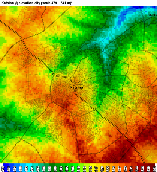
Below is the Elevation map of Katsina, which displays elevation range with different colors. Scale of the first map is from 479 to 541 m (1572 to 1775 ft) with average elevation of 515.8 meters (=1692 ft) [note 1]
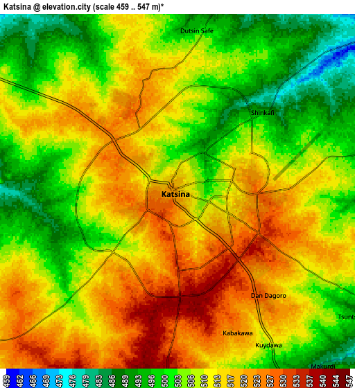
These maps also provides idea of topography and contour of this city, they are displayed at different zoom levels. More info about maps, scale and edge coordinates you can find below images.
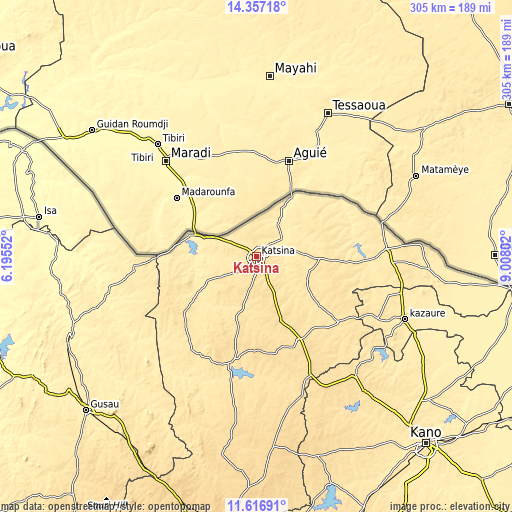
| \ | Map #1 | Map #2 | Topo.Map |
| Scale [m] | 479..541 m | 459..547 m | × |
| Scale [ft] | 1572..1775 ft | 1506..1795 ft | × |
| Average | 515.8 m = 1692 ft | 509.5 m = 1672 ft | × |
| Width | 9.52 km = 5.9 mi | 19.04 km = 11.8 mi | 304.7 km = 189.3 mi |
| Height | 9.52 km = 5.9 mi | 19.04 km = 11.8 mi | 304.7 km = 189.3 mi |
| ↑Max Latitude | 13.033637° | 13.076446° | 14.35718° |
| Latitude at center | 12.99082° | 12.99082° | 12.99082° |
| ↓Min Latitude | 12.947996° | 12.905164° | 11.61691° |
| ← Min Longitude | 7.557825° | 7.513879° | 6.19552° |
| Longitude center | 7.60177° | 7.60177° | 7.60177° |
| →Max Longitude | 7.645715° | 7.689661° | 9.00802° |
Nearby cities:
Cities around Katsina sort by population:
• Jibia elevation 409 m
42.3 km,  285°
285°
• Ruma 502 m
42.3 km,  250°
250°
• Mashi 494 m
37.4 km,  91°
91°
• Batsari 471 m
46.4 km,  235°
235°
• Dankama 414 m
40 km,  31°
31°
• Bindawa 532 m
42.1 km,  147°
147°
• Kurfi 532 m
38.2 km,  199°
199°
• Charanchi 550 m
38.1 km,  158°
158°
• Mani 521 m
33.3 km,  117°
117°
• Rimi 525 m
19.5 km,  143°
143°
• Kaita 443 m
18.3 km,  55°
55°
• Batagarawa 532 m
9.4 km,  177°
177°
Multilingual:
 En español:
Katsina elevación 519 m.
 En France:
Katsina élévation 519 m.


Sources and notes:
- [note 1] Map square and city borders are not equal. Map elevation data is calculated only from area inside that square.
- [src 1] Elevation data from geonames database provided with same terms of usage.
- [src 2] The elevation map of Katsina is generated using elevation data from NASA's 3 arcsec (90m) resolution SRTM data.
- [src 3] Base (background) map © OpenStreetMap contributors tiles are generated by Geofabrik and OpenTopoMap.
Copyright & License:
This Katsina Elevation Map is licensed under CC BY-SA. You may reuse any part from this page, if you give a proper credit by linking to this URL:
 More info on terms of use page.