Modakeke elevation
Modakeke (Osun, Irewole), Nigeria elevation is 228 meters and Modakeke elevation in feet is 748 ft above sea level [src 1]. Modakeke is a populated place (feature code) with elevation that is 69 meters (226 ft) smaller than average city elevation in Nigeria.
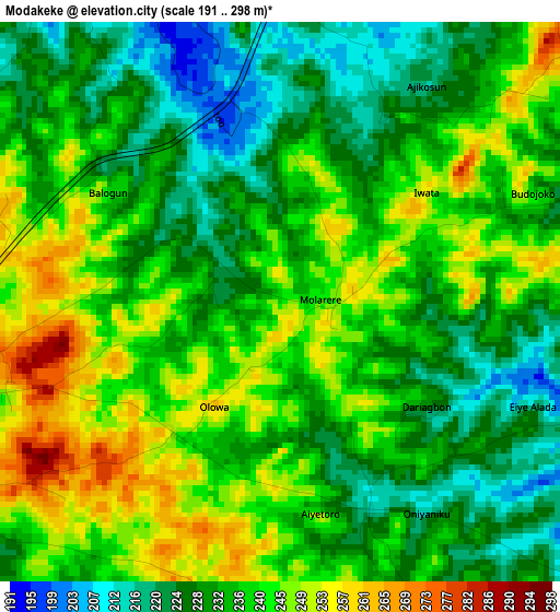
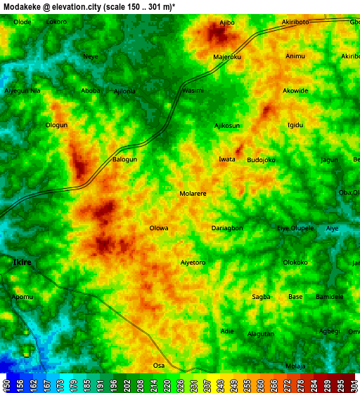
Below is the Elevation map of Modakeke, which displays elevation range with different colors. Scale of the first map is from 191 to 298 m (627 to 978 ft) with average elevation of 235.9 meters (=774 ft) [note 1]
These maps also provides idea of topography and contour of this city, they are displayed at different zoom levels. More info about maps, scale and edge coordinates you can find below images.
| \ | Map #1 | Map #2 | Topo.Map |
| Scale [m] | 191..298 m | 150..301 m | × |
| Scale [ft] | 627..978 ft | 492..988 ft | × |
| Average | 235.9 m = 774 ft | 222.1 m = 729 ft | × |
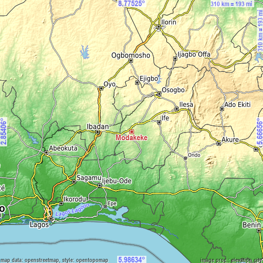
| Width | 9.69 km = 6 mi | 19.38 km = 12 mi | 310.1 km = 192.7 mi |
| Height | 9.69 km = 6 mi | 19.38 km = 12 mi | 310.1 km = 192.7 mi |
| ↑Max Latitude | 7.426569° | 7.470143° | 8.77525° |
| Latitude at center | 7.38299° | 7.38299° | 7.38299° |
| ↓Min Latitude | 7.339407° | 7.295819° | 5.98634° |
| ← Min Longitude | 4.216365° | 4.172419° | 2.85406° |
| Longitude center | 4.26031° | 4.26031° | 4.26031° |
| →Max Longitude | 4.304255° | 4.348201° | 5.66656° |
Nearby cities:
Cities around Modakeke sort by population:
• Iwo elevation 246 m
29.4 km,  342°
342°
• Ikire 216 m
8.3 km,  259°
259°
• Gbongan 236 m
14.7 km,  44°
44°
• Olupona 241 m
25.6 km, 340°
• Lalupon 226 m
23.4 km,  293°
293°
• Apomu 193 m
9.2 km,  247°
247°
• Ile-Ife 295 m
34.9 km,  71°
71°
• Akanran 182 m
28.3 km, 246°
• Ile-Ogbo 274 m
26.5 km,  356°
356°
• Ipetumodu 255 m
25.5 km,  52°
52°
• Iyana-Ofa 219 m
23.6 km,  303°
303°
• Egbeda 194 m
23.2 km,  268°
268°
Multilingual:
 En español:
Modakeke elevación 228 m.
 En France:
Modakeke élévation 228 m.
 Auf Deutsch:
Modakeke höhe über dem Meeresspiegel ist 228 m.

Sources and notes:
- [note 1] Map square and city borders are not equal. Map elevation data is calculated only from area inside that square.
- [src 1] Elevation data from geonames database provided with same terms of usage.
- [src 2] The elevation map of Modakeke is generated using elevation data from NASA's 3 arcsec (90m) resolution SRTM data.
- [src 3] Base (background) map © OpenStreetMap contributors tiles are generated by Geofabrik and OpenTopoMap.
Copyright & License:
This Modakeke Elevation Map is licensed under CC BY-SA. You may reuse any part from this page, if you give a proper credit by linking to this URL:
 More info on terms of use page.