Nnewi elevation
Nnewi (Anambra, Nnewi North), Nigeria elevation is 151 meters and Nnewi elevation in feet is 495 ft above sea level [src 1]. Nnewi is a seat of a second-order administrative division (feature code) with elevation that is 146 meters (479 ft) smaller than average city elevation in Nigeria.
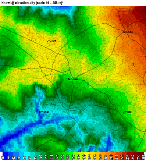
Below is the Elevation map of Nnewi, which displays elevation range with different colors. Scale of the first map is from 46 to 258 m (151 to 846 ft) with average elevation of 139.4 meters (=457 ft) [note 1]
These maps also provides idea of topography and contour of this city, they are displayed at different zoom levels. More info about maps, scale and edge coordinates you can find below images.
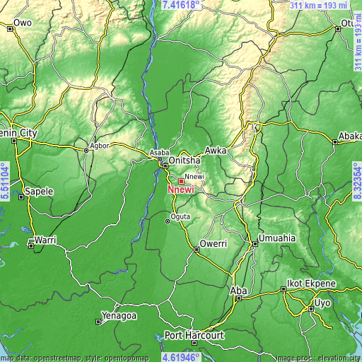
| \ | Map #1 | Map #2 | Topo.Map |
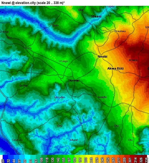
| Scale [m] | 46..258 m | 20..338 m | × |
| Scale [ft] | 151..846 ft | 66..1109 ft | × |
| Average | 139.4 m = 457 ft | 138.3 m = 454 ft | × |
| Width | 9.72 km = 6 mi | 19.44 km = 12.1 mi | 311 km = 193.2 mi |
| Height | 9.72 km = 6 mi | 19.44 km = 12.1 mi | 311 km = 193.2 mi |
| ↑Max Latitude | 6.063321° | 6.107019° | 7.41618° |
| Latitude at center | 6.01962° | 6.01962° | 6.01962° |
| ↓Min Latitude | 5.975915° | 5.932207° | 4.61946° |
| ← Min Longitude | 6.873345° | 6.829399° | 5.51104° |
| Longitude center | 6.91729° | 6.91729° | 6.91729° |
| →Max Longitude | 6.961235° | 7.005181° | 8.32354° |
Nearby cities:
Cities around Nnewi sort by population:
• Atani elevation 25 m
18.8 km,  267°
267°
• Nkpor 124 m
17.4 km,  326°
326°
• Ihiala 146 m
19.4 km,  199°
199°
• Agulu 201 m
18.3 km,  60°
60°
• Igbo-Ukwu 359 m
11.4 km,  90°
90°
• Ozubulu 135 m
9.9 km,  225°
225°
• Uruobo-Okija 86 m
15.6 km,  211°
211°
• Aguata 307 m
18.9 km, 91°
• Ogidi 150 m
15.9 km,  337°
337°
• Neni 189 m
14.5 km,  54°
54°
• Ukpor 130 m
8.7 km,  171°
171°
• Ojoto 143 m
7.6 km,  304°
304°
Multilingual:
 En español:
Nnewi elevación 151 m.
 En France:
Nnewi élévation 151 m.


Sources and notes:
- [note 1] Map square and city borders are not equal. Map elevation data is calculated only from area inside that square.
- [src 1] Elevation data from geonames database provided with same terms of usage.
- [src 2] The elevation map of Nnewi is generated using elevation data from NASA's 3 arcsec (90m) resolution SRTM data.
- [src 3] Base (background) map © OpenStreetMap contributors tiles are generated by Geofabrik and OpenTopoMap.
Copyright & License:
This Nnewi Elevation Map is licensed under CC BY-SA. You may reuse any part from this page, if you give a proper credit by linking to this URL:
 More info on terms of use page.