Owode elevation
Owode (Ogun, Obafemi Owode), Nigeria elevation is 134 meters and Owode elevation in feet is 440 ft above sea level [src 1]. Owode is a seat of a second-order administrative division (feature code) with elevation that is 163 meters (535 ft) smaller than average city elevation in Nigeria.
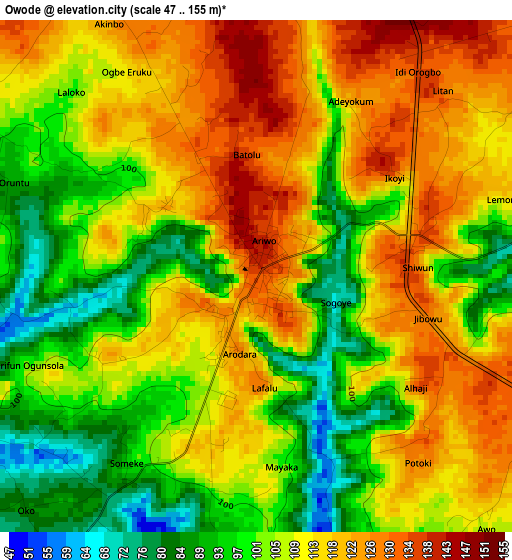
Below is the Elevation map of Owode, which displays elevation range with different colors. Scale of the first map is from 47 to 155 m (154 to 509 ft) with average elevation of 108.8 meters (=357 ft) [note 1]
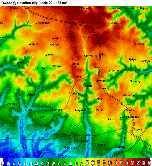
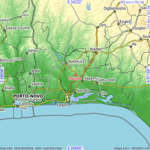
These maps also provides idea of topography and contour of this city, they are displayed at different zoom levels. More info about maps, scale and edge coordinates you can find below images.
| \ | Map #1 | Map #2 | Topo.Map |
| Scale [m] | 47..155 m | 20..163 m | × |
| Scale [ft] | 154..509 ft | 66..535 ft | × |
| Average | 108.8 m = 357 ft | 97.9 m = 321 ft | × |
| Width | 9.7 km = 6 mi | 19.4 km = 12.1 mi | 310.4 km = 192.9 mi |
| Height | 9.7 km = 6 mi | 19.4 km = 12.1 mi | 310.4 km = 192.9 mi |
| ↑Max Latitude | 6.992131° | 7.035747° | 8.34222° |
| Latitude at center | 6.94851° | 6.94851° | 6.94851° |
| ↓Min Latitude | 6.904885° | 6.861257° | 5.55065° |
| ← Min Longitude | 3.461665° | 3.417719° | 2.09936° |
| Longitude center | 3.50561° | 3.50561° | 3.50561° |
| →Max Longitude | 3.549555° | 3.593501° | 4.91186° |
Nearby cities:
Cities around Owode sort by population:
• Abeokuta elevation 64 m
29.1 km,  322°
322°
• Ebute Ikorodu 4 m
38.7 km,  182°
182°
• Shagamu 53 m
19.1 km,  125°
125°
• Ifo 65 m
37.3 km,  246°
246°
• Iperu 97 m
18.2 km,  103°
103°
• Isara 138 m
20 km,  75°
75°
• Ifako 52 m
39.3 km,  210°
210°
• Ikorodu 36 m
37.1 km, 179°
• Odeda 161 m
31.7 km,  4°
4°
• Itori 24 m
31.4 km,  266°
266°
• Odogbolu 47 m
30.8 km,  112°
112°
• Ikenne 49 m
24.9 km, 111°
Multilingual:
 En español:
Owode elevación 134 m.
 En France:
Owode élévation 134 m.


Sources and notes:
- [note 1] Map square and city borders are not equal. Map elevation data is calculated only from area inside that square.
- [src 1] Elevation data from geonames database provided with same terms of usage.
- [src 2] The elevation map of Owode is generated using elevation data from NASA's 3 arcsec (90m) resolution SRTM data.
- [src 3] Base (background) map © OpenStreetMap contributors tiles are generated by Geofabrik and OpenTopoMap.
Copyright & License:
This Owode Elevation Map is licensed under CC BY-SA. You may reuse any part from this page, if you give a proper credit by linking to this URL:
 More info on terms of use page.