Uga elevation
Uga (Anambra, Aguata), Nigeria elevation is 227 meters and Uga elevation in feet is 745 ft above sea level [src 1]. Uga is a populated place (feature code) with elevation that is 70 meters (230 ft) smaller than average city elevation in Nigeria.
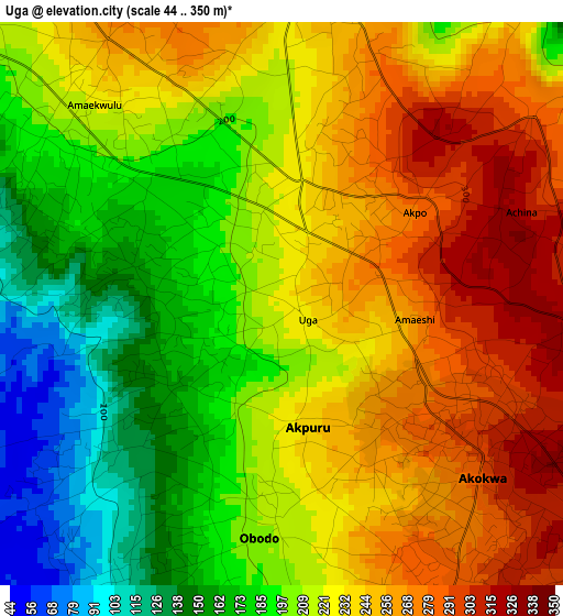
Below is the Elevation map of Uga, which displays elevation range with different colors. Scale of the first map is from 44 to 350 m (144 to 1148 ft) with average elevation of 219 meters (=719 ft) [note 1]
These maps also provides idea of topography and contour of this city, they are displayed at different zoom levels. More info about maps, scale and edge coordinates you can find below images.
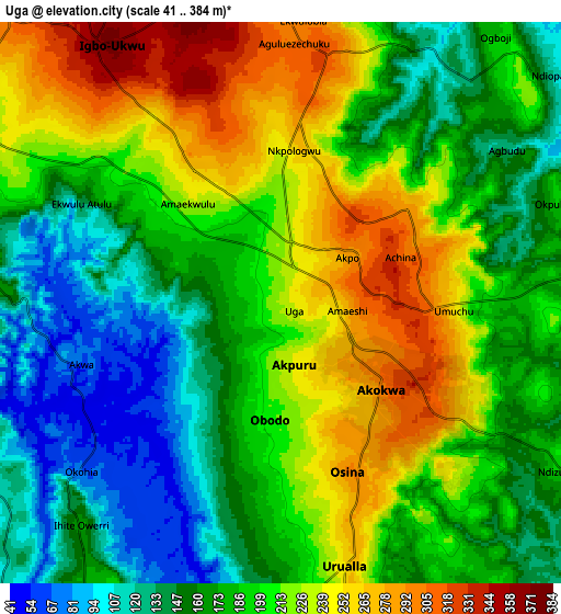
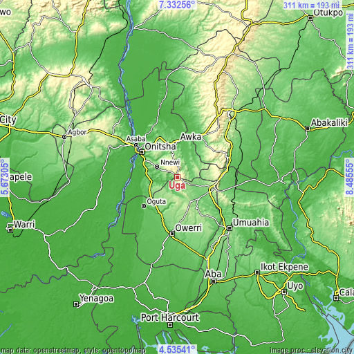
| \ | Map #1 | Map #2 | Topo.Map |
| Scale [m] | 44..350 m | 41..384 m | × |
| Scale [ft] | 144..1148 ft | 135..1260 ft | × |
| Average | 219 m = 719 ft | 192.3 m = 631 ft | × |
| Width | 9.72 km = 6 mi | 19.44 km = 12.1 mi | 311 km = 193.2 mi |
| Height | 9.72 km = 6 mi | 19.44 km = 12.1 mi | 311 km = 193.2 mi |
| ↑Max Latitude | 5.979468° | 6.023172° | 7.33256° |
| Latitude at center | 5.93576° | 5.93576° | 5.93576° |
| ↓Min Latitude | 5.892049° | 5.848334° | 4.53541° |
| ← Min Longitude | 7.035355° | 6.991409° | 5.67305° |
| Longitude center | 7.0793° | 7.0793° | 7.0793° |
| →Max Longitude | 7.123245° | 7.167191° | 8.48555° |
Nearby cities:
Cities around Uga sort by population:
• Agulu elevation 201 m
18.4 km,  353°
353°
• Igbo-Ukwu 359 m
11.2 km,  324°
324°
• Nkwerre 179 m
19.8 km,  172°
172°
• Orlu 173 m
16.3 km,  197°
197°
• Awo-Idemili 158 m
20.2 km,  232°
232°
• Dikenafai 166 m
20.2 km,  155°
155°
• Neni 189 m
18.7 km,  341°
341°
• Ajalli 140 m
18.7 km,  49°
49°
• Umunze 189 m
17.7 km,  78°
78°
• Ukpor 130 m
16.6 km,  272°
272°
• Urualla 252 m
9.4 km, 166°
• Aguata 307 m
9 km,  6°
6°
Multilingual:
 En español:
Uga elevación 227 m.
 En France:
Uga élévation 227 m.


Sources and notes:
- [note 1] Map square and city borders are not equal. Map elevation data is calculated only from area inside that square.
- [src 1] Elevation data from geonames database provided with same terms of usage.
- [src 2] The elevation map of Uga is generated using elevation data from NASA's 3 arcsec (90m) resolution SRTM data.
- [src 3] Base (background) map © OpenStreetMap contributors tiles are generated by Geofabrik and OpenTopoMap.
Copyright & License:
This Uga Elevation Map is licensed under CC BY-SA. You may reuse any part from this page, if you give a proper credit by linking to this URL:
 More info on terms of use page.