Rundu elevation
Rundu (Kavango East), Namibia elevation is 1110 meters and Rundu elevation in feet is 3642 ft above sea level [src 1]. Rundu is a seat of a first-order administrative division (feature code) with elevation that is 82 meters (269 ft) bigger than average city elevation in Namibia.
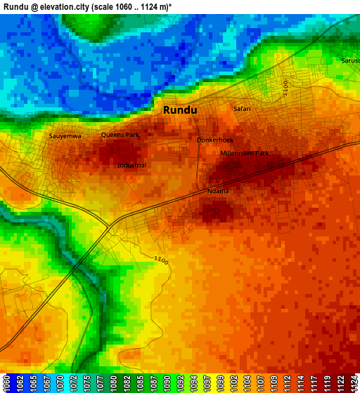
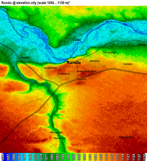
Below is the Elevation map of Rundu, which displays elevation range with different colors. Scale of the first map is from 1060 to 1124 m (3478 to 3688 ft) with average elevation of 1098.1 meters (=3603 ft) [note 1]
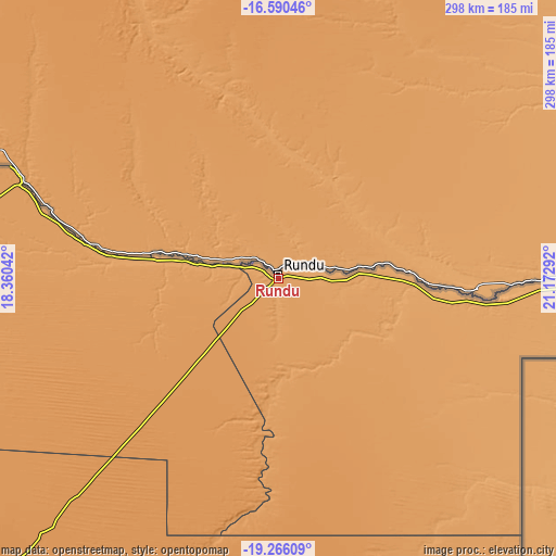
These maps also provides idea of topography and contour of this city, they are displayed at different zoom levels. More info about maps, scale and edge coordinates you can find below images.
| \ | Map #1 | Map #2 | Topo.Map |
| Scale [m] | 1060..1124 m | 1054..1130 m | × |
| Scale [ft] | 3478..3688 ft | 3458..3707 ft | × |
| Average | 1098.1 m = 3603 ft | 1098.4 m = 3604 ft | × |
| Width | 9.3 km = 5.8 mi | 18.6 km = 11.6 mi | 297.5 km = 184.9 mi |
| Height | 9.3 km = 5.8 mi | 18.6 km = 11.6 mi | 297.5 km = 184.9 mi |
| ↑Max Latitude | -17.891515° | -17.84969° | -16.59046° |
| Latitude at center | -17.93333° | -17.93333° | -17.93333° |
| ↓Min Latitude | -17.975135° | -18.016931° | -19.26609° |
| ← Min Longitude | 19.722725° | 19.678779° | 18.36042° |
| Longitude center | 19.76667° | 19.76667° | 19.76667° |
| →Max Longitude | 19.810615° | 19.854561° | 21.17292° |
Nearby cities:
Cities around Rundu sort by population:
• Grootfontein elevation 1440 m
251.3 km,  223°
223°
• Tsumeb 1281 m
259.9 km,  236°
236°
• Ondangwa 1098 m
403.8 km,  270°
270°
• Okakarara 1347 m
383.1 km, 219°
• Omuthiya 1098 m
339.9 km,  261°
261°
• Otavi 1414 m
319.4 km,  233°
233°
• Oshikango 1111 m
415.7 km,  278°
278°
• Bagani 1007 m
196.6 km,  95°
95°
• Eenhana 1121 m
367.4 km, 278°
• Nkurenkuru 1098 m
128.4 km,  285°
285°
Multilingual:
 En español:
Rundu elevación 1110 m.
 En France:
Rundu élévation 1110 m.


Sources and notes:
- [note 1] Map square and city borders are not equal. Map elevation data is calculated only from area inside that square.
- [src 1] Elevation data from geonames database provided with same terms of usage.
- [src 2] The elevation map of Rundu is generated using elevation data from NASA's 3 arcsec (90m) resolution SRTM data.
- [src 3] Base (background) map © OpenStreetMap contributors tiles are generated by Geofabrik and OpenTopoMap.
Copyright & License:
This Rundu Elevation Map is licensed under CC BY-SA. You may reuse any part from this page, if you give a proper credit by linking to this URL:
 More info on terms of use page.