Tarímbaro elevation
Tarímbaro (Michoacán), Mexico elevation is 1895 meters and Tarímbaro elevation in feet is 6217 ft above sea level [src 1]. Tarímbaro is a populated place (feature code) with elevation that is 581 meters (1906 ft) bigger than average city elevation in Mexico.
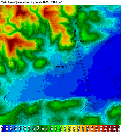
Below is the Elevation map of Tarímbaro, which displays elevation range with different colors. Scale of the first map is from 1839 to 2181 m (6033 to 7156 ft) with average elevation of 1931.5 meters (=6337 ft) [note 1]
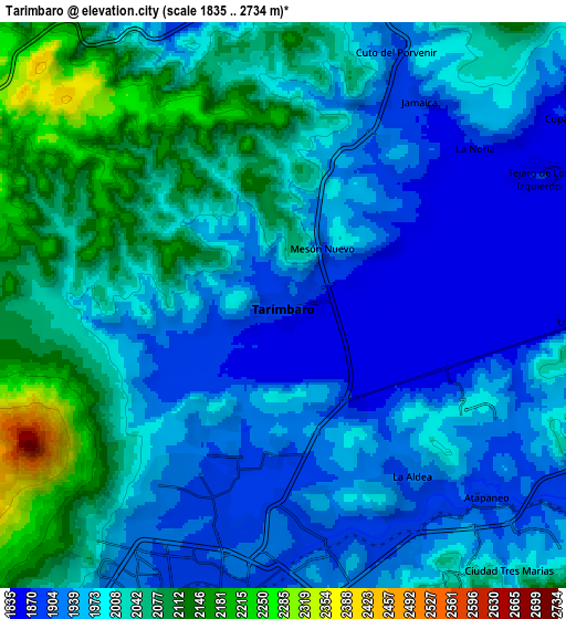
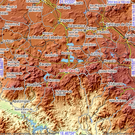
These maps also provides idea of topography and contour of this city, they are displayed at different zoom levels. More info about maps, scale and edge coordinates you can find below images.
| \ | Map #1 | Map #2 | Topo.Map |
| Scale [m] | 1839..2181 m | 1835..2734 m | × |
| Scale [ft] | 6033..7156 ft | 6020..8970 ft | × |
| Average | 1931.5 m = 6337 ft | 1991.8 m = 6535 ft | × |
| Width | 9.19 km = 5.7 mi | 18.39 km = 11.4 mi | 294.2 km = 182.8 mi |
| Height | 9.2 km = 5.7 mi | 18.39 km = 11.4 mi | 294.2 km = 182.8 mi |
| ↑Max Latitude | 19.837123° | 19.878455° | 21.11333° |
| Latitude at center | 19.79578° | 19.79578° | 19.79578° |
| ↓Min Latitude | 19.754426° | 19.713062° | 18.46724° |
| ← Min Longitude | -101.221765° | -101.265711° | -102.58407° |
| Longitude center | -101.17782° | -101.17782° | -101.17782° |
| →Max Longitude | -101.133875° | -101.089929° | -99.77157° |
Nearby cities:
Cities around Tarímbaro sort by population:
• Fraccionamiento Galaxia Tarímbaro elevation 1922 m
4.2 km,  204°
204°
• Fraccionamiento Metrópolis II 1908 m
5.2 km,  212°
212°
• Real Hacienda (Metrópolis) 1896 m
5.4 km, 201°
• San Pedro de los Sauces 1845 m
4.3 km,  103°
103°
• San Bernabé de las Canteras 1911 m
3.6 km,  155°
155°
• Conjunto Habitacional el Trébol 1863 m
4 km,  142°
142°
• Mesón Nuevo (Cañada de la Magdalena) 1907 m
2.4 km,  30°
30°
• El Colegio 1867 m
2.5 km,  179°
179°
• Ex-Hacienda de Guadalupe 1914 m
4.1 km,  251°
251°
• Fraccionamiento Privadas del Sol 1899 m
5 km, 196°
• Peña del Panal 1873 m
2.8 km, 205°
• La Palma (Las Palmas) 1873 m
4.7 km,  125°
125°
Multilingual:
 En español:
Tarímbaro elevación 1895 m.
 En France:
Tarímbaro élévation 1895 m.
 Auf Deutsch:
Tarímbaro höhe über dem Meeresspiegel ist 1895 m.

Sources and notes:
- [note 1] Map square and city borders are not equal. Map elevation data is calculated only from area inside that square.
- [src 1] Elevation data from geonames database provided with same terms of usage.
- [src 2] The elevation map of Tarímbaro is generated using elevation data from NASA's 3 arcsec (90m) resolution SRTM data.
- [src 3] Base (background) map © OpenStreetMap contributors tiles are generated by Geofabrik and OpenTopoMap.
Copyright & License:
This Tarímbaro Elevation Map is licensed under CC BY-SA. You may reuse any part from this page, if you give a proper credit by linking to this URL:
 More info on terms of use page.