Chalchihuapan elevation
Chalchihuapan (Puebla, Ocoyucan), Mexico elevation is 2217 meters and Chalchihuapan elevation in feet is 7274 ft above sea level [src 1]. Chalchihuapan is a populated place (feature code) with elevation that is 903 meters (2963 ft) bigger than average city elevation in Mexico.
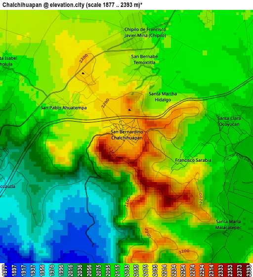
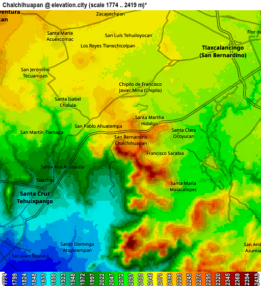
Below is the Elevation map of Chalchihuapan, which displays elevation range with different colors. Scale of the first map is from 1877 to 2393 m (6158 to 7851 ft) with average elevation of 2118.3 meters (=6950 ft) [note 1]
These maps also provides idea of topography and contour of this city, they are displayed at different zoom levels. More info about maps, scale and edge coordinates you can find below images.
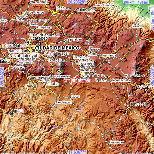
| \ | Map #1 | Map #2 | Topo.Map |
| Scale [m] | 1877..2393 m | 1774..2419 m | × |
| Scale [ft] | 6158..7851 ft | 5820..7936 ft | × |
| Average | 2118.3 m = 6950 ft | 2091.6 m = 6862 ft | × |
| Width | 9.24 km = 5.7 mi | 18.48 km = 11.5 mi | 295.7 km = 183.7 mi |
| Height | 9.24 km = 5.7 mi | 18.48 km = 11.5 mi | 295.7 km = 183.7 mi |
| ↑Max Latitude | 19.013383° | 19.054926° | 20.29628° |
| Latitude at center | 18.97183° | 18.97183° | 18.97183° |
| ↓Min Latitude | 18.930267° | 18.888693° | 17.63677° |
| ← Min Longitude | -98.380925° | -98.424871° | -99.74323° |
| Longitude center | -98.33698° | -98.33698° | -98.33698° |
| →Max Longitude | -98.293035° | -98.249089° | -96.93073° |
Nearby cities:
Cities around Chalchihuapan sort by population:
• Santa Clara elevation 2112 m
3.8 km,  82°
82°
• San Gregorio Atzompa 2151 m
5.9 km,  348°
348°
• San Bernabé Temoxtitla 2145 m
2.9 km,  12°
12°
• Santa María Malacatepec 2098 m
5 km,  132°
132°
• Chipilo de Francisco Javier Mina 2143 m
3.9 km, 10°
• San Pablo Ahuatempa 2157 m
2.5 km,  294°
294°
• Santa Isabel Cholula 2120 m
5.2 km,  301°
301°
• Santa Ana Acozautla 1987 m
5.2 km,  249°
249°
• Los Reyes Tlanechicolpan 2160 m
6.9 km, 346°
• Santa Martha Hidalgo 2135 m
2 km,  42°
42°
• San Martín Tlamapa 2127 m
6.3 km,  275°
275°
• Francisco Sarabia 2136 m
2.6 km,  109°
109°
Multilingual:
 En español:
San Bernardino Chalchihuapan, Chalchihuapan elevación 2217 m.
 En France:
Chalchihuapan élévation 2217 m.
 Auf Deutsch:
Chalchihuapan höhe über dem Meeresspiegel ist 2217 m.

Sources and notes:
- [note 1] Map square and city borders are not equal. Map elevation data is calculated only from area inside that square.
- [src 1] Elevation data from geonames database provided with same terms of usage.
- [src 2] The elevation map of Chalchihuapan is generated using elevation data from NASA's 3 arcsec (90m) resolution SRTM data.
- [src 3] Base (background) map © OpenStreetMap contributors tiles are generated by Geofabrik and OpenTopoMap.
Copyright & License:
This Chalchihuapan Elevation Map is licensed under CC BY-SA. You may reuse any part from this page, if you give a proper credit by linking to this URL:
 More info on terms of use page.