San Lucas Totolmaloya elevation
San Lucas Totolmaloya (State of Mexico, Aculco), Mexico elevation is 2378 meters and San Lucas Totolmaloya elevation in feet is 7802 ft above sea level [src 1]. San Lucas Totolmaloya is a populated place (feature code) with elevation that is 1064 meters (3491 ft) bigger than average city elevation in Mexico.
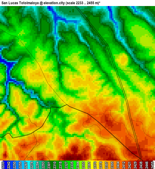
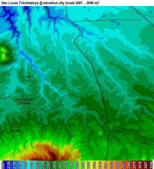
Below is the Elevation map of San Lucas Totolmaloya, which displays elevation range with different colors. Scale of the first map is from 2233 to 2455 m (7326 to 8054 ft) with average elevation of 2347 meters (=7700 ft) [note 1]
These maps also provides idea of topography and contour of this city, they are displayed at different zoom levels. More info about maps, scale and edge coordinates you can find below images.
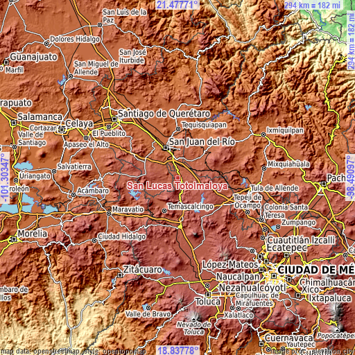
| \ | Map #1 | Map #2 | Topo.Map |
| Scale [m] | 2233..2455 m | 2081..3096 m | × |
| Scale [ft] | 7326..8054 ft | 6827..10157 ft | × |
| Average | 2347 m = 7700 ft | 2370.9 m = 7779 ft | × |
| Width | 9.17 km = 5.7 mi | 18.35 km = 11.4 mi | 293.5 km = 182.4 mi |
| Height | 9.17 km = 5.7 mi | 18.35 km = 11.4 mi | 293.6 km = 182.4 mi |
| ↑Max Latitude | 20.204577° | 20.245812° | 21.47771° |
| Latitude at center | 20.16333° | 20.16333° | 20.16333° |
| ↓Min Latitude | 20.122072° | 20.080804° | 18.83778° |
| ← Min Longitude | -99.941165° | -99.985111° | -101.30347° |
| Longitude center | -99.89722° | -99.89722° | -99.89722° |
| →Max Longitude | -99.853275° | -99.809329° | -98.49097° |
Nearby cities:
Cities around San Lucas Totolmaloya sort by population:
• San Ildefonso Tultepec elevation 2391 m
6.8 km,  251°
251°
• Polotitlán de la Ilustración 2317 m
11 km,  51°
51°
• Gunyo Poniente (San José Gunyo) 2418 m
8.4 km,  133°
133°
• Aculco de Espinoza 2449 m
10.2 km, 134°
• La Soledad Barrio 2462 m
11.1 km,  135°
135°
• Yosphí 2368 m
5.8 km,  278°
278°
• El Mogote 2380 m
1.8 km, 278°
• San Sebastián de Las Barrancas Sur 2203 m
12.1 km,  340°
340°
• Mesillas 2397 m
11.3 km, 254°
• San Pedro Denxhi Centro 2238 m
12.1 km,  322°
322°
• Celayita 2275 m
9.4 km,  23°
23°
• La Presita Segundo Cuartel 2361 m
2.6 km,  91°
91°
Multilingual:
 En español:
San Lucas Totolmaloya, Primer Cuartel elevación 2378 m.
 En France:
San Lucas Totolmaloya élévation 2378 m.
 Auf Deutsch:
San Lucas Totolmaloya höhe über dem Meeresspiegel ist 2378 m.
 На русском:
San Lucas Totolmaloya высота над уровнем моря 2378 м
Sources and notes:
- [note 1] Map square and city borders are not equal. Map elevation data is calculated only from area inside that square.
- [src 1] Elevation data from geonames database provided with same terms of usage.
- [src 2] The elevation map of San Lucas Totolmaloya is generated using elevation data from NASA's 3 arcsec (90m) resolution SRTM data.
- [src 3] Base (background) map © OpenStreetMap contributors tiles are generated by Geofabrik and OpenTopoMap.
Copyright & License:
This San Lucas Totolmaloya Elevation Map is licensed under CC BY-SA. You may reuse any part from this page, if you give a proper credit by linking to this URL:
 More info on terms of use page.