Sosa elevation
Sosa (Puebla, Chignautla), Mexico elevation is 2162 meters and Sosa elevation in feet is 7093 ft above sea level [src 1]. Sosa is a populated place (feature code) with elevation that is 848 meters (2782 ft) bigger than average city elevation in Mexico.
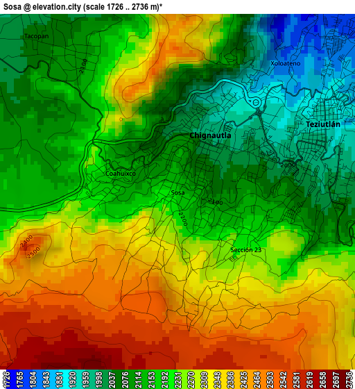
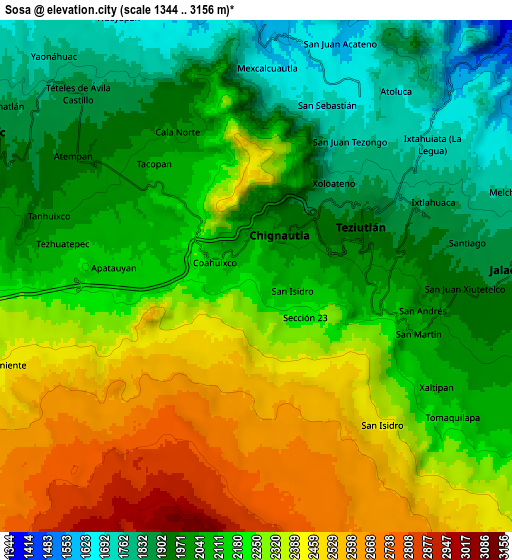
Below is the Elevation map of Sosa, which displays elevation range with different colors. Scale of the first map is from 1726 to 2736 m (5663 to 8976 ft) with average elevation of 2223 meters (=7293 ft) [note 1]
These maps also provides idea of topography and contour of this city, they are displayed at different zoom levels. More info about maps, scale and edge coordinates you can find below images.
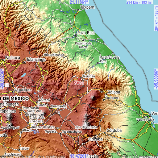
| \ | Map #1 | Map #2 | Topo.Map |
| Scale [m] | 1726..2736 m | 1344..3156 m | × |
| Scale [ft] | 5663..8976 ft | 4409..10354 ft | × |
| Average | 2223 m = 7293 ft | 2177.5 m = 7144 ft | × |
| Width | 9.19 km = 5.7 mi | 18.39 km = 11.4 mi | 294.2 km = 182.8 mi |
| Height | 9.19 km = 5.7 mi | 18.39 km = 11.4 mi | 294.2 km = 182.8 mi |
| ↑Max Latitude | 19.842452° | 19.883783° | 21.11861° |
| Latitude at center | 19.80111° | 19.80111° | 19.80111° |
| ↓Min Latitude | 19.759758° | 19.718395° | 18.47261° |
| ← Min Longitude | -97.440055° | -97.484001° | -98.80236° |
| Longitude center | -97.39611° | -97.39611° | -97.39611° |
| →Max Longitude | -97.352165° | -97.308219° | -95.98986° |
Nearby cities:
Cities around Sosa sort by population:
• Teziutlan elevation 1943 m
4.2 km,  64°
64°
• Chinautla 1984 m
2.2 km,  20°
20°
• Tacopan 2061 m
5.5 km,  317°
317°
• Xoloateno 1834 m
4.3 km,  39°
39°
• Coahuixco 2141 m
1.6 km,  288°
288°
• San Isidro 2108 m
1.4 km,  111°
111°
• Cala Sur 2096 m
4.4 km, 323°
• Apatauyan 2172 m
5.1 km,  267°
267°
• Ixticpan 1917 m
5.6 km,  74°
74°
• Cuaxoxpan 1971 m
5.3 km,  81°
81°
• Sección 23 2232 m
2.3 km,  129°
129°
• Yopi 1920 m
3.3 km,  30°
30°
Multilingual:
 En español:
Sosa elevación 2162 m.
 En France:
Sosa élévation 2162 m.


Sources and notes:
- [note 1] Map square and city borders are not equal. Map elevation data is calculated only from area inside that square.
- [src 1] Elevation data from geonames database provided with same terms of usage.
- [src 2] The elevation map of Sosa is generated using elevation data from NASA's 3 arcsec (90m) resolution SRTM data.
- [src 3] Base (background) map © OpenStreetMap contributors tiles are generated by Geofabrik and OpenTopoMap.
Copyright & License:
This Sosa Elevation Map is licensed under CC BY-SA. You may reuse any part from this page, if you give a proper credit by linking to this URL:
 More info on terms of use page.