La Trinidad elevation
La Trinidad (State of Mexico, Tenancingo), Mexico elevation is 2034 meters and La Trinidad elevation in feet is 6673 ft above sea level [src 1]. La Trinidad is a populated place (feature code) with elevation that is 720 meters (2362 ft) bigger than average city elevation in Mexico.
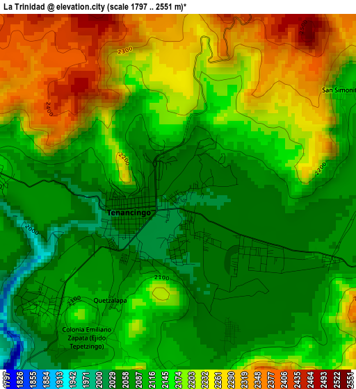
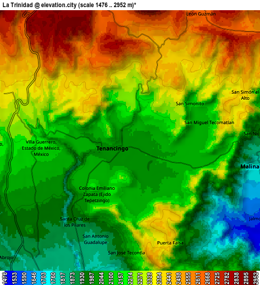
Below is the Elevation map of La Trinidad, which displays elevation range with different colors. Scale of the first map is from 1797 to 2551 m (5896 to 8369 ft) with average elevation of 2150.4 meters (=7055 ft) [note 1]
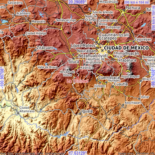
These maps also provides idea of topography and contour of this city, they are displayed at different zoom levels. More info about maps, scale and edge coordinates you can find below images.
| \ | Map #1 | Map #2 | Topo.Map |
| Scale [m] | 1797..2551 m | 1476..2952 m | × |
| Scale [ft] | 5896..8369 ft | 4843..9685 ft | × |
| Average | 2150.4 m = 7055 ft | 2215.9 m = 7270 ft | × |
| Width | 9.24 km = 5.7 mi | 18.48 km = 11.5 mi | 295.7 km = 183.7 mi |
| Height | 9.24 km = 5.7 mi | 18.48 km = 11.5 mi | 295.7 km = 183.7 mi |
| ↑Max Latitude | 19.007944° | 19.049488° | 20.29089° |
| Latitude at center | 18.96639° | 18.96639° | 18.96639° |
| ↓Min Latitude | 18.924825° | 18.88325° | 17.63129° |
| ← Min Longitude | -99.624775° | -99.668721° | -100.98708° |
| Longitude center | -99.58083° | -99.58083° | -99.58083° |
| →Max Longitude | -99.536885° | -99.492939° | -98.17458° |
Nearby cities:
Cities around La Trinidad sort by population:
• Tenancingo de Degollado elevation 2033 m
1.1 km,  240°
240°
• San José el Cuartel 2037 m
0.8 km,  152°
152°
• El Salitre 2021 m
1.8 km,  211°
211°
• San Martín Coapaxtongo 2210 m
3.3 km,  20°
20°
• La Ciénega 2029 m
1.1 km,  182°
182°
• Colonia Emiliano Zapata Ejido de Tenancingo 2043 m
2.7 km,  121°
121°
• Colonia San Ramón 2033 m
0.9 km,  76°
76°
• Tepoxtepec 2052 m
2.6 km,  98°
98°
• Chalchihuapan 2060 m
1.3 km,  28°
28°
• Pueblo Nuevo 2056 m
2.1 km,  189°
189°
• Tierra Blanca 2106 m
1.3 km,  299°
299°
• San Diego 2036 m
0.9 km,  327°
327°
Multilingual:
 En español:
La Trinidad elevación 2034 m.
 En France:
La Trinidad élévation 2034 m.
 Auf Deutsch:
La Trinidad höhe über dem Meeresspiegel ist 2034 m.

Sources and notes:
- [note 1] Map square and city borders are not equal. Map elevation data is calculated only from area inside that square.
- [src 1] Elevation data from geonames database provided with same terms of usage.
- [src 2] The elevation map of La Trinidad is generated using elevation data from NASA's 3 arcsec (90m) resolution SRTM data.
- [src 3] Base (background) map © OpenStreetMap contributors tiles are generated by Geofabrik and OpenTopoMap.
Copyright & License:
This La Trinidad Elevation Map is licensed under CC BY-SA. You may reuse any part from this page, if you give a proper credit by linking to this URL:
 More info on terms of use page.