Los Torrentes elevation
Los Torrentes (Veracruz), Mexico elevation is 54 meters and Los Torrentes elevation in feet is 177 ft above sea level [src 1]. Los Torrentes is a populated place (feature code) with elevation that is 1260 meters (4134 ft) smaller than average city elevation in Mexico.
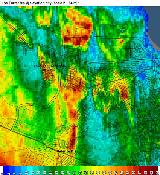
Below is the Elevation map of Los Torrentes, which displays elevation range with different colors. Scale of the first map is from 2 to 64 m (7 to 210 ft) with average elevation of 27.6 meters (=91 ft) [note 1]
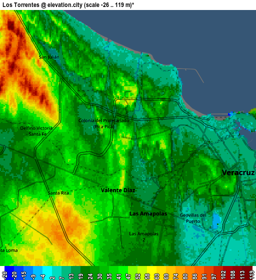
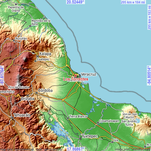
These maps also provides idea of topography and contour of this city, they are displayed at different zoom levels. More info about maps, scale and edge coordinates you can find below images.
| \ | Map #1 | Map #2 | Topo.Map |
| Scale [m] | 2..64 m | -26..119 m | × |
| Scale [ft] | 7..210 ft | -85..390 ft | × |
| Average | 27.6 m = 91 ft | 32.2 m = 106 ft | × |
| Width | 9.23 km = 5.7 mi | 18.46 km = 11.5 mi | 295.3 km = 183.5 mi |
| Height | 9.23 km = 5.7 mi | 18.46 km = 11.5 mi | 295.3 km = 183.5 mi |
| ↑Max Latitude | 19.243435° | 19.28492° | 20.52449° |
| Latitude at center | 19.20194° | 19.20194° | 19.20194° |
| ↓Min Latitude | 19.160434° | 19.118918° | 17.86867° |
| ← Min Longitude | -96.255335° | -96.299281° | -97.61764° |
| Longitude center | -96.21139° | -96.21139° | -96.21139° |
| →Max Longitude | -96.167445° | -96.123499° | -94.80514° |
Nearby cities:
Cities around Los Torrentes sort by population:
• Valente Diaz elevation 39 m
4.3 km,  187°
187°
• Las Amapolas 19 m
5.7 km,  165°
165°
• Fraccionamiento Geovillas los Pinos 19 m
2.3 km,  317°
317°
• Delfino Victoria (Santa Fe) 36 m
6.5 km,  275°
275°
• Fraccionamiento Costa Dorada 44 m
0.9 km, 323°
• Oasis 41 m
0.8 km,  267°
267°
• Río Medio [Granja] 27 m
0.9 km,  16°
16°
• Lomas de Río Medio Cuatro 25 m
1 km, 174°
• Arboledas 46 m
0.7 km,  331°
331°
• Colonia el Renacimiento 26 m
2 km,  344°
344°
• Colonia Chalchihuecan 23 m
1.4 km,  346°
346°
• Santa Rita 47 m
6.4 km,  233°
233°
Multilingual:
 En español:
Los Torrentes elevación 54 m.
 En France:
Los Torrentes élévation 54 m.
 Auf Deutsch:
Los Torrentes höhe über dem Meeresspiegel ist 54 m.

Sources and notes:
- [note 1] Map square and city borders are not equal. Map elevation data is calculated only from area inside that square.
- [src 1] Elevation data from geonames database provided with same terms of usage.
- [src 2] The elevation map of Los Torrentes is generated using elevation data from NASA's 3 arcsec (90m) resolution SRTM data.
- [src 3] Base (background) map © OpenStreetMap contributors tiles are generated by Geofabrik and OpenTopoMap.
Copyright & License:
This Los Torrentes Elevation Map is licensed under CC BY-SA. You may reuse any part from this page, if you give a proper credit by linking to this URL:
 More info on terms of use page.