Atoluca elevation
Atoluca (Puebla, Teziutlán), Mexico elevation is 1761 meters and Atoluca elevation in feet is 5778 ft above sea level [src 1]. Atoluca is a populated place (feature code) with elevation that is 447 meters (1467 ft) bigger than average city elevation in Mexico.
Below is the Elevation map of Atoluca, which displays elevation range with different colors. Scale of the first map is from 1211 to 2520 m (3973 to 8268 ft) with average elevation of 1742.7 meters (=5718 ft) [note 1]
These maps also provides idea of topography and contour of this city, they are displayed at different zoom levels. More info about maps, scale and edge coordinates you can find below images.
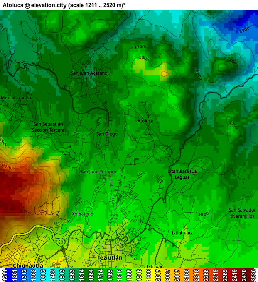
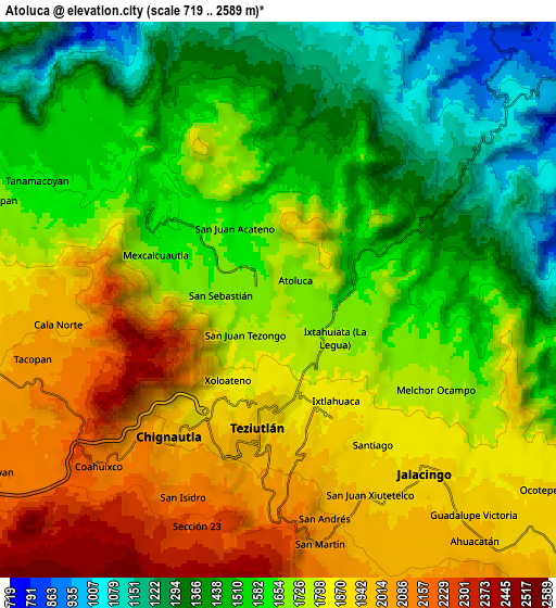
| \ | Map #1 | Map #2 | Topo.Map |
| Scale [m] | 1211..2520 m | 719..2589 m | × |
| Scale [ft] | 3973..8268 ft | 2359..8494 ft | × |
| Average | 1742.7 m = 5718 ft | 1694.4 m = 5559 ft | × |
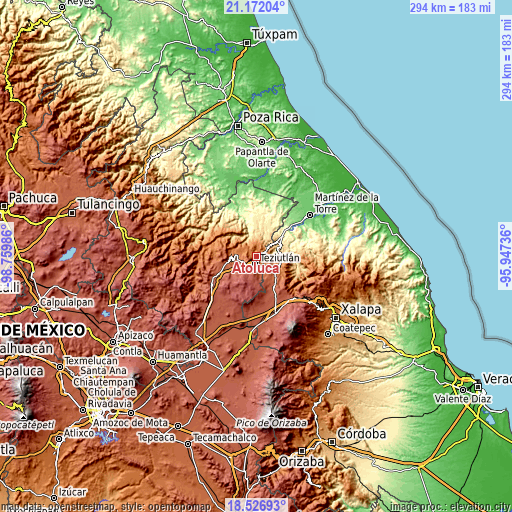
| Width | 9.19 km = 5.7 mi | 18.38 km = 11.4 mi | 294.1 km = 182.7 mi |
| Height | 9.19 km = 5.7 mi | 18.38 km = 11.4 mi | 294.1 km = 182.7 mi |
| ↑Max Latitude | 19.896328° | 19.937644° | 21.17204° |
| Latitude at center | 19.855° | 19.855° | 19.855° |
| ↓Min Latitude | 19.813662° | 19.772313° | 18.52693° |
| ← Min Longitude | -97.397555° | -97.441501° | -98.75986° |
| Longitude center | -97.35361° | -97.35361° | -97.35361° |
| →Max Longitude | -97.309665° | -97.265719° | -95.94736° |
Nearby cities:
Cities around Atoluca sort by population:
• Teziutlan elevation 1943 m
4.2 km,  188°
188°
• San Acateno 1611 m
2.6 km,  328°
328°
• San Sebastián 1729 m
1.8 km,  270°
270°
• Xoloateno 1834 m
3.1 km,  211°
211°
• San Salvador (Naranjillo) 1749 m
4.8 km,  123°
123°
• San Diego 1692 m
0.8 km,  283°
283°
• Mexcalcuautla 1661 m
4.2 km,  287°
287°
• Ixticpan 1917 m
4.6 km,  168°
168°
• Ixtahuiata (La Legua) 1739 m
2.3 km, 123°
• San Juan Tezongo 1746 m
1.6 km,  223°
223°
• Ixtlahuaca 1881 m
4 km,  151°
151°
• Yopi 1920 m
4.2 km, 221°
Multilingual:
 En español:
Atoluca elevación 1761 m.
 En France:
Atoluca élévation 1761 m.
 Auf Deutsch:
Atoluca höhe über dem Meeresspiegel ist 1761 m.

Sources and notes:
- [note 1] Map square and city borders are not equal. Map elevation data is calculated only from area inside that square.
- [src 1] Elevation data from geonames database provided with same terms of usage.
- [src 2] The elevation map of Atoluca is generated using elevation data from NASA's 3 arcsec (90m) resolution SRTM data.
- [src 3] Base (background) map © OpenStreetMap contributors tiles are generated by Geofabrik and OpenTopoMap.
Copyright & License:
This Atoluca Elevation Map is licensed under CC BY-SA. You may reuse any part from this page, if you give a proper credit by linking to this URL:
 More info on terms of use page.