Galaxia la Noria elevation
Galaxia la Noria (Jalisco, Tlajomulco de Zúñiga), Mexico elevation is 1565 meters and Galaxia la Noria elevation in feet is 5135 ft above sea level [src 1]. Galaxia la Noria is a populated place (feature code) with elevation that is 251 meters (823 ft) bigger than average city elevation in Mexico.
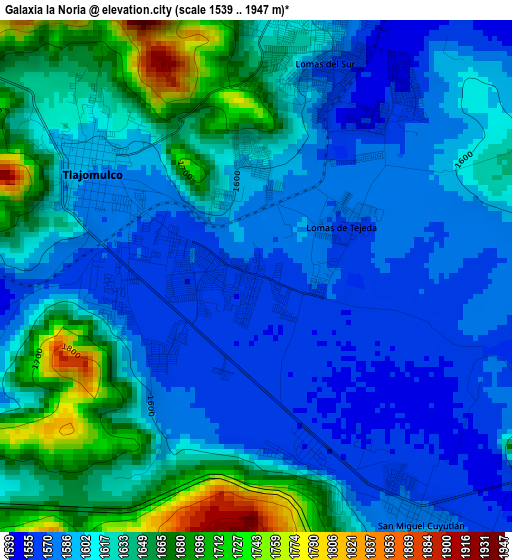
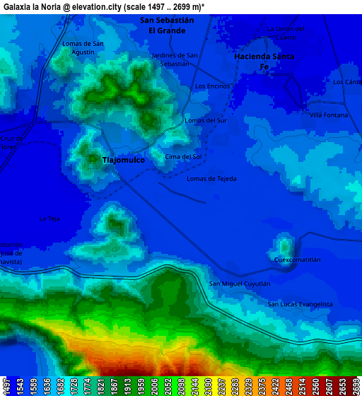
Below is the Elevation map of Galaxia la Noria, which displays elevation range with different colors. Scale of the first map is from 1539 to 1947 m (5049 to 6388 ft) with average elevation of 1615.4 meters (=5300 ft) [note 1]
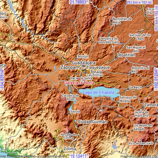
These maps also provides idea of topography and contour of this city, they are displayed at different zoom levels. More info about maps, scale and edge coordinates you can find below images.
| \ | Map #1 | Map #2 | Topo.Map |
| Scale [m] | 1539..1947 m | 1497..2699 m | × |
| Scale [ft] | 5049..6388 ft | 4911..8855 ft | × |
| Average | 1615.4 m = 5300 ft | 1675.8 m = 5498 ft | × |
| Width | 9.16 km = 5.7 mi | 18.31 km = 11.4 mi | 293 km = 182.1 mi |
| Height | 9.16 km = 5.7 mi | 18.31 km = 11.4 mi | 293 km = 182.1 mi |
| ↑Max Latitude | 20.498388° | 20.539546° | 21.76903° |
| Latitude at center | 20.45722° | 20.45722° | 20.45722° |
| ↓Min Latitude | 20.416041° | 20.37485° | 19.13411° |
| ← Min Longitude | -103.462835° | -103.506781° | -104.82514° |
| Longitude center | -103.41889° | -103.41889° | -103.41889° |
| →Max Longitude | -103.374945° | -103.330999° | -102.01264° |
Nearby cities:
Cities around Galaxia la Noria sort by population:
• Hacienda Santa Fe elevation 1559 m
7.9 km,  30°
30°
• Tlajomulco de Zúñiga 1586 m
3.4 km,  303°
303°
• Lomas del Sur 1636 m
3.9 km,  2°
2°
• San Miguel Cuyutlán 1585 m
5.5 km,  146°
146°
• Colinas del Roble 1560 m
5.6 km,  22°
22°
• Hacienda los Fresnos 1548 m
7.4 km, 21°
• Jardines de San Sebastián 1570 m
6.9 km,  357°
357°
• Lomas de Tejeda 1573 m
2 km,  59°
59°
• La Roca 1602 m
6.2 km,  352°
352°
• Cima del Sol (Fraccionamiento Cima del Sol) 1584 m
1.3 km,  7°
7°
• Cuexcomatitlán 1560 m
6.8 km,  118°
118°
• El Cortijo 1591 m
1.4 km, 346°
Multilingual:
 En español:
Galaxia la Noria elevación 1565 m.
 En France:
Galaxia la Noria élévation 1565 m.
 Auf Deutsch:
Galaxia la Noria höhe über dem Meeresspiegel ist 1565 m.

Sources and notes:
- [note 1] Map square and city borders are not equal. Map elevation data is calculated only from area inside that square.
- [src 1] Elevation data from geonames database provided with same terms of usage.
- [src 2] The elevation map of Galaxia la Noria is generated using elevation data from NASA's 3 arcsec (90m) resolution SRTM data.
- [src 3] Base (background) map © OpenStreetMap contributors tiles are generated by Geofabrik and OpenTopoMap.
Copyright & License:
This Galaxia la Noria Elevation Map is licensed under CC BY-SA. You may reuse any part from this page, if you give a proper credit by linking to this URL:
 More info on terms of use page.