La Aldea elevation
La Aldea (Michoacán, Morelia), Mexico elevation is 1908 meters and La Aldea elevation in feet is 6260 ft above sea level [src 1]. La Aldea is a populated place (feature code) with elevation that is 594 meters (1949 ft) bigger than average city elevation in Mexico.
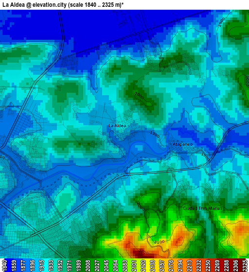
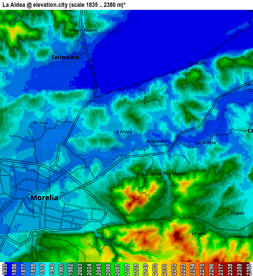
Below is the Elevation map of La Aldea, which displays elevation range with different colors. Scale of the first map is from 1840 to 2325 m (6037 to 7628 ft) with average elevation of 1936.2 meters (=6352 ft) [note 1]
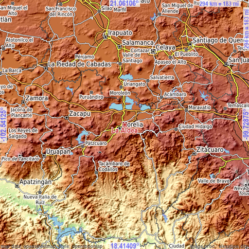
These maps also provides idea of topography and contour of this city, they are displayed at different zoom levels. More info about maps, scale and edge coordinates you can find below images.
| \ | Map #1 | Map #2 | Topo.Map |
| Scale [m] | 1840..2325 m | 1835..2380 m | × |
| Scale [ft] | 6037..7628 ft | 6020..7808 ft | × |
| Average | 1936.2 m = 6352 ft | 1948.2 m = 6392 ft | × |
| Width | 9.2 km = 5.7 mi | 18.4 km = 11.4 mi | 294.3 km = 182.9 mi |
| Height | 9.2 km = 5.7 mi | 18.4 km = 11.4 mi | 294.3 km = 182.9 mi |
| ↑Max Latitude | 19.784417° | 19.825763° | 21.06106° |
| Latitude at center | 19.74306° | 19.74306° | 19.74306° |
| ↓Min Latitude | 19.701693° | 19.660314° | 18.41409° |
| ← Min Longitude | -101.178945° | -101.222891° | -102.54125° |
| Longitude center | -101.135° | -101.135° | -101.135° |
| →Max Longitude | -101.091055° | -101.047109° | -99.72875° |
Nearby cities:
Cities around La Aldea sort by population:
• Fraccionamiento Misión del Valle elevation 1995 m
2.9 km,  29°
29°
• Campestre Tarímbaro 1850 m
3.6 km,  9°
9°
• Atapaneo 1896 m
2.1 km,  102°
102°
• San Pedro de los Sauces 1845 m
4.8 km,  356°
356°
• La Goleta 1878 m
5.6 km,  94°
94°
• San Bernabé de las Canteras 1911 m
3.9 km,  311°
311°
• Conjunto Habitacional el Trébol 1863 m
3.4 km,  322°
322°
• Fraccionamiento Laureles Eréndira 1861 m
3.3 km, 8°
• El Colegio 1867 m
5.6 km, 307°
• Colonia Miguel Hidalgo 1847 m
5.9 km,  36°
36°
• El Cuitzillo Grande 1858 m
4.5 km,  24°
24°
• La Palma (Las Palmas) 1873 m
3.2 km,  348°
348°
Multilingual:
 En español:
La Aldea elevación 1908 m.
 En France:
La Aldea élévation 1908 m.
 Auf Deutsch:
La Aldea höhe über dem Meeresspiegel ist 1908 m.

Sources and notes:
- [note 1] Map square and city borders are not equal. Map elevation data is calculated only from area inside that square.
- [src 1] Elevation data from geonames database provided with same terms of usage.
- [src 2] The elevation map of La Aldea is generated using elevation data from NASA's 3 arcsec (90m) resolution SRTM data.
- [src 3] Base (background) map © OpenStreetMap contributors tiles are generated by Geofabrik and OpenTopoMap.
Copyright & License:
This La Aldea Elevation Map is licensed under CC BY-SA. You may reuse any part from this page, if you give a proper credit by linking to this URL:
 More info on terms of use page.