El Súchil elevation
El Súchil (Guerrero, Técpan de Galeana), Mexico elevation is 43 meters and El Súchil elevation in feet is 141 ft above sea level [src 1]. El Súchil is a populated place (feature code) with elevation that is 1271 meters (4170 ft) smaller than average city elevation in Mexico.
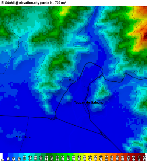
Below is the Elevation map of El Súchil, which displays elevation range with different colors. Scale of the first map is from 9 to 702 m (30 to 2303 ft) with average elevation of 106.4 meters (=349 ft) [note 1]
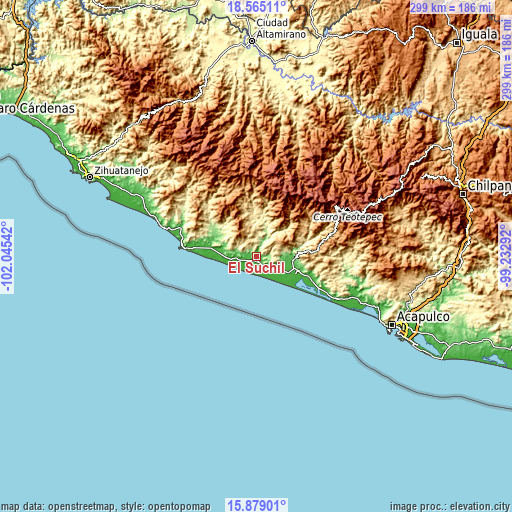
These maps also provides idea of topography and contour of this city, they are displayed at different zoom levels. More info about maps, scale and edge coordinates you can find below images.
| \ | Map #1 | Map #2 | Topo.Map |
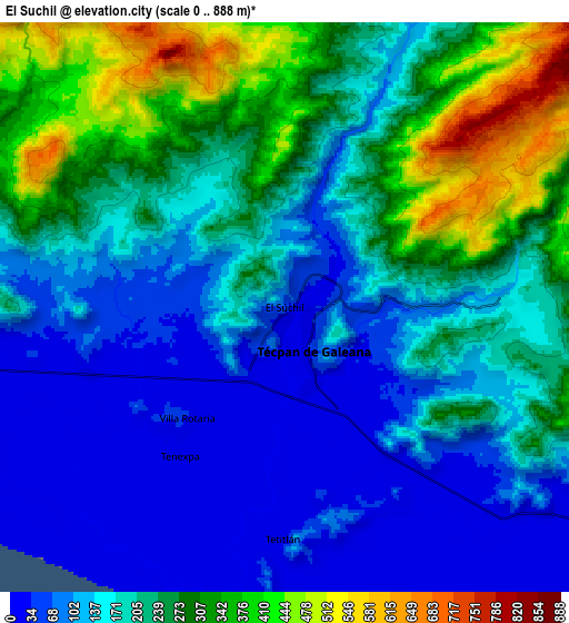
| Scale [m] | 9..702 m | 0..888 m | × |
| Scale [ft] | 30..2303 ft | 0..2913 ft | × |
| Average | 106.4 m = 349 ft | 194 m = 636 ft | × |
| Width | 9.33 km = 5.8 mi | 18.67 km = 11.6 mi | 298.7 km = 185.6 mi |
| Height | 9.33 km = 5.8 mi | 18.67 km = 11.6 mi | 298.7 km = 185.6 mi |
| ↑Max Latitude | 17.268909° | 17.310869° | 18.56511° |
| Latitude at center | 17.22694° | 17.22694° | 17.22694° |
| ↓Min Latitude | 17.184961° | 17.142973° | 15.87901° |
| ← Min Longitude | -100.683115° | -100.727061° | -102.04542° |
| Longitude center | -100.63917° | -100.63917° | -100.63917° |
| →Max Longitude | -100.595225° | -100.551279° | -99.23292° |
Nearby cities:
Cities around El Súchil sort by population:
• Atoyac de Álvarez elevation 59 m
22 km,  95°
95°
• Técpan de Galeana 30 m
1.2 km,  130°
130°
• San Jerónimo de Juárez 48 m
20.4 km,  118°
118°
• El Ticui 55 m
20.7 km,  93°
93°
• Hacienda de Cabañas 10 m
22.9 km, 128°
• Nuxco 27 m
12.6 km,  261°
261°
• Tenexpa 14 m
5.8 km,  215°
215°
• Tetitlán 14 m
7.6 km,  180°
180°
• Villa Rotaria 23 m
4.8 km, 221°
• Corral Falso 26 m
20 km,  107°
107°
• Arenal de Álvarez (Arenal de Paco) 17 m
22.5 km, 119°
• Las Tunas 27 m
20.4 km, 125°
Multilingual:
 En español:
El Súchil elevación 43 m.
 En France:
El Súchil élévation 43 m.
 Auf Deutsch:
El Súchil höhe über dem Meeresspiegel ist 43 m.

Sources and notes:
- [note 1] Map square and city borders are not equal. Map elevation data is calculated only from area inside that square.
- [src 1] Elevation data from geonames database provided with same terms of usage.
- [src 2] The elevation map of El Súchil is generated using elevation data from NASA's 3 arcsec (90m) resolution SRTM data.
- [src 3] Base (background) map © OpenStreetMap contributors tiles are generated by Geofabrik and OpenTopoMap.
Copyright & License:
This El Súchil Elevation Map is licensed under CC BY-SA. You may reuse any part from this page, if you give a proper credit by linking to this URL:
 More info on terms of use page.