San Buenaventura elevation
San Buenaventura (State of Mexico, Ixtapaluca), Mexico elevation is 2278 meters and San Buenaventura elevation in feet is 7474 ft above sea level [src 1]. San Buenaventura is a populated place (feature code) with elevation that is 964 meters (3163 ft) bigger than average city elevation in Mexico.
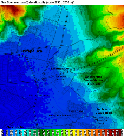
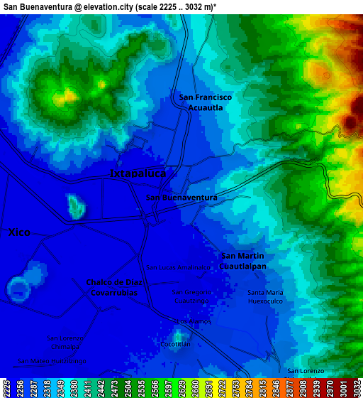
Below is the Elevation map of San Buenaventura, which displays elevation range with different colors. Scale of the first map is from 2233 to 2533 m (7326 to 8310 ft) with average elevation of 2289.2 meters (=7510 ft) [note 1]
These maps also provides idea of topography and contour of this city, they are displayed at different zoom levels. More info about maps, scale and edge coordinates you can find below images.
| \ | Map #1 | Map #2 | Topo.Map |
| Scale [m] | 2233..2533 m | 2225..3032 m | × |
| Scale [ft] | 7326..8310 ft | 7300..9948 ft | × |
| Average | 2289.2 m = 7510 ft | 2367.9 m = 7769 ft | × |
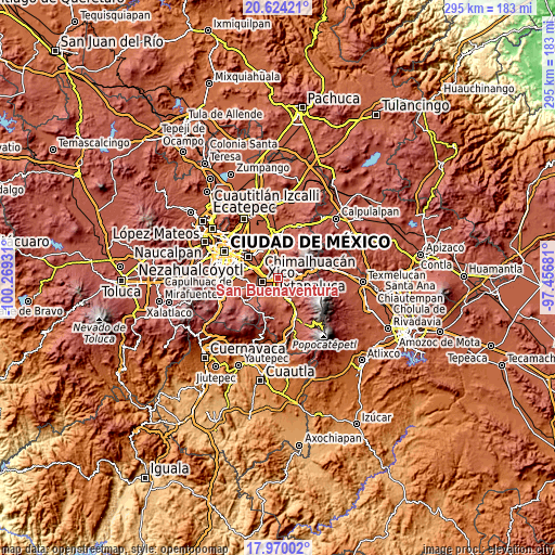
| Width | 9.22 km = 5.7 mi | 18.45 km = 11.5 mi | 295.1 km = 183.4 mi |
| Height | 9.22 km = 5.7 mi | 18.45 km = 11.5 mi | 295.1 km = 183.4 mi |
| ↑Max Latitude | 19.34397° | 19.385429° | 20.62421° |
| Latitude at center | 19.3025° | 19.3025° | 19.3025° |
| ↓Min Latitude | 19.26102° | 19.219529° | 17.97002° |
| ← Min Longitude | -98.907005° | -98.950951° | -100.26931° |
| Longitude center | -98.86306° | -98.86306° | -98.86306° |
| →Max Longitude | -98.819115° | -98.775169° | -97.45681° |
Nearby cities:
Cities around San Buenaventura sort by population:
• Ixtapaluca elevation 2253 m
2.5 km,  304°
304°
• Chalco 2245 m
5.8 km,  218°
218°
• San Jerónimo Cuatro Vientos 2322 m
2.5 km,  115°
115°
• San Francisco Acuautla 2288 m
4.8 km,  3°
3°
• San Martín Cuautlalpan 2279 m
4.4 km,  131°
131°
• San Gregorio Cuautzingo 2252 m
4.8 km,  172°
172°
• Santa María Huexoculco 2293 m
6.7 km,  137°
137°
• San Marcos Huixtoco 2261 m
0.7 km,  185°
185°
• Jorge Jiménez Cantú 2309 m
1.9 km,  64°
64°
• La Candelaria Tlapala 2260 m
7.1 km, 166°
• San Lucas Amalinalco 2250 m
3.6 km,  181°
181°
• Zoquiapan 2275 m
2.2 km,  39°
39°
Multilingual:
 En español:
San Buenaventura elevación 2278 m.
 En France:
San Buenaventura élévation 2278 m.
 Auf Deutsch:
San Buenaventura höhe über dem Meeresspiegel ist 2278 m.

Sources and notes:
- [note 1] Map square and city borders are not equal. Map elevation data is calculated only from area inside that square.
- [src 1] Elevation data from geonames database provided with same terms of usage.
- [src 2] The elevation map of San Buenaventura is generated using elevation data from NASA's 3 arcsec (90m) resolution SRTM data.
- [src 3] Base (background) map © OpenStreetMap contributors tiles are generated by Geofabrik and OpenTopoMap.
Copyright & License:
This San Buenaventura Elevation Map is licensed under CC BY-SA. You may reuse any part from this page, if you give a proper credit by linking to this URL:
 More info on terms of use page.