Pie de Gallo elevation
Pie de Gallo (Querétaro), Mexico elevation is 2095 meters and Pie de Gallo elevation in feet is 6873 ft above sea level [src 1]. Pie de Gallo is a populated place (feature code) with elevation that is 781 meters (2562 ft) bigger than average city elevation in Mexico.
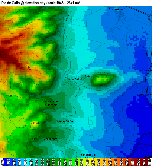
Below is the Elevation map of Pie de Gallo, which displays elevation range with different colors. Scale of the first map is from 1948 to 2641 m (6391 to 8665 ft) with average elevation of 2138.6 meters (=7016 ft) [note 1]
These maps also provides idea of topography and contour of this city, they are displayed at different zoom levels. More info about maps, scale and edge coordinates you can find below images.
| \ | Map #1 | Map #2 | Topo.Map |
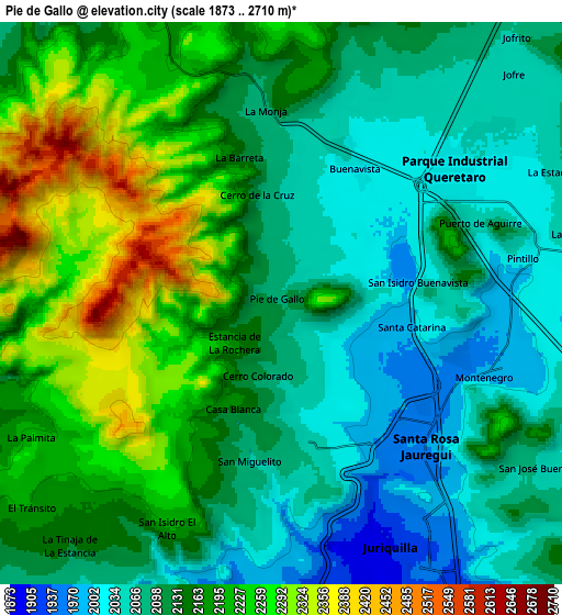
| Scale [m] | 1948..2641 m | 1873..2710 m | × |
| Scale [ft] | 6391..8665 ft | 6145..8891 ft | × |
| Average | 2138.6 m = 7016 ft | 2143.2 m = 7031 ft | × |
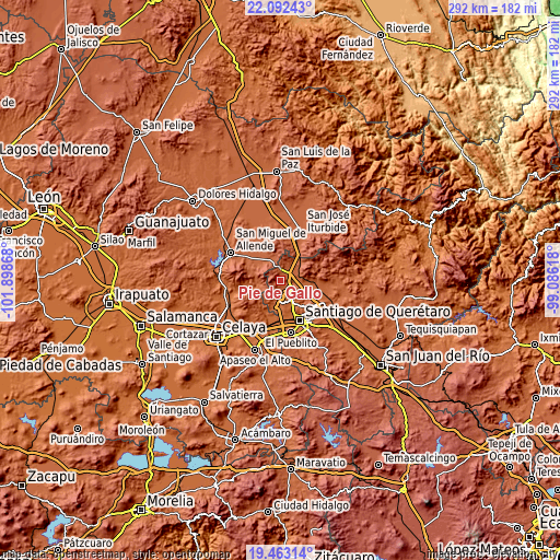
| Width | 9.14 km = 5.7 mi | 18.27 km = 11.4 mi | 292.3 km = 181.6 mi |
| Height | 9.14 km = 5.7 mi | 18.27 km = 11.4 mi | 292.4 km = 181.7 mi |
| ↑Max Latitude | 20.82459° | 20.865659° | 22.09243° |
| Latitude at center | 20.78351° | 20.78351° | 20.78351° |
| ↓Min Latitude | 20.742419° | 20.701316° | 19.46314° |
| ← Min Longitude | -100.536375° | -100.580321° | -101.89868° |
| Longitude center | -100.49243° | -100.49243° | -100.49243° |
| →Max Longitude | -100.448485° | -100.404539° | -99.08618° |
Nearby cities:
Cities around Pie de Gallo sort by population:
• Santa Rosa Jauregui elevation 1963 m
6.6 km,  135°
135°
• Buenavista 2029 m
5 km,  27°
27°
• Montenegro 1979 m
7 km,  108°
108°
• San Miguelito 2073 m
5.3 km,  191°
191°
• Puerto de Aguirre 2056 m
6.8 km,  67°
67°
• Santa Catarina 1981 m
4.2 km,  100°
100°
• San Isidro Buenavista 2040 m
4.5 km,  82°
82°
• El Pinto 2023 m
8.7 km, 75°
• La Barreta 2160 m
5.2 km,  343°
343°
• La Monja 2089 m
6.6 km,  355°
355°
• Pintillo 2023 m
8 km, 79°
• Cerro de la Cruz 2116 m
3.6 km,  345°
345°
Multilingual:
 En español:
Pie de Gallo elevación 2095 m.
 En France:
Pie de Gallo élévation 2095 m.
 Auf Deutsch:
Pie de Gallo höhe über dem Meeresspiegel ist 2095 m.

Sources and notes:
- [note 1] Map square and city borders are not equal. Map elevation data is calculated only from area inside that square.
- [src 1] Elevation data from geonames database provided with same terms of usage.
- [src 2] The elevation map of Pie de Gallo is generated using elevation data from NASA's 3 arcsec (90m) resolution SRTM data.
- [src 3] Base (background) map © OpenStreetMap contributors tiles are generated by Geofabrik and OpenTopoMap.
Copyright & License:
This Pie de Gallo Elevation Map is licensed under CC BY-SA. You may reuse any part from this page, if you give a proper credit by linking to this URL:
 More info on terms of use page.