Guerrero Negro elevation
Guerrero Negro (Baja California), Mexico elevation is 4 meters and Guerrero Negro elevation in feet is 13 ft above sea level [src 1]. Guerrero Negro is a populated place (feature code) with elevation that is 1310 meters (4298 ft) smaller than average city elevation in Mexico.
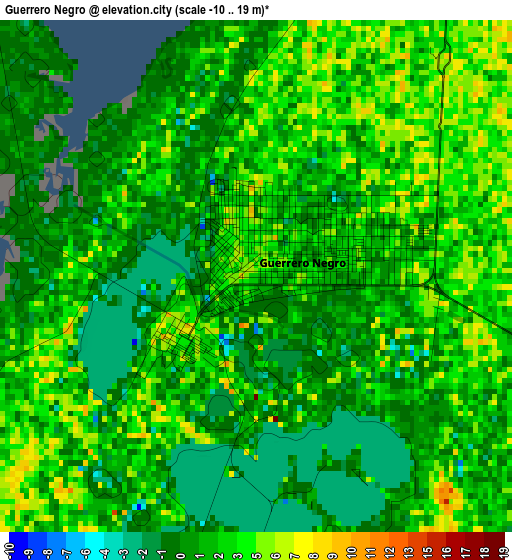
Below is the Elevation map of Guerrero Negro, which displays elevation range with different colors. Scale of the first map is from -10 to 19 m (-33 to 62 ft) with average elevation of 1.9 meters (=6 ft) [note 1]
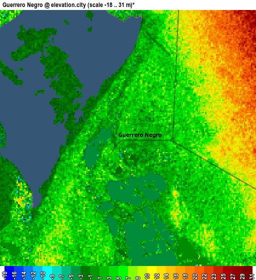
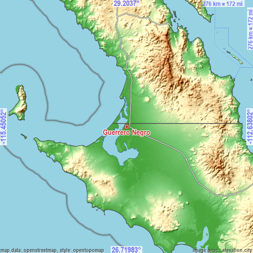
These maps also provides idea of topography and contour of this city, they are displayed at different zoom levels. More info about maps, scale and edge coordinates you can find below images.
| \ | Map #1 | Map #2 | Topo.Map |
| Scale [m] | -10..19 m | -18..31 m | × |
| Scale [ft] | -33..62 ft | -59..102 ft | × |
| Average | 1.9 m = 6 ft | 4.9 m = 16 ft | × |
| Width | 8.63 km = 5.4 mi | 17.26 km = 10.7 mi | 276.2 km = 171.6 mi |
| Height | 8.63 km = 5.4 mi | 17.26 km = 10.7 mi | 276.2 km = 171.6 mi |
| ↑Max Latitude | 28.007716° | 28.046507° | 29.2037° |
| Latitude at center | 27.96891° | 27.96891° | 27.96891° |
| ↓Min Latitude | 27.93009° | 27.891257° | 26.71983° |
| ← Min Longitude | -114.088215° | -114.132161° | -115.45052° |
| Longitude center | -114.04427° | -114.04427° | -114.04427° |
| →Max Longitude | -114.000325° | -113.956379° | -112.63802° |
Nearby cities:
Cities around Guerrero Negro sort by population:
• Santa Rosalía elevation 19 m
188.4 km,  111°
111°
• San Luis 534 m
59.1 km,  29°
29°
• Villa Alberto Andrés Alvarado Arámburo 79 m
74.2 km,  119°
119°
• Bahía de Kino 1 m
226.6 km,  65°
65°
• La Providencia 33 m
254.7 km, 70°
• Mulegé 24 m
236.1 km, 120°
• La Libertad 24 m
253.1 km, 31°
• Bahía Tortugas 9 m
89.3 km,  249°
249°
• San Francisco 72 m
71.3 km, 120°
• Las Margaritas 65 m
70 km, 123°
• Bahía Asunción 14 m
95.2 km,  195°
195°
• El Silencio 72 m
92 km,  127°
127°
Multilingual:
 En español:
Guerrero Negro elevación 4 m.
 En France:
Guerrero Negro élévation 4 m.
 Auf Deutsch:
Guerrero Negro höhe über dem Meeresspiegel ist 4 m.

Sources and notes:
- [note 1] Map square and city borders are not equal. Map elevation data is calculated only from area inside that square.
- [src 1] Elevation data from geonames database provided with same terms of usage.
- [src 2] The elevation map of Guerrero Negro is generated using elevation data from NASA's 3 arcsec (90m) resolution SRTM data.
- [src 3] Base (background) map © OpenStreetMap contributors tiles are generated by Geofabrik and OpenTopoMap.
Copyright & License:
This Guerrero Negro Elevation Map is licensed under CC BY-SA. You may reuse any part from this page, if you give a proper credit by linking to this URL:
 More info on terms of use page.