Acaponeta elevation
Acaponeta (Nayarit), Mexico elevation is 30 meters and Acaponeta elevation in feet is 98 ft above sea level [src 1]. Acaponeta is a seat of a second-order administrative division (feature code) with elevation that is 1284 meters (4213 ft) smaller than average city elevation in Mexico.
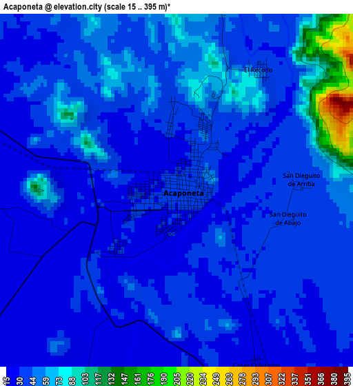
Below is the Elevation map of Acaponeta, which displays elevation range with different colors. Scale of the first map is from 15 to 395 m (49 to 1296 ft) with average elevation of 43.5 meters (=143 ft) [note 1]
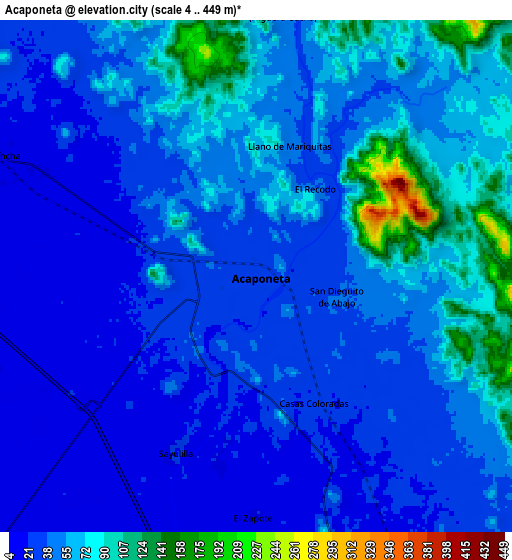
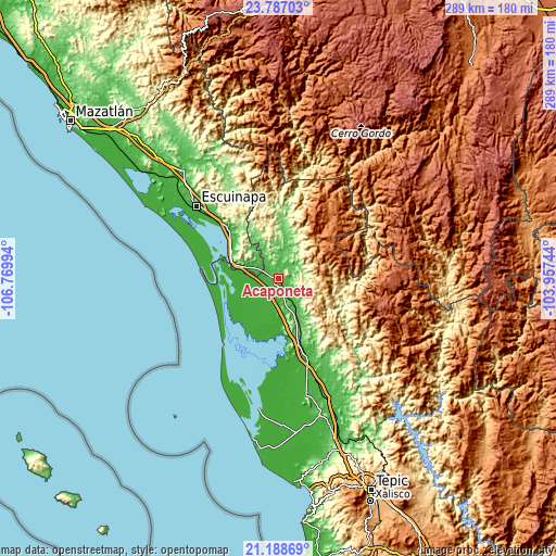
These maps also provides idea of topography and contour of this city, they are displayed at different zoom levels. More info about maps, scale and edge coordinates you can find below images.
| \ | Map #1 | Map #2 | Topo.Map |
| Scale [m] | 15..395 m | 4..449 m | × |
| Scale [ft] | 49..1296 ft | 13..1473 ft | × |
| Average | 43.5 m = 143 ft | 48.9 m = 160 ft | × |
| Width | 9.03 km = 5.6 mi | 18.06 km = 11.2 mi | 288.9 km = 179.5 mi |
| Height | 9.03 km = 5.6 mi | 18.06 km = 11.2 mi | 288.9 km = 179.5 mi |
| ↑Max Latitude | 22.534556° | 22.57514° | 23.78703° |
| Latitude at center | 22.49396° | 22.49396° | 22.49396° |
| ↓Min Latitude | 22.453352° | 22.412732° | 21.18869° |
| ← Min Longitude | -105.407635° | -105.451581° | -106.76994° |
| Longitude center | -105.36369° | -105.36369° | -105.36369° |
| →Max Longitude | -105.319745° | -105.275799° | -103.95744° |
Nearby cities:
Cities around Acaponeta sort by population:
• Tecuala elevation 14 m
14.4 km,  222°
222°
• San Felipe Aztatán 17 m
13.5 km,  205°
205°
• Quimichis 8 m
23.3 km,  230°
230°
• Huajicori 73 m
16.5 km,  15°
15°
• Ojo de Agua de Palmillas 11 m
28.4 km,  299°
299°
• Sayulilla 21 m
6.8 km,  204°
204°
• Milpas Viejas 11 m
18.4 km, 218°
• La Concha (La Concepción) 18 m
10.1 km, 295°
• Camalotita 16 m
12.1 km, 215°
• La Presa 12 m
17 km,  190°
190°
• La Guásima 19 m
10.1 km, 194°
• San José de Gracia 29 m
2.1 km, 227°
Multilingual:
 En español:
Acaponeta elevación 30 m.
 En France:
Acaponeta élévation 30 m.
 Auf Deutsch:
Acaponeta höhe über dem Meeresspiegel ist 30 m.

Sources and notes:
- [note 1] Map square and city borders are not equal. Map elevation data is calculated only from area inside that square.
- [src 1] Elevation data from geonames database provided with same terms of usage.
- [src 2] The elevation map of Acaponeta is generated using elevation data from NASA's 3 arcsec (90m) resolution SRTM data.
- [src 3] Base (background) map © OpenStreetMap contributors tiles are generated by Geofabrik and OpenTopoMap.
Copyright & License:
This Acaponeta Elevation Map is licensed under CC BY-SA. You may reuse any part from this page, if you give a proper credit by linking to this URL:
 More info on terms of use page.