Arandas elevation
Arandas (Jalisco), Mexico elevation is 2069 meters and Arandas elevation in feet is 6788 ft above sea level [src 1]. Arandas is a seat of a second-order administrative division (feature code) with elevation that is 755 meters (2477 ft) bigger than average city elevation in Mexico.
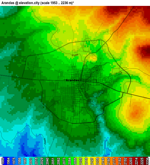
Below is the Elevation map of Arandas, which displays elevation range with different colors. Scale of the first map is from 1953 to 2236 m (6407 to 7336 ft) with average elevation of 2074.4 meters (=6806 ft) [note 1]
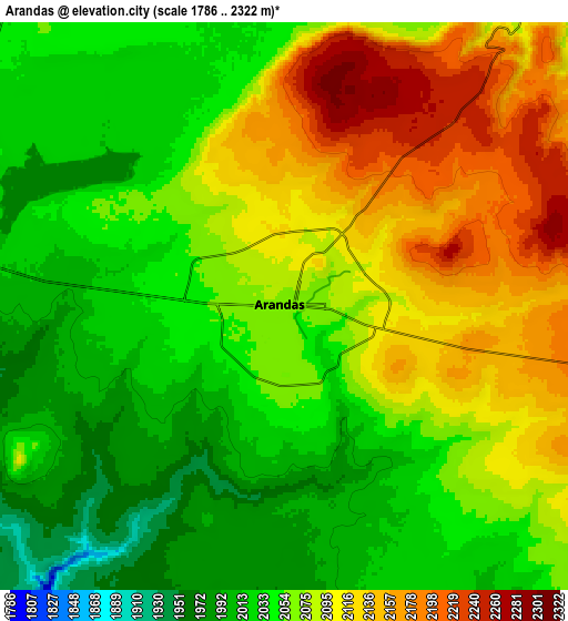
These maps also provides idea of topography and contour of this city, they are displayed at different zoom levels. More info about maps, scale and edge coordinates you can find below images.
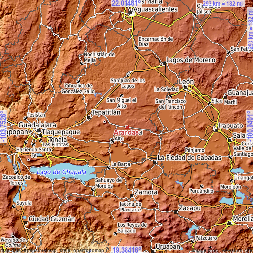
| \ | Map #1 | Map #2 | Topo.Map |
| Scale [m] | 1953..2236 m | 1786..2322 m | × |
| Scale [ft] | 6407..7336 ft | 5860..7618 ft | × |
| Average | 2074.4 m = 6806 ft | 2072.2 m = 6799 ft | × |
| Width | 9.14 km = 5.7 mi | 18.28 km = 11.4 mi | 292.5 km = 181.8 mi |
| Height | 9.14 km = 5.7 mi | 18.28 km = 11.4 mi | 292.5 km = 181.8 mi |
| ↑Max Latitude | 20.746291° | 20.787382° | 22.01481° |
| Latitude at center | 20.70519° | 20.70519° | 20.70519° |
| ↓Min Latitude | 20.664077° | 20.622954° | 19.38416° |
| ← Min Longitude | -102.390295° | -102.434241° | -103.7526° |
| Longitude center | -102.34635° | -102.34635° | -102.34635° |
| →Max Longitude | -102.302405° | -102.258459° | -100.9401° |
Nearby cities:
Cities around Arandas sort by population:
• Atotonilco el Alto elevation 1607 m
24.1 km,  224°
224°
• Ayotlán 1618 m
19.7 km,  173°
173°
• San Ignacio Cerro Gordo 2076 m
20.1 km,  282°
282°
• Jesús María 2097 m
17 km,  130°
130°
• San Francisco de Asís 1966 m
25.6 km,  241°
241°
• San José de Gracia 1907 m
23.5 km,  261°
261°
• Santa María del Valle 2065 m
19.6 km,  349°
349°
• Vistas del Maguey [Fraccionamiento] 1581 m
27 km, 223°
• Betania 1938 m
14.1 km,  193°
193°
• Ojo de Agua de Morán 1987 m
22.7 km, 237°
• Santiaguito (Santiaguito de Velázquez) 2189 m
11.6 km,  78°
78°
• La Isla 1583 m
24.2 km,  180°
180°
Multilingual:
 En español:
Arandas elevación 2069 m.
 En France:
Arandas élévation 2069 m.
 Auf Deutsch:
Arandas höhe über dem Meeresspiegel ist 2069 m.

Sources and notes:
- [note 1] Map square and city borders are not equal. Map elevation data is calculated only from area inside that square.
- [src 1] Elevation data from geonames database provided with same terms of usage.
- [src 2] The elevation map of Arandas is generated using elevation data from NASA's 3 arcsec (90m) resolution SRTM data.
- [src 3] Base (background) map © OpenStreetMap contributors tiles are generated by Geofabrik and OpenTopoMap.
Copyright & License:
This Arandas Elevation Map is licensed under CC BY-SA. You may reuse any part from this page, if you give a proper credit by linking to this URL:
 More info on terms of use page.