Escuinapa elevation
Escuinapa (Sinaloa), Mexico elevation is 25 meters and Escuinapa elevation in feet is 82 ft above sea level [src 1]. Escuinapa is a seat of a second-order administrative division (feature code) with elevation that is 1289 meters (4229 ft) smaller than average city elevation in Mexico.
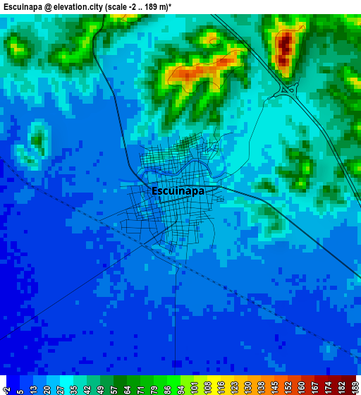
Below is the Elevation map of Escuinapa, which displays elevation range with different colors. Scale of the first map is from -2 to 189 m (-7 to 620 ft) with average elevation of 28.3 meters (=93 ft) [note 1]
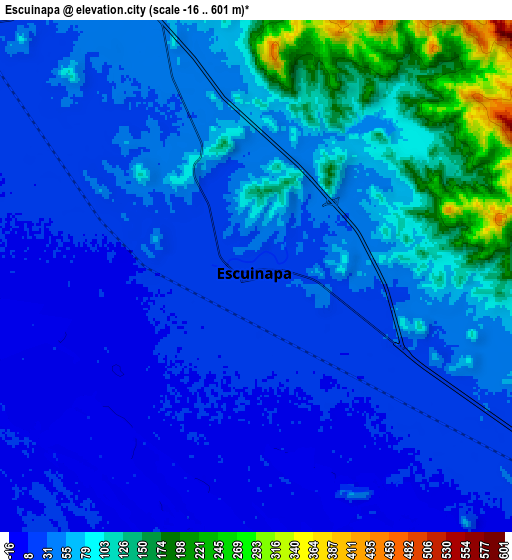
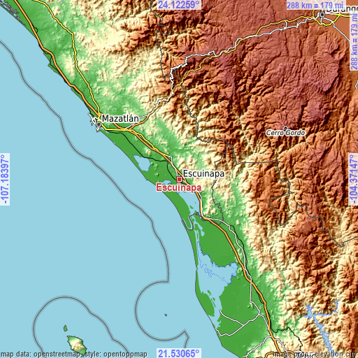
These maps also provides idea of topography and contour of this city, they are displayed at different zoom levels. More info about maps, scale and edge coordinates you can find below images.
| \ | Map #1 | Map #2 | Topo.Map |
| Scale [m] | -2..189 m | -16..601 m | × |
| Scale [ft] | -7..620 ft | -52..1972 ft | × |
| Average | 28.3 m = 93 ft | 56 m = 184 ft | × |
| Width | 9.01 km = 5.6 mi | 18.01 km = 11.2 mi | 288.2 km = 179.1 mi |
| Height | 9.01 km = 5.6 mi | 18.01 km = 11.2 mi | 288.2 km = 179.1 mi |
| ↑Max Latitude | 22.873286° | 22.913769° | 24.12259° |
| Latitude at center | 22.83279° | 22.83279° | 22.83279° |
| ↓Min Latitude | 22.792282° | 22.751762° | 21.53065° |
| ← Min Longitude | -105.821665° | -105.865611° | -107.18397° |
| Longitude center | -105.77772° | -105.77772° | -105.77772° |
| →Max Longitude | -105.733775° | -105.689829° | -104.37147° |
Nearby cities:
Cities around Escuinapa sort by population:
• El Rosario elevation 34 m
19.5 km,  335°
335°
• Isla del Bosque 6 m
13.1 km,  212°
212°
• Agua Verde 10 m
21.1 km,  288°
288°
• Ojo de Agua de Palmillas 11 m
29.6 km,  143°
143°
• El Pozole 16 m
16.6 km,  303°
303°
• Cristo Rey 6 m
28.5 km,  168°
168°
• Apoderado 16 m
17.2 km, 299°
• Chametla 19 m
19.1 km, 285°
• Ejido Cajón Ojo de Agua Número Dos 10 m
21.2 km, 290°
• Cacalotán 39 m
26.9 km,  345°
345°
• Palmito del Verde 5 m
19.4 km,  177°
177°
• Tecualilla 14 m
13.1 km,  124°
124°
Multilingual:
 En español:
Escuinapa elevación 25 m.
 En France:
Escuinapa élévation 25 m.
 Auf Deutsch:
Escuinapa höhe über dem Meeresspiegel ist 25 m.

Sources and notes:
- [note 1] Map square and city borders are not equal. Map elevation data is calculated only from area inside that square.
- [src 1] Elevation data from geonames database provided with same terms of usage.
- [src 2] The elevation map of Escuinapa is generated using elevation data from NASA's 3 arcsec (90m) resolution SRTM data.
- [src 3] Base (background) map © OpenStreetMap contributors tiles are generated by Geofabrik and OpenTopoMap.
Copyright & License:
This Escuinapa Elevation Map is licensed under CC BY-SA. You may reuse any part from this page, if you give a proper credit by linking to this URL:
 More info on terms of use page.