Huanímaro elevation
Huanímaro (Guanajuato), Mexico elevation is 1719 meters and Huanímaro elevation in feet is 5640 ft above sea level [src 1]. Huanímaro is a seat of a second-order administrative division (feature code) with elevation that is 405 meters (1329 ft) bigger than average city elevation in Mexico.
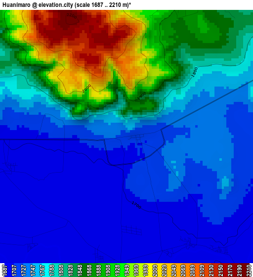
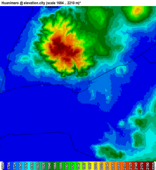
Below is the Elevation map of Huanímaro, which displays elevation range with different colors. Scale of the first map is from 1687 to 2210 m (5535 to 7251 ft) with average elevation of 1793.6 meters (=5885 ft) [note 1]
These maps also provides idea of topography and contour of this city, they are displayed at different zoom levels. More info about maps, scale and edge coordinates you can find below images.
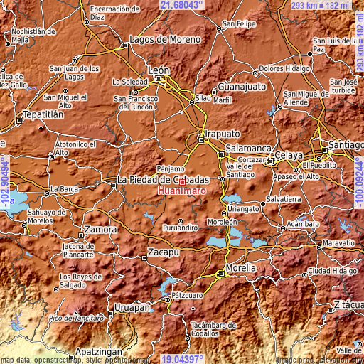
| \ | Map #1 | Map #2 | Topo.Map |
| Scale [m] | 1687..2210 m | 1684..2210 m | × |
| Scale [ft] | 5535..7251 ft | 5525..7251 ft | × |
| Average | 1793.6 m = 5885 ft | 1763 m = 5784 ft | × |
| Width | 9.16 km = 5.7 mi | 18.32 km = 11.4 mi | 293.1 km = 182.1 mi |
| Height | 9.16 km = 5.7 mi | 18.32 km = 11.4 mi | 293.2 km = 182.2 mi |
| ↑Max Latitude | 20.409022° | 20.450203° | 21.68043° |
| Latitude at center | 20.36783° | 20.36783° | 20.36783° |
| ↓Min Latitude | 20.326627° | 20.285413° | 19.04397° |
| ← Min Longitude | -101.542635° | -101.586581° | -102.90494° |
| Longitude center | -101.49869° | -101.49869° | -101.49869° |
| →Max Longitude | -101.454745° | -101.410799° | -100.09244° |
Nearby cities:
Cities around Huanímaro sort by population:
• Abasolo elevation 1712 m
9.7 km,  339°
339°
• San José Huipana 1718 m
10.5 km,  163°
163°
• Boquillas 1721 m
8.7 km,  51°
51°
• Héroes de Chapultepec (Rodeo de San Antonio) 1694 m
6.3 km,  183°
183°
• La Lobera 1696 m
4.5 km,  256°
256°
• Labor de Peralta 1704 m
10.4 km,  63°
63°
• San José de Ayala 1723 m
6.3 km,  70°
70°
• Tamazula 1693 m
10 km,  325°
325°
• San Bernardo Peña Blanca 1727 m
10.6 km,  9°
9°
• Otates 1868 m
4.1 km,  25°
25°
• Monte Blanco 1695 m
3.3 km,  244°
244°
• San Juan Grande 1741 m
3.1 km,  287°
287°
Multilingual:
 En español:
Huanimaro elevación 1719 m.
 En France:
Huanímaro élévation 1719 m.
 Auf Deutsch:
Huanímaro höhe über dem Meeresspiegel ist 1719 m.

Sources and notes:
- [note 1] Map square and city borders are not equal. Map elevation data is calculated only from area inside that square.
- [src 1] Elevation data from geonames database provided with same terms of usage.
- [src 2] The elevation map of Huanímaro is generated using elevation data from NASA's 3 arcsec (90m) resolution SRTM data.
- [src 3] Base (background) map © OpenStreetMap contributors tiles are generated by Geofabrik and OpenTopoMap.
Copyright & License:
This Huanímaro Elevation Map is licensed under CC BY-SA. You may reuse any part from this page, if you give a proper credit by linking to this URL:
 More info on terms of use page.