La Reforma elevation
La Reforma (Sinaloa, Angostura), Mexico elevation is 8 meters and La Reforma elevation in feet is 26 ft above sea level [src 1]. La Reforma is a populated place (feature code) with elevation that is 1306 meters (4285 ft) smaller than average city elevation in Mexico.
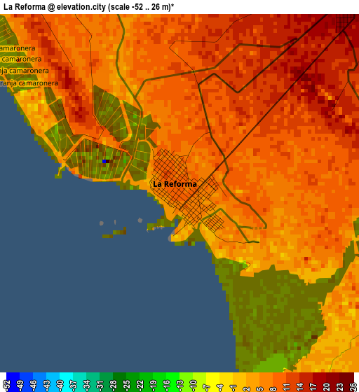
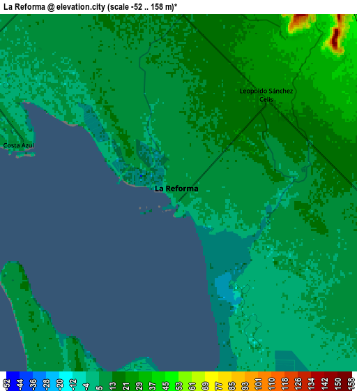
Below is the Elevation map of La Reforma, which displays elevation range with different colors. Scale of the first map is from -52 to 26 m (-171 to 85 ft) with average elevation of 7.4 meters (=24 ft) [note 1]
These maps also provides idea of topography and contour of this city, they are displayed at different zoom levels. More info about maps, scale and edge coordinates you can find below images.
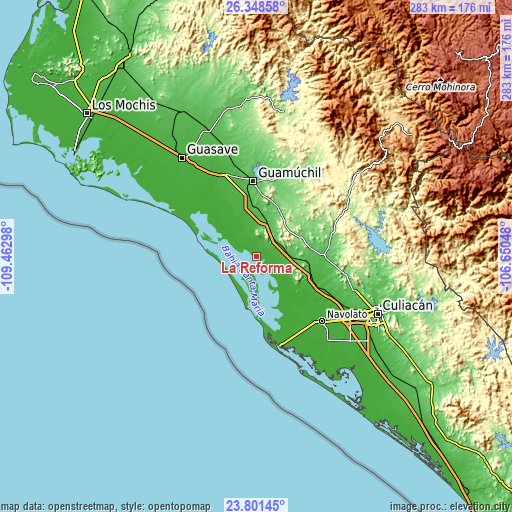
| \ | Map #1 | Map #2 | Topo.Map |
| Scale [m] | -52..26 m | -52..158 m | × |
| Scale [ft] | -171..85 ft | -171..518 ft | × |
| Average | 7.4 m = 24 ft | 11.3 m = 37 ft | × |
| Width | 8.85 km = 5.5 mi | 17.7 km = 11 mi | 283.2 km = 176 mi |
| Height | 8.85 km = 5.5 mi | 17.7 km = 11 mi | 283.2 km = 176 mi |
| ↑Max Latitude | 25.121435° | 25.161217° | 26.34858° |
| Latitude at center | 25.08164° | 25.08164° | 25.08164° |
| ↓Min Latitude | 25.041832° | 25.002011° | 23.80145° |
| ← Min Longitude | -108.100675° | -108.144621° | -109.46298° |
| Longitude center | -108.05673° | -108.05673° | -108.05673° |
| →Max Longitude | -108.012785° | -107.968839° | -106.65048° |
Nearby cities:
Cities around La Reforma sort by population:
• Angostura elevation 28 m
33.3 km,  341°
341°
• Juan Aldama (El Tigre) 20 m
28.5 km,  123°
123°
• Colonia Agrícola México (Palmitas) 25 m
11.7 km,  74°
74°
• Alhuey 26 m
33.8 km,  347°
347°
• Estación Chimaneco 22 m
34.1 km,  114°
114°
• Melchor Ocampo 28 m
16.8 km,  103°
103°
• Recoveco 27 m
34.5 km, 106°
• La Esperanza 21 m
32.5 km, 336°
• Costa Azul 7 m
8.4 km,  285°
285°
• Potrero de los Sánchez (Estación Techa) 43 m
16 km,  78°
78°
• Gustavo Díaz Ordaz 28 m
21 km, 349°
• La Palma 27 m
35 km, 342°
Multilingual:
 En español:
La Reforma, Peonía elevación 8 m.
 En France:
La Reforma élévation 8 m.
 Auf Deutsch:
La Reforma höhe über dem Meeresspiegel ist 8 m.

Sources and notes:
- [note 1] Map square and city borders are not equal. Map elevation data is calculated only from area inside that square.
- [src 1] Elevation data from geonames database provided with same terms of usage.
- [src 2] The elevation map of La Reforma is generated using elevation data from NASA's 3 arcsec (90m) resolution SRTM data.
- [src 3] Base (background) map © OpenStreetMap contributors tiles are generated by Geofabrik and OpenTopoMap.
Copyright & License:
This La Reforma Elevation Map is licensed under CC BY-SA. You may reuse any part from this page, if you give a proper credit by linking to this URL:
 More info on terms of use page.