Los Arquitos elevation
Los Arquitos (Aguascalientes, Jesús María), Mexico elevation is 1905 meters and Los Arquitos elevation in feet is 6250 ft above sea level [src 1]. Los Arquitos is a populated place (feature code) with elevation that is 591 meters (1939 ft) bigger than average city elevation in Mexico.
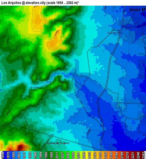
Below is the Elevation map of Los Arquitos, which displays elevation range with different colors. Scale of the first map is from 1854 to 2262 m (6083 to 7421 ft) with average elevation of 1948.6 meters (=6393 ft) [note 1]
These maps also provides idea of topography and contour of this city, they are displayed at different zoom levels. More info about maps, scale and edge coordinates you can find below images.
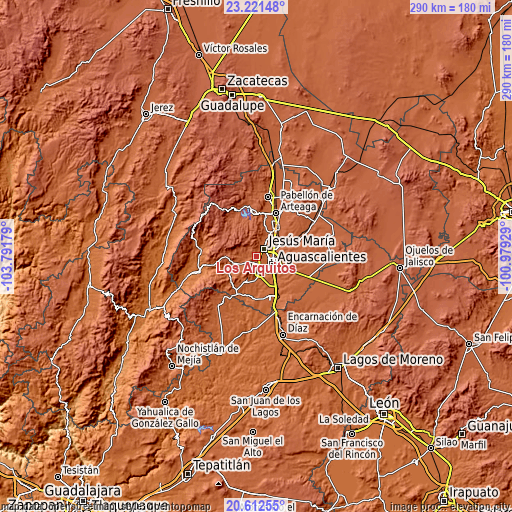
| \ | Map #1 | Topo.Map |
| Scale [m] | 1854..2262 m | × |
| Scale [ft] | 6083..7421 ft | × |
| Average | 1948.6 m = 6393 ft | × |
| Width | 9.07 km = 5.6 mi | 290.1 km = 180.3 mi |
| Height | 9.07 km = 5.6 mi | 290.1 km = 180.3 mi |
| ↑Max Latitude | 21.963752° | 23.22148° |
| Latitude at center | 21.92299° | 21.92299° |
| ↓Min Latitude | 21.882217° | 20.61255° |
| ← Min Longitude | -102.429485° | -103.79179° |
| Longitude center | -102.38554° | -102.38554° |
| →Max Longitude | -102.341595° | -100.97929° |
Nearby cities:
Cities around Los Arquitos sort by population:
• Jesús María elevation 1873 m
6.1 km,  45°
45°
• Pocitos 1861 m
5.2 km,  91°
91°
• Corral de Barrancos 1858 m
6.3 km,  61°
61°
• El Llano 1861 m
6.9 km,  70°
70°
• Maravillas 1856 m
6.7 km, 58°
• Paso Blanco 1864 m
9 km, 51°
• Tepetates 1865 m
7.6 km, 60°
• General Ignacio Zaragoza 1998 m
9.4 km,  240°
240°
• Paseos de las Haciendas [Fraccionamiento] 1901 m
8.8 km,  29°
29°
• La Loma de los Negritos 1870 m
6.9 km,  147°
147°
• San Ignacio 1873 m
5.8 km,  125°
125°
• Miravalle 1870 m
9.4 km, 54°
Multilingual:
 En español:
Los Arquitos elevación 1905 m.
 En France:
Los Arquitos élévation 1905 m.
 Auf Deutsch:
Los Arquitos höhe über dem Meeresspiegel ist 1905 m.

Sources and notes:
- [note 1] Map square and city borders are not equal. Map elevation data is calculated only from area inside that square.
- [src 1] Elevation data from geonames database provided with same terms of usage.
- [src 2] The elevation map of Los Arquitos is generated using elevation data from NASA's 3 arcsec (90m) resolution SRTM data.
- [src 3] Base (background) map © OpenStreetMap contributors tiles are generated by Geofabrik and OpenTopoMap.
Copyright & License:
This Los Arquitos Elevation Map is licensed under CC BY-SA. You may reuse any part from this page, if you give a proper credit by linking to this URL:
 More info on terms of use page.