Primero de Mayo elevation
Primero de Mayo (Sinaloa, Ahome), Mexico elevation is 13 meters and Primero de Mayo elevation in feet is 43 ft above sea level [src 1]. Primero de Mayo is a populated place (feature code) with elevation that is 1301 meters (4268 ft) smaller than average city elevation in Mexico.
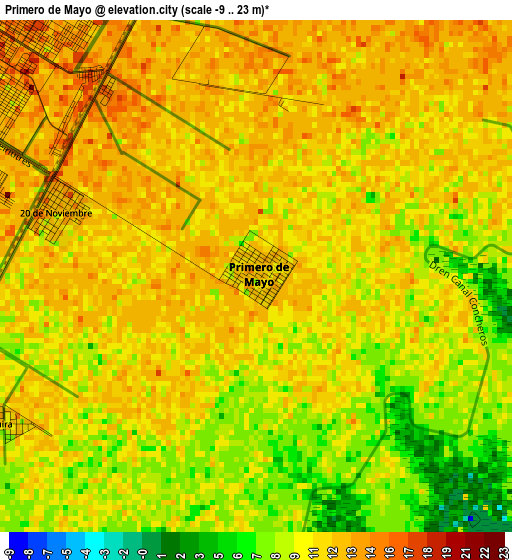
Below is the Elevation map of Primero de Mayo, which displays elevation range with different colors. Scale of the first map is from -9 to 23 m (-30 to 75 ft) with average elevation of 10.5 meters (=34 ft) [note 1]
These maps also provides idea of topography and contour of this city, they are displayed at different zoom levels. More info about maps, scale and edge coordinates you can find below images.
| \ | Map #1 | Map #2 | Topo.Map |
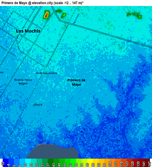
| Scale [m] | -9..23 m | -12..147 m | × |
| Scale [ft] | -30..75 ft | -39..482 ft | × |
| Average | 10.5 m = 34 ft | 9.6 m = 31 ft | × |
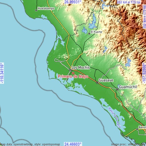
| Width | 8.8 km = 5.5 mi | 17.61 km = 10.9 mi | 281.7 km = 175 mi |
| Height | 8.8 km = 5.5 mi | 17.61 km = 10.9 mi | 281.7 km = 175 mi |
| ↑Max Latitude | 25.778998° | 25.818564° | 26.99931° |
| Latitude at center | 25.73942° | 25.73942° | 25.73942° |
| ↓Min Latitude | 25.699828° | 25.660224° | 24.46603° |
| ← Min Longitude | -108.978855° | -109.022801° | -110.34116° |
| Longitude center | -108.93491° | -108.93491° | -108.93491° |
| →Max Longitude | -108.890965° | -108.847019° | -107.52866° |
Nearby cities:
Cities around Primero de Mayo sort by population:
• Los Mochis elevation 14 m
8.7 km,  313°
313°
• Juan José Ríos 15 m
11.3 km,  79°
79°
• Las Compuertas 16 m
14.2 km,  323°
323°
• Bachoco 11 m
13 km,  111°
111°
• Mochis 10 m
15.2 km, 309°
• Cerrillos (Campo 35) 48 m
15.8 km,  12°
12°
• Ejido Cinco de Mayo 21 m
12.6 km,  348°
348°
• Ejido Ohuira 10 m
5 km,  239°
239°
• Ricardo Flores Magón 13 m
6.1 km,  271°
271°
• Campo la Arrocera 20 m
11.9 km, 8°
• Benito Juárez 10 m
10.5 km,  291°
291°
• Plan de Ayala (Campo Cinco) 7 m
11.1 km, 287°
Multilingual:
 En español:
Primero de Mayo elevación 13 m.
 En France:
Primero de Mayo élévation 13 m.
 Auf Deutsch:
Primero de Mayo höhe über dem Meeresspiegel ist 13 m.

Sources and notes:
- [note 1] Map square and city borders are not equal. Map elevation data is calculated only from area inside that square.
- [src 1] Elevation data from geonames database provided with same terms of usage.
- [src 2] The elevation map of Primero de Mayo is generated using elevation data from NASA's 3 arcsec (90m) resolution SRTM data.
- [src 3] Base (background) map © OpenStreetMap contributors tiles are generated by Geofabrik and OpenTopoMap.
Copyright & License:
This Primero de Mayo Elevation Map is licensed under CC BY-SA. You may reuse any part from this page, if you give a proper credit by linking to this URL:
 More info on terms of use page.