Puga elevation
Puga (Nayarit, Tepic), Mexico elevation is 724 meters and Puga elevation in feet is 2375 ft above sea level [src 1]. Puga is a populated place (feature code) with elevation that is 590 meters (1936 ft) smaller than average city elevation in Mexico.
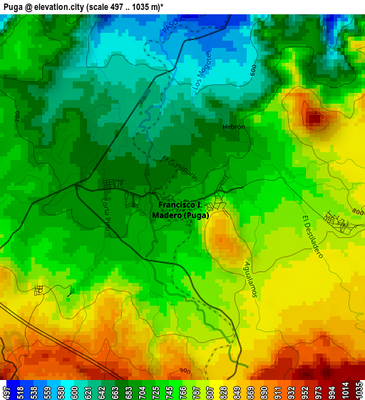
Below is the Elevation map of Puga, which displays elevation range with different colors. Scale of the first map is from 497 to 1035 m (1631 to 3396 ft) with average elevation of 744.1 meters (=2441 ft) [note 1]
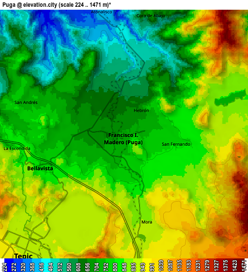
These maps also provides idea of topography and contour of this city, they are displayed at different zoom levels. More info about maps, scale and edge coordinates you can find below images.
| \ | Map #1 | Map #2 | Topo.Map |
| Scale [m] | 497..1035 m | 224..1471 m | × |
| Scale [ft] | 1631..3396 ft | 735..4826 ft | × |
| Average | 744.1 m = 2441 ft | 806.9 m = 2647 ft | × |
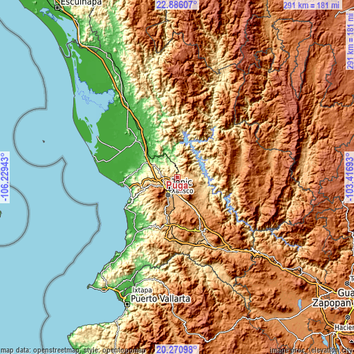
| Width | 9.09 km = 5.6 mi | 18.17 km = 11.3 mi | 290.8 km = 180.7 mi |
| Height | 9.09 km = 5.6 mi | 18.17 km = 11.3 mi | 290.8 km = 180.7 mi |
| ↑Max Latitude | 21.625288° | 21.666134° | 22.88607° |
| Latitude at center | 21.58443° | 21.58443° | 21.58443° |
| ↓Min Latitude | 21.543561° | 21.50268° | 20.27098° |
| ← Min Longitude | -104.867125° | -104.911071° | -106.22943° |
| Longitude center | -104.82318° | -104.82318° | -104.82318° |
| →Max Longitude | -104.779235° | -104.735289° | -103.41693° |
Nearby cities:
Cities around Puga sort by population:
• Tepic elevation 932 m
11.2 km,  221°
221°
• Francisco I. Madero 742 m
0.5 km,  125°
125°
• San Cayetano 948 m
15 km,  177°
177°
• Camichín de Jauja 976 m
13.4 km,  170°
170°
• Bellavista 783 m
6.6 km,  248°
248°
• Atonalisco 375 m
9.2 km,  349°
349°
• Santiago de Pochotitán 768 m
12.9 km,  91°
91°
• Lo de Lamedo 841 m
13.1 km, 246°
• San Luis de Lozada 1086 m
15.2 km, 126°
• La Cantera 963 m
9 km, 179°
• El Ahuacate 995 m
14.7 km,  238°
238°
• La Fortuna 808 m
13.7 km,  255°
255°
Multilingual:
 En español:
Puga elevación 724 m.
 En France:
Puga élévation 724 m.


Sources and notes:
- [note 1] Map square and city borders are not equal. Map elevation data is calculated only from area inside that square.
- [src 1] Elevation data from geonames database provided with same terms of usage.
- [src 2] The elevation map of Puga is generated using elevation data from NASA's 3 arcsec (90m) resolution SRTM data.
- [src 3] Base (background) map © OpenStreetMap contributors tiles are generated by Geofabrik and OpenTopoMap.
Copyright & License:
This Puga Elevation Map is licensed under CC BY-SA. You may reuse any part from this page, if you give a proper credit by linking to this URL:
 More info on terms of use page.