Quila elevation
Quila (Sinaloa, Culiacán), Mexico elevation is 43 meters and Quila elevation in feet is 141 ft above sea level [src 1]. Quila is a populated place (feature code) with elevation that is 1271 meters (4170 ft) smaller than average city elevation in Mexico.
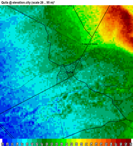
Below is the Elevation map of Quila, which displays elevation range with different colors. Scale of the first map is from 26 to 95 m (85 to 312 ft) with average elevation of 45.8 meters (=150 ft) [note 1]
These maps also provides idea of topography and contour of this city, they are displayed at different zoom levels. More info about maps, scale and edge coordinates you can find below images.
| \ | Map #1 | Map #2 | Topo.Map |
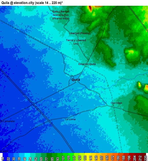
| Scale [m] | 26..95 m | 14..220 m | × |
| Scale [ft] | 85..312 ft | 46..722 ft | × |
| Average | 45.8 m = 150 ft | 50.1 m = 164 ft | × |
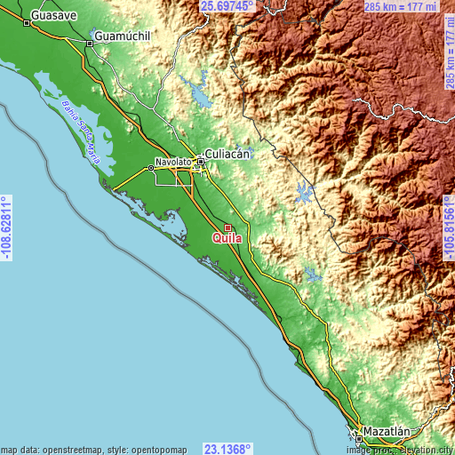
| Width | 8.9 km = 5.5 mi | 17.8 km = 11.1 mi | 284.7 km = 176.9 mi |
| Height | 8.9 km = 5.5 mi | 17.8 km = 11.1 mi | 284.7 km = 176.9 mi |
| ↑Max Latitude | 24.463626° | 24.50362° | 25.69745° |
| Latitude at center | 24.42362° | 24.42362° | 24.42362° |
| ↓Min Latitude | 24.383601° | 24.343569° | 23.1368° |
| ← Min Longitude | -107.265805° | -107.309751° | -108.62811° |
| Longitude center | -107.22186° | -107.22186° | -107.22186° |
| →Max Longitude | -107.177915° | -107.133969° | -105.81561° |
Nearby cities:
Cities around Quila sort by population:
• El Dorado elevation 13 m
18.2 km,  231°
231°
• Guadalupe Victoria 19 m
14.7 km,  199°
199°
• Pueblos Unidos 39 m
16.2 km,  153°
153°
• Salado 91 m
11.3 km,  34°
34°
• Oso Viejo 62 m
5.8 km,  117°
117°
• El Higueral 13 m
17.9 km, 225°
• Estación Obispo 38 m
15.8 km,  156°
156°
• Miguel Valdez Quintero (El Corazón) 33 m
12.5 km,  308°
308°
• Portaceli 22 m
12 km, 225°
• La Loma (La Loma de Quila) 40 m
4.8 km,  185°
185°
• San Diego 20 m
12 km,  247°
247°
• San Francisco de Tacuichamona 120 m
16.3 km, 115°
Multilingual:
 En español:
Quila elevación 43 m.
 En France:
Quila élévation 43 m.


Sources and notes:
- [note 1] Map square and city borders are not equal. Map elevation data is calculated only from area inside that square.
- [src 1] Elevation data from geonames database provided with same terms of usage.
- [src 2] The elevation map of Quila is generated using elevation data from NASA's 3 arcsec (90m) resolution SRTM data.
- [src 3] Base (background) map © OpenStreetMap contributors tiles are generated by Geofabrik and OpenTopoMap.
Copyright & License:
This Quila Elevation Map is licensed under CC BY-SA. You may reuse any part from this page, if you give a proper credit by linking to this URL:
 More info on terms of use page.