Lázaro Cárdenas (Rancho Grande) elevation
Lázaro Cárdenas (Rancho Grande) (Zacatecas, Fresnillo), Mexico elevation is 2022 meters and Lázaro Cárdenas (Rancho Grande) elevation in feet is 6634 ft above sea level [src 1]. Lázaro Cárdenas (Rancho Grande) is a populated place (feature code) with elevation that is 708 meters (2323 ft) bigger than average city elevation in Mexico.
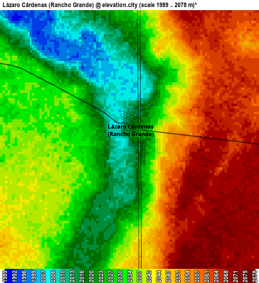
Below is the Elevation map of Lázaro Cárdenas (Rancho Grande), which displays elevation range with different colors. Scale of the first map is from 1989 to 2078 m (6526 to 6818 ft) with average elevation of 2039.1 meters (=6690 ft) [note 1]
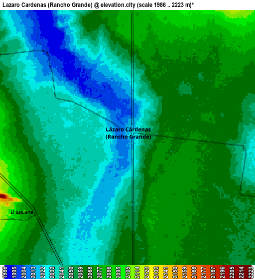
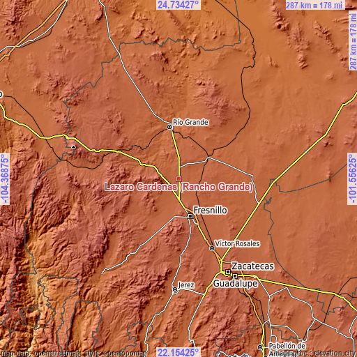
These maps also provides idea of topography and contour of this city, they are displayed at different zoom levels. More info about maps, scale and edge coordinates you can find below images.
| \ | Map #1 | Map #2 | Topo.Map |
| Scale [m] | 1989..2078 m | 1986..2223 m | × |
| Scale [ft] | 6526..6818 ft | 6516..7293 ft | × |
| Average | 2039.1 m = 6690 ft | 2052.6 m = 6734 ft | × |
| Width | 8.97 km = 5.6 mi | 17.93 km = 11.1 mi | 286.9 km = 178.3 mi |
| Height | 8.97 km = 5.6 mi | 17.93 km = 11.1 mi | 286.9 km = 178.3 mi |
| ↑Max Latitude | 23.490869° | 23.531167° | 24.73427° |
| Latitude at center | 23.45056° | 23.45056° | 23.45056° |
| ↓Min Latitude | 23.410238° | 23.369904° | 22.15425° |
| ← Min Longitude | -103.006445° | -103.050391° | -104.36875° |
| Longitude center | -102.9625° | -102.9625° | -102.9625° |
| →Max Longitude | -102.918555° | -102.874609° | -101.55625° |
Nearby cities:
Cities around Lázaro Cárdenas (Rancho Grande) sort by population:
• San Jose de Lourdes elevation 2044 m
20 km,  193°
193°
• Plateros 2175 m
27.5 km,  153°
153°
• Río Florido 2034 m
12.1 km, 193°
• Seis de Enero 2121 m
14.6 km,  231°
231°
• Rio de Medina 2001 m
8.1 km,  315°
315°
• Colonia Montemariana (Colonia Mariana) 2131 m
20.6 km, 227°
• Altamira 2029 m
8 km,  197°
197°
• Colonia Plenitud 2060 m
26.8 km,  205°
205°
• José María Morelos (Santa Mónica) 1965 m
22.9 km, 318°
• José María Morelos 2040 m
15.2 km, 200°
• Sain Bajo 1970 m
28.4 km,  310°
310°
• Carrillo 2123 m
27.5 km, 185°
Multilingual:
 En español:
Lázaro Cárdenas (Rancho Grande) elevación 2022 m.
 En France:
Lázaro Cárdenas (Rancho Grande) élévation 2022 m.
 Auf Deutsch:
Lázaro Cárdenas (Rancho Grande) höhe über dem Meeresspiegel ist 2022 m.
 На русском:
Lázaro Cárdenas (Rancho Grande) высота над уровнем моря 2022 м
Sources and notes:
- [note 1] Map square and city borders are not equal. Map elevation data is calculated only from area inside that square.
- [src 1] Elevation data from geonames database provided with same terms of usage.
- [src 2] The elevation map of Lázaro Cárdenas (Rancho Grande) is generated using elevation data from NASA's 3 arcsec (90m) resolution SRTM data.
- [src 3] Base (background) map © OpenStreetMap contributors tiles are generated by Geofabrik and OpenTopoMap.
Copyright & License:
This Lázaro Cárdenas (Rancho Grande) Elevation Map is licensed under CC BY-SA. You may reuse any part from this page, if you give a proper credit by linking to this URL:
 More info on terms of use page.