Rancho La Gloria elevation
Rancho La Gloria (Baja California, Tijuana), Mexico elevation is 302 meters and Rancho La Gloria elevation in feet is 991 ft above sea level [src 1]. Rancho La Gloria is a populated place (feature code) with elevation that is 1012 meters (3320 ft) smaller than average city elevation in Mexico.
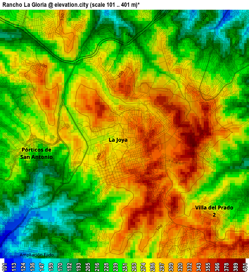
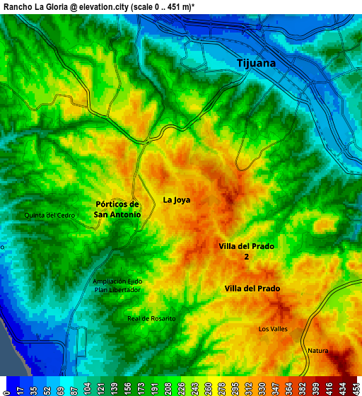
Below is the Elevation map of Rancho La Gloria, which displays elevation range with different colors. Scale of the first map is from 101 to 401 m (331 to 1316 ft) with average elevation of 264.7 meters (=868 ft) [note 1]
These maps also provides idea of topography and contour of this city, they are displayed at different zoom levels. More info about maps, scale and edge coordinates you can find below images.
| \ | Map #1 | Map #2 | Topo.Map |
| Scale [m] | 101..401 m | 0..451 m | × |
| Scale [ft] | 331..1316 ft | 0..1480 ft | × |
| Average | 264.7 m = 868 ft | 191.8 m = 629 ft | × |
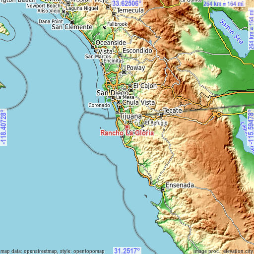
| Width | 8.25 km = 5.1 mi | 16.49 km = 10.2 mi | 263.9 km = 164 mi |
| Height | 8.25 km = 5.1 mi | 16.49 km = 10.2 mi | 263.9 km = 164 mi |
| ↑Max Latitude | 32.483268° | 32.52033° | 33.62506° |
| Latitude at center | 32.44619° | 32.44619° | 32.44619° |
| ↓Min Latitude | 32.409097° | 32.371989° | 31.2517° |
| ← Min Longitude | -117.044975° | -117.088921° | -118.40728° |
| Longitude center | -117.00103° | -117.00103° | -117.00103° |
| →Max Longitude | -116.957085° | -116.913139° | -115.59478° |
Nearby cities:
Cities around Rancho La Gloria sort by population:
• Tijuana elevation 97 m
6.3 km,  357°
357°
• Rosarito 46 m
10.4 km,  204°
204°
• Pórticos de San Antonio 275 m
3.1 km,  262°
262°
• Villa del Prado 2da Sección 274 m
3.7 km,  131°
131°
• Las Delicias 277 m
6.8 km, 127°
• San Luis 188 m
4.7 km,  109°
109°
• Quinta del Cedro 206 m
6.2 km, 260°
• Los Valles 331 m
7.4 km,  144°
144°
• Buenos Aires 222 m
6.2 km, 114°
• Colinas del Sol 233 m
5.5 km,  210°
210°
• La Esperanza [Granjas Familiares] 123 m
9.9 km,  280°
280°
• Colinas del Sol 284 m
4 km,  302°
302°
Multilingual:
 En español:
La Joya elevación 302 m.
 En France:
Rancho La Gloria élévation 302 m.
 Auf Deutsch:
Rancho La Gloria höhe über dem Meeresspiegel ist 302 m.

Sources and notes:
- [note 1] Map square and city borders are not equal. Map elevation data is calculated only from area inside that square.
- [src 1] Elevation data from geonames database provided with same terms of usage.
- [src 2] The elevation map of Rancho La Gloria is generated using elevation data from NASA's 3 arcsec (90m) resolution SRTM data.
- [src 3] Base (background) map © OpenStreetMap contributors tiles are generated by Geofabrik and OpenTopoMap.
Copyright & License:
This Rancho La Gloria Elevation Map is licensed under CC BY-SA. You may reuse any part from this page, if you give a proper credit by linking to this URL:
 More info on terms of use page.