San Ignacio elevation
San Ignacio (Coahuila, San Pedro), Mexico elevation is 1108 meters and San Ignacio elevation in feet is 3635 ft above sea level [src 1]. San Ignacio is a populated place (feature code) with elevation that is 206 meters (676 ft) smaller than average city elevation in Mexico.
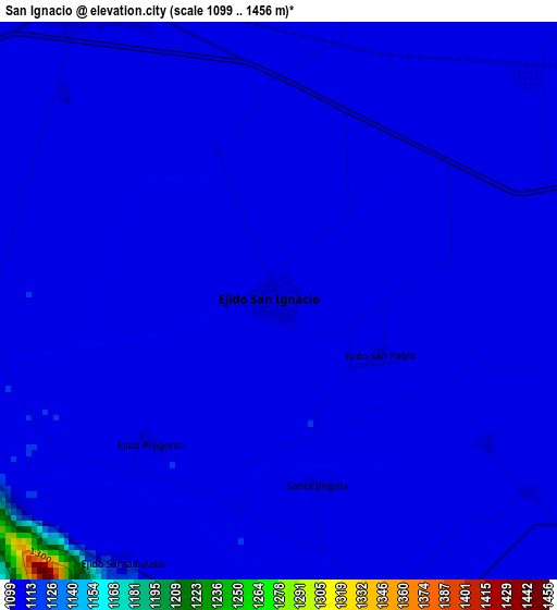
Below is the Elevation map of San Ignacio, which displays elevation range with different colors. Scale of the first map is from 1099 to 1456 m (3606 to 4777 ft) with average elevation of 1108.5 meters (=3637 ft) [note 1]
These maps also provides idea of topography and contour of this city, they are displayed at different zoom levels. More info about maps, scale and edge coordinates you can find below images.
| \ | Map #1 | Topo.Map |
| Scale [m] | 1099..1456 m | × |
| Scale [ft] | 3606..4777 ft | × |
| Average | 1108.5 m = 3637 ft | × |
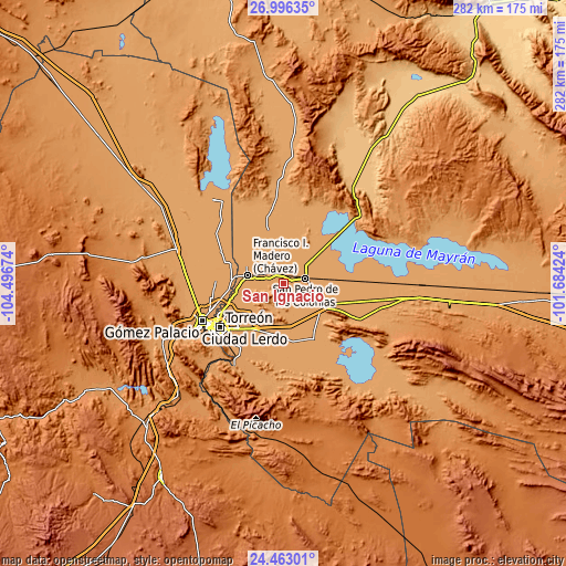
| Width | 8.8 km = 5.5 mi | 281.7 km = 175 mi |
| Height | 8.8 km = 5.5 mi | 281.7 km = 175 mi |
| ↑Max Latitude | 25.776009° | 26.99635° |
| Latitude at center | 25.73643° | 25.73643° |
| ↓Min Latitude | 25.696837° | 24.46301° |
| ← Min Longitude | -103.134435° | -104.49674° |
| Longitude center | -103.09049° | -103.09049° |
| →Max Longitude | -103.046545° | -101.68424° |
Nearby cities:
Cities around San Ignacio sort by population:
• San Pedro elevation 1101 m
10.9 km,  78°
78°
• Concordia 1108 m
5.5 km,  331°
331°
• Luchanas 1110 m
12 km,  300°
300°
• El Retiro 1105 m
10.9 km,  338°
338°
• San Lorenzo 1111 m
6.5 km,  256°
256°
• Tacubaya 1109 m
6.3 km,  159°
159°
• San Miguel 1101 m
14.6 km,  106°
106°
• Alejo González (Bilbao) 1109 m
14.1 km,  312°
312°
• San Esteban de Abajo 1102 m
9.5 km, 108°
• San Francisco de Arriba 1114 m
6.8 km,  283°
283°
• San Marcos 1105 m
11.3 km,  133°
133°
• Veinte de Noviembre (Santa Lucía) 1106 m
8.5 km, 313°
Multilingual:
 En español:
San Ignacio elevación 1108 m.
 En France:
San Ignacio élévation 1108 m.
 Auf Deutsch:
San Ignacio höhe über dem Meeresspiegel ist 1108 m.

Sources and notes:
- [note 1] Map square and city borders are not equal. Map elevation data is calculated only from area inside that square.
- [src 1] Elevation data from geonames database provided with same terms of usage.
- [src 2] The elevation map of San Ignacio is generated using elevation data from NASA's 3 arcsec (90m) resolution SRTM data.
- [src 3] Base (background) map © OpenStreetMap contributors tiles are generated by Geofabrik and OpenTopoMap.
Copyright & License:
This San Ignacio Elevation Map is licensed under CC BY-SA. You may reuse any part from this page, if you give a proper credit by linking to this URL:
 More info on terms of use page.