San José Temascatío elevation
San José Temascatío (Guanajuato, Salamanca), Mexico elevation is 1739 meters and San José Temascatío elevation in feet is 5705 ft above sea level [src 1]. San José Temascatío is a populated place (feature code) with elevation that is 425 meters (1394 ft) bigger than average city elevation in Mexico.
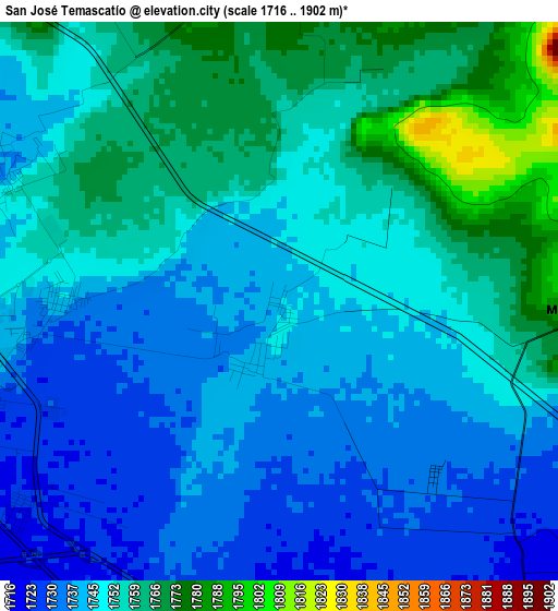
Below is the Elevation map of San José Temascatío, which displays elevation range with different colors. Scale of the first map is from 1716 to 1902 m (5630 to 6240 ft) with average elevation of 1749.3 meters (=5739 ft) [note 1]
These maps also provides idea of topography and contour of this city, they are displayed at different zoom levels. More info about maps, scale and edge coordinates you can find below images.
| \ | Map #1 | Map #2 | Topo.Map |
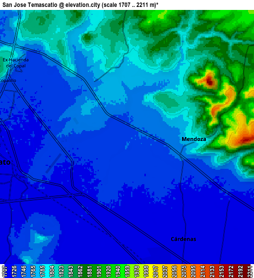
| Scale [m] | 1716..1902 m | 1707..2211 m | × |
| Scale [ft] | 5630..6240 ft | 5600..7254 ft | × |
| Average | 1749.3 m = 5739 ft | 1772.8 m = 5816 ft | × |
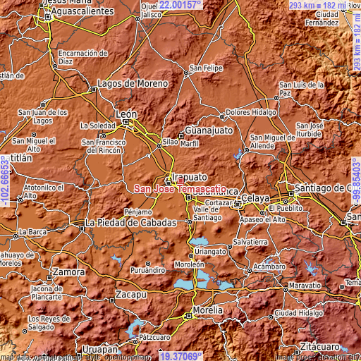
| Width | 9.14 km = 5.7 mi | 18.28 km = 11.4 mi | 292.5 km = 181.8 mi |
| Height | 9.14 km = 5.7 mi | 18.28 km = 11.4 mi | 292.5 km = 181.8 mi |
| ↑Max Latitude | 20.732935° | 20.774029° | 22.00157° |
| Latitude at center | 20.69183° | 20.69183° | 20.69183° |
| ↓Min Latitude | 20.650714° | 20.609587° | 19.37069° |
| ← Min Longitude | -101.304225° | -101.348171° | -102.66653° |
| Longitude center | -101.26028° | -101.26028° | -101.26028° |
| →Max Longitude | -101.216335° | -101.172389° | -99.85403° |
Nearby cities:
Cities around San José Temascatío sort by population:
• Carrizal Grande elevation 1744 m
5 km,  288°
288°
• Cuarta Brigada 1714 m
8 km,  194°
194°
• Cárdenas 1715 m
8 km,  148°
148°
• Valencianita 1801 m
7.5 km,  324°
324°
• El Carrizalito 1728 m
6.8 km,  281°
281°
• San José de Mendoza 1785 m
4.9 km,  92°
92°
• San Antonio el Chico 1717 m
7.5 km,  198°
198°
• El Copalillo 1745 m
9.7 km, 294°
• San Nicolás Temascatío 1766 m
3.9 km,  18°
18°
• Peñuelas 1744 m
4.8 km,  305°
305°
• Ex-Hacienda del Copal 1756 m
9.5 km,  304°
304°
• San Vicente de Flores 1715 m
7.8 km,  174°
174°
Multilingual:
 En español:
San José Temascatío elevación 1739 m.
 En France:
San José Temascatío élévation 1739 m.
 Auf Deutsch:
San José Temascatío höhe über dem Meeresspiegel ist 1739 m.
 На русском:
San José Temascatío высота над уровнем моря 1739 м
Sources and notes:
- [note 1] Map square and city borders are not equal. Map elevation data is calculated only from area inside that square.
- [src 1] Elevation data from geonames database provided with same terms of usage.
- [src 2] The elevation map of San José Temascatío is generated using elevation data from NASA's 3 arcsec (90m) resolution SRTM data.
- [src 3] Base (background) map © OpenStreetMap contributors tiles are generated by Geofabrik and OpenTopoMap.
Copyright & License:
This San José Temascatío Elevation Map is licensed under CC BY-SA. You may reuse any part from this page, if you give a proper credit by linking to this URL:
 More info on terms of use page.