San Miguel Totolapan elevation
San Miguel Totolapan (Guerrero), Mexico elevation is 302 meters and San Miguel Totolapan elevation in feet is 991 ft above sea level [src 1]. San Miguel Totolapan is a seat of a second-order administrative division (feature code) with elevation that is 1012 meters (3320 ft) smaller than average city elevation in Mexico.
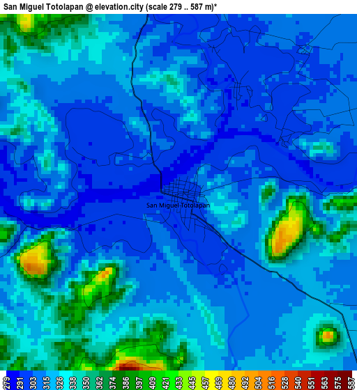
Below is the Elevation map of San Miguel Totolapan, which displays elevation range with different colors. Scale of the first map is from 279 to 587 m (915 to 1926 ft) with average elevation of 321.4 meters (=1054 ft) [note 1]
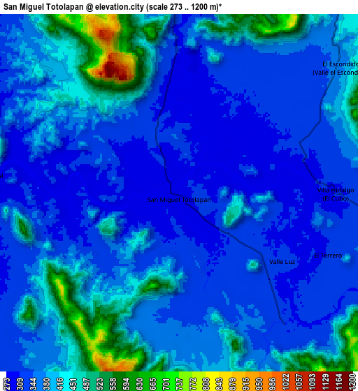
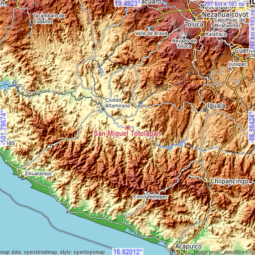
These maps also provides idea of topography and contour of this city, they are displayed at different zoom levels. More info about maps, scale and edge coordinates you can find below images.
| \ | Map #1 | Map #2 | Topo.Map |
| Scale [m] | 279..587 m | 273..1200 m | × |
| Scale [ft] | 915..1926 ft | 896..3937 ft | × |
| Average | 321.4 m = 1054 ft | 380 m = 1247 ft | × |
| Width | 9.29 km = 5.8 mi | 18.57 km = 11.5 mi | 297.1 km = 184.6 mi |
| Height | 9.29 km = 5.8 mi | 18.57 km = 11.5 mi | 297.1 km = 184.6 mi |
| ↑Max Latitude | 18.203071° | 18.244812° | 19.4923° |
| Latitude at center | 18.16132° | 18.16132° | 18.16132° |
| ↓Min Latitude | 18.119559° | 18.077788° | 16.82012° |
| ← Min Longitude | -100.434435° | -100.478381° | -101.79674° |
| Longitude center | -100.39049° | -100.39049° | -100.39049° |
| →Max Longitude | -100.346545° | -100.302599° | -98.98424° |
Nearby cities:
Cities around San Miguel Totolapan sort by population:
• Tlapehuala elevation 281 m
17.9 km,  299°
299°
• Ajuchitlán del Progreso 297 m
9.9 km,  263°
263°
• San José Poliutla 310 m
12.4 km,  359°
359°
• Villa Nicolás Bravo 278 m
17.6 km,  289°
289°
• San Antonio de las Huertas 364 m
19 km,  314°
314°
• Valle Luz 313 m
6.3 km,  122°
122°
• El Terrero 313 m
8.4 km,  114°
114°
• San Jerónimo el Grande 276 m
13 km, 295°
• Nuevo Guerrero 272 m
16 km, 296°
• El Escondido 368 m
10.6 km,  51°
51°
• Villa Hidalgo (El Cubo) 304 m
8 km,  89°
89°
• San Cristóbal 289 m
10.2 km,  275°
275°
Multilingual:
 En español:
San Miguel Totolapan elevación 302 m.
 En France:
San Miguel Totolapan élévation 302 m.
 Auf Deutsch:
San Miguel Totolapan höhe über dem Meeresspiegel ist 302 m.
 На русском:
San Miguel Totolapan высота над уровнем моря 302 м
Sources and notes:
- [note 1] Map square and city borders are not equal. Map elevation data is calculated only from area inside that square.
- [src 1] Elevation data from geonames database provided with same terms of usage.
- [src 2] The elevation map of San Miguel Totolapan is generated using elevation data from NASA's 3 arcsec (90m) resolution SRTM data.
- [src 3] Base (background) map © OpenStreetMap contributors tiles are generated by Geofabrik and OpenTopoMap.
Copyright & License:
This San Miguel Totolapan Elevation Map is licensed under CC BY-SA. You may reuse any part from this page, if you give a proper credit by linking to this URL:
 More info on terms of use page.