Soledad Nueva elevation
Soledad Nueva (Guanajuato, Dolores Hidalgo Cuna de la Independencia Nacional), Mexico elevation is 2007 meters and Soledad Nueva elevation in feet is 6585 ft above sea level [src 1]. Soledad Nueva is a populated place (feature code) with elevation that is 693 meters (2274 ft) bigger than average city elevation in Mexico.
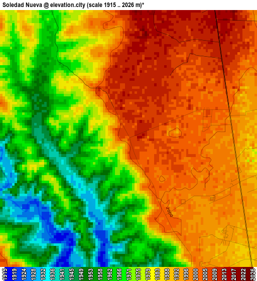
Below is the Elevation map of Soledad Nueva, which displays elevation range with different colors. Scale of the first map is from 1915 to 2026 m (6283 to 6647 ft) with average elevation of 1981.3 meters (=6500 ft) [note 1]
These maps also provides idea of topography and contour of this city, they are displayed at different zoom levels. More info about maps, scale and edge coordinates you can find below images.
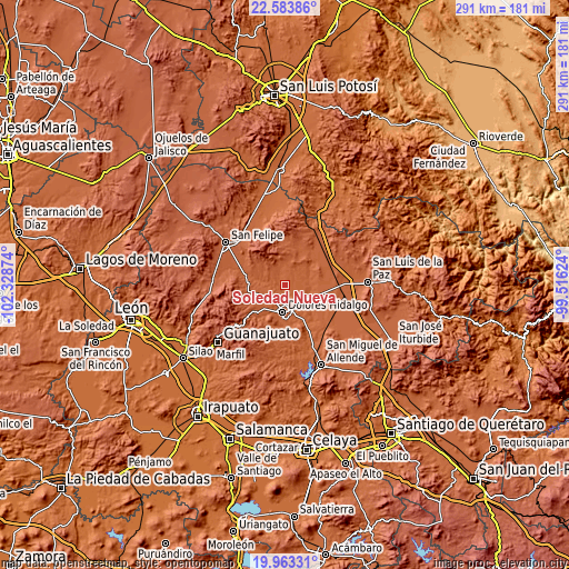
| \ | Map #1 | Topo.Map |
| Scale [m] | 1915..2026 m | × |
| Scale [ft] | 6283..6647 ft | × |
| Average | 1981.3 m = 6500 ft | × |
| Width | 9.11 km = 5.7 mi | 291.4 km = 181.1 mi |
| Height | 9.11 km = 5.7 mi | 291.4 km = 181.1 mi |
| ↑Max Latitude | 21.320363° | 22.58386° |
| Latitude at center | 21.27942° | 21.27942° |
| ↓Min Latitude | 21.238465° | 19.96331° |
| ← Min Longitude | -100.966435° | -102.32874° |
| Longitude center | -100.92249° | -100.92249° |
| →Max Longitude | -100.878545° | -99.51624° |
Nearby cities:
Cities around Soledad Nueva sort by population:
• Dolores Hidalgo Cuna de la Independencia Nacional elevation 1918 m
13.7 km,  184°
184°
• San Diego de la Unión 2071 m
21.5 km,  13°
13°
• San Juan Pan de Arriba 2111 m
21.4 km,  0°
0°
• Río Laja 1915 m
8.5 km, 180°
• Tequisquiapan 1879 m
24.6 km,  154°
154°
• San Gabriel 1895 m
19 km, 151°
• Ejido Jesús María 1917 m
15.3 km, 175°
• El Llanito 1934 m
17.8 km,  189°
189°
• Colonia Padre Hidalgo 1968 m
12.2 km, 186°
• El Gallinero 1950 m
11.5 km,  199°
199°
• Adjuntas del Río 1914 m
19 km,  162°
162°
• Rancho de Guadalupe 2018 m
11.5 km,  232°
232°
Multilingual:
 En español:
Soledad Nueva elevación 2007 m.
 En France:
Soledad Nueva élévation 2007 m.
 Auf Deutsch:
Soledad Nueva höhe über dem Meeresspiegel ist 2007 m.

Sources and notes:
- [note 1] Map square and city borders are not equal. Map elevation data is calculated only from area inside that square.
- [src 1] Elevation data from geonames database provided with same terms of usage.
- [src 2] The elevation map of Soledad Nueva is generated using elevation data from NASA's 3 arcsec (90m) resolution SRTM data.
- [src 3] Base (background) map © OpenStreetMap contributors tiles are generated by Geofabrik and OpenTopoMap.
Copyright & License:
This Soledad Nueva Elevation Map is licensed under CC BY-SA. You may reuse any part from this page, if you give a proper credit by linking to this URL:
 More info on terms of use page.