Tangancícuaro de Arista elevation
Tangancícuaro de Arista (State of Mexico), Mexico elevation is 1712 meters and Tangancícuaro de Arista elevation in feet is 5617 ft above sea level [src 1]. Tangancícuaro de Arista is a populated place (feature code) with elevation that is 398 meters (1306 ft) bigger than average city elevation in Mexico.
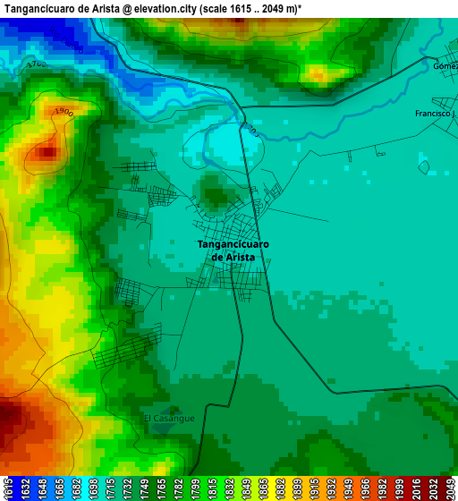
Below is the Elevation map of Tangancícuaro de Arista, which displays elevation range with different colors. Scale of the first map is from 1615 to 2049 m (5299 to 6722 ft) with average elevation of 1755.6 meters (=5760 ft) [note 1]
These maps also provides idea of topography and contour of this city, they are displayed at different zoom levels. More info about maps, scale and edge coordinates you can find below images.
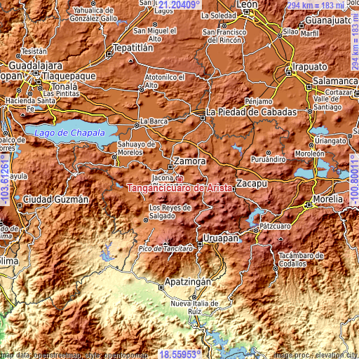
| \ | Map #1 | Map #2 | Topo.Map |
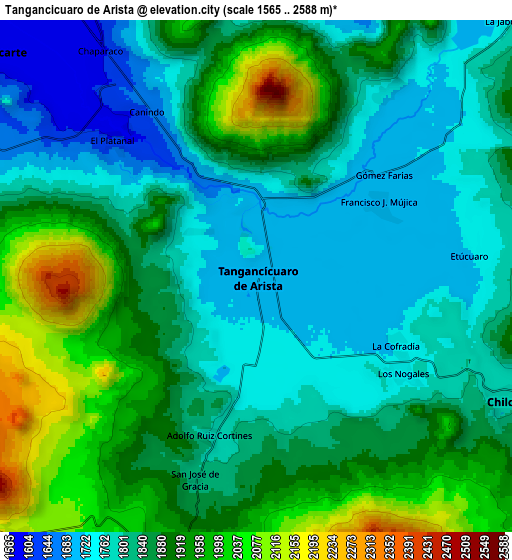
| Scale [m] | 1615..2049 m | 1565..2588 m | × |
| Scale [ft] | 5299..6722 ft | 5135..8491 ft | × |
| Average | 1755.6 m = 5760 ft | 1858.1 m = 6096 ft | × |
| Width | 9.19 km = 5.7 mi | 18.38 km = 11.4 mi | 294 km = 182.7 mi |
| Height | 9.19 km = 5.7 mi | 18.38 km = 11.4 mi | 294.1 km = 182.7 mi |
| ↑Max Latitude | 19.928649° | 19.969958° | 21.20409° |
| Latitude at center | 19.88733° | 19.88733° | 19.88733° |
| ↓Min Latitude | 19.846° | 19.804659° | 18.55953° |
| ← Min Longitude | -102.250305° | -102.294251° | -103.61261° |
| Longitude center | -102.20636° | -102.20636° | -102.20636° |
| →Max Longitude | -102.162415° | -102.118469° | -100.80011° |
Nearby cities:
Cities around Tangancícuaro de Arista sort by population:
• Chilchota elevation 1778 m
10.4 km,  115°
115°
• Ocumicho 2006 m
10.2 km,  189°
189°
• Chaparaco 1592 m
9.9 km,  325°
325°
• Fraccionamiento Ex-Hacienda el Refugio 1607 m
8.8 km,  323°
323°
• Acachuén 1800 m
12.7 km,  110°
110°
• Colonia las Malvinas (Colonia Antorcha) 1723 m
2.3 km,  243°
243°
• Fraccionamiento Monte Olivo 1578 m
11.8 km,  336°
336°
• Tamándaro 1591 m
10.7 km,  310°
310°
• Tanaquillo 1789 m
12.2 km, 112°
• Urén 1784 m
11.5 km, 113°
• Los Nogales 1736 m
6.2 km, 122°
• Etúcuaro 1731 m
8.1 km,  85°
85°
Multilingual:
 En español:
Tangancícuaro de Arista elevación 1712 m.
 En France:
Tangancícuaro de Arista élévation 1712 m.
 Auf Deutsch:
Tangancícuaro de Arista höhe über dem Meeresspiegel ist 1712 m.
 На русском:
Tangancícuaro de Arista высота над уровнем моря 1712 м
Sources and notes:
- [note 1] Map square and city borders are not equal. Map elevation data is calculated only from area inside that square.
- [src 1] Elevation data from geonames database provided with same terms of usage.
- [src 2] The elevation map of Tangancícuaro de Arista is generated using elevation data from NASA's 3 arcsec (90m) resolution SRTM data.
- [src 3] Base (background) map © OpenStreetMap contributors tiles are generated by Geofabrik and OpenTopoMap.
Copyright & License:
This Tangancícuaro de Arista Elevation Map is licensed under CC BY-SA. You may reuse any part from this page, if you give a proper credit by linking to this URL:
 More info on terms of use page.