Tecate elevation
Tecate (Baja California), Mexico elevation is 525 meters and Tecate elevation in feet is 1722 ft above sea level [src 1]. Tecate is a seat of a second-order administrative division (feature code) with elevation that is 789 meters (2589 ft) smaller than average city elevation in Mexico.
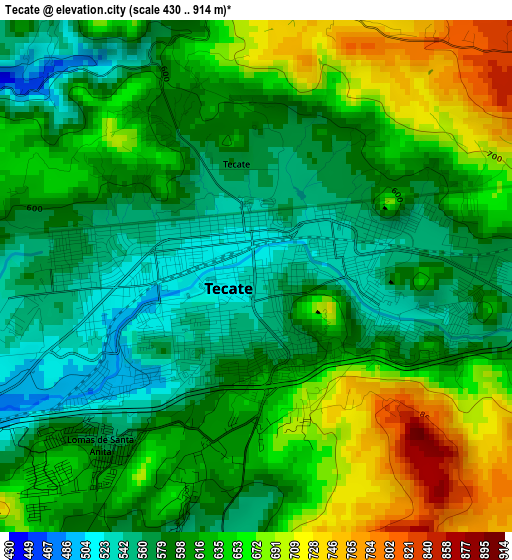
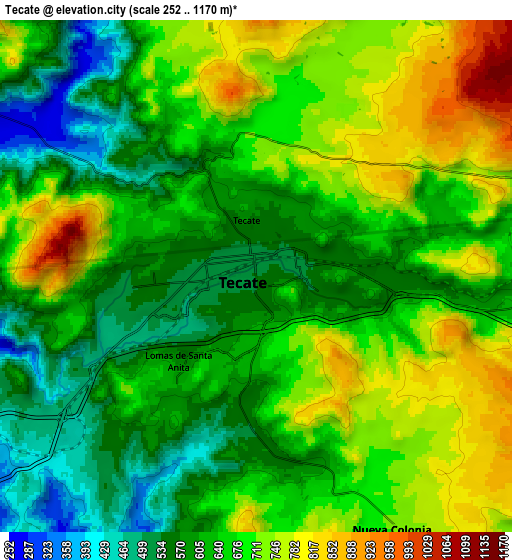
Below is the Elevation map of Tecate, which displays elevation range with different colors. Scale of the first map is from 430 to 914 m (1411 to 2999 ft) with average elevation of 616.9 meters (=2024 ft) [note 1]
These maps also provides idea of topography and contour of this city, they are displayed at different zoom levels. More info about maps, scale and edge coordinates you can find below images.
| \ | Map #1 | Map #2 | Topo.Map |
| Scale [m] | 430..914 m | 252..1170 m | × |
| Scale [ft] | 1411..2999 ft | 827..3839 ft | × |
| Average | 616.9 m = 2024 ft | 653.8 m = 2145 ft | × |
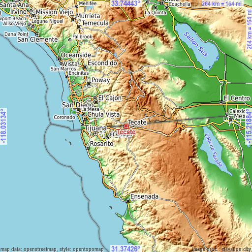
| Width | 8.24 km = 5.1 mi | 16.47 km = 10.2 mi | 263.5 km = 163.7 mi |
| Height | 8.24 km = 5.1 mi | 16.47 km = 10.2 mi | 263.5 km = 163.7 mi |
| ↑Max Latitude | 32.604198° | 32.64121° | 33.74443° |
| Latitude at center | 32.56717° | 32.56717° | 32.56717° |
| ↓Min Latitude | 32.530127° | 32.493069° | 31.37426° |
| ← Min Longitude | -116.669035° | -116.712981° | -118.03134° |
| Longitude center | -116.62509° | -116.62509° | -116.62509° |
| →Max Longitude | -116.581145° | -116.537199° | -115.21884° |
Nearby cities:
Cities around Tecate sort by population:
• Terrazas del Valle elevation 189 m
20.9 km,  244°
244°
• Villa del Campo 373 m
12.5 km, 237°
• El Niño 229 m
17 km,  247°
247°
• Maclovio Rojas 187 m
19.7 km, 237°
• Lomas de Santa Anita 569 m
3.7 km,  222°
222°
• Ejido Javier Rojo Gómez 218 m
20.2 km, 246°
• Hacienda Tecate 610 m
9.4 km,  91°
91°
• Buenos Aires 222 m
33.7 km, 241°
• Ejido Ojo de Agua 184 m
18.4 km, 236°
• Maclovio Herrera (Colonia Aviación) 608 m
3 km,  200°
200°
• Alfonso Garzón [Granjas Familiares] 698 m
2.4 km,  162°
162°
• Lomas de Tlatelolco 197 m
19 km, 240°
Multilingual:
 En español:
Tecate elevación 525 m.
 En France:
Tecate élévation 525 m.


Sources and notes:
- [note 1] Map square and city borders are not equal. Map elevation data is calculated only from area inside that square.
- [src 1] Elevation data from geonames database provided with same terms of usage.
- [src 2] The elevation map of Tecate is generated using elevation data from NASA's 3 arcsec (90m) resolution SRTM data.
- [src 3] Base (background) map © OpenStreetMap contributors tiles are generated by Geofabrik and OpenTopoMap.
Copyright & License:
This Tecate Elevation Map is licensed under CC BY-SA. You may reuse any part from this page, if you give a proper credit by linking to this URL:
 More info on terms of use page.